Updated 12 Mar 2021
![]()
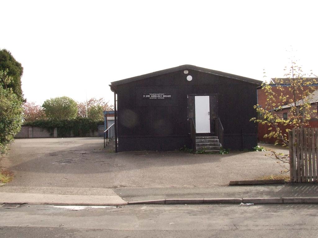
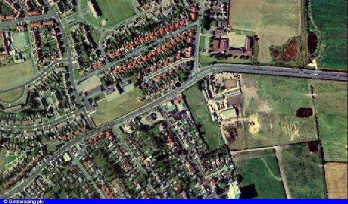
(See also Moreton Youth Club) Moreton Cross Leasowe Lighthouse Old Hall Farm Stavordale Garage & The Marcos Shanty Town Moreton Shore Moreton 1889 Schools
Some origins: Moreton (1278). Town by a moor or fen. Farm at a marsh. From mor tun. Mortona 1287; Murton 1321; Moorton 1377
| The name Moreton comes from the Anglo-Saxon More - meaning a Lake and Ton - meaning Town. It was known as Moreton-cum-Lingham by 1889 and was bounded by Great Meols to the West with Bidston and Wallasey to the South and East. Before the embankment was constructed, it was 3000 acres of tidal lagoon between one and two metres below sea level with most of the remainder little more than one metre above. Lingham means Heather Island and is derived from the Norse words Lyng - meaning heather and Holm - meaning island. Leasowe - from the Anglo-Saxon Leasowes - means Meadow Pasture. Would you believe that Wikipedia, that fountain of knowledge, has Moreton as part of Eastham!! And Google has Moreton as part of Greasby. Before 1928 Moreton did not 'belong' to anyone; then Wallasey Corporation took it on. Someone even mentions Moreton as part of Birkenhead!! 'never happened' ! |
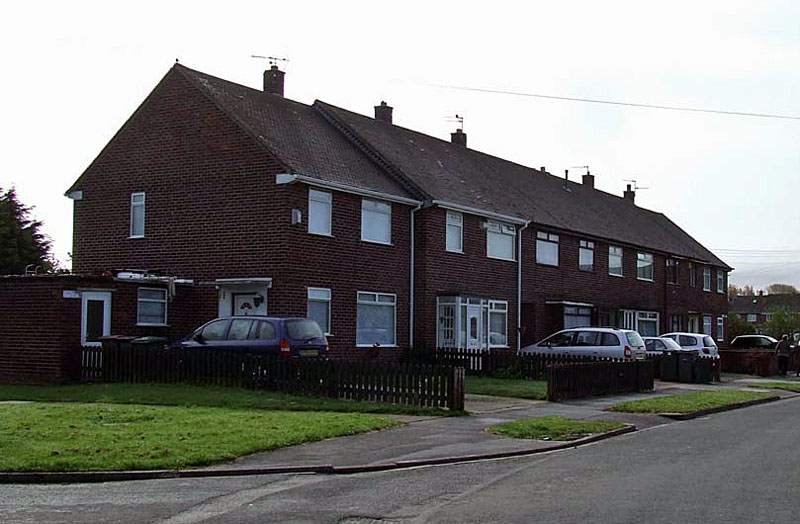
The Moreton I Knew I was born in Hull, Yorkshire and, at a very early age, moved to Liscard Wallasey, to Monks Road I believe. From there we moved into what was then the new post war estate of Leasowe (71 Twickenham Drive). It was in a three storey block of flats, (71 being in the middle) opposite my favourite haunt then, the sweet shop! Brian Lloyd emailed me in August 2006 to tell me that these shops were: Greengrocer; Grocer; Sweet Shop and Chemist. The grocers was called McCulloghs. These few shops are now residences. I remembered a sweet shop and a grocer but not sure what the other one (or two) were. I attended Birket Primary School from the age of 5. I had a red three wheeler trike. I was riding it along a new road, Franklyn Road, I think which was behind the flats. A young lad called Les Appleton threw a brick from the window of one of the partially built houses, it hit me full in the face, blood everywhere. My mum told me I was carried home by a workman; with a very apologetic Leslie in tow. I grew up and got to know Les again, in Moreton, as a teenager. But he died young, very sad. |
 |
The date was around the mid 50s and I moved into Hoylake Road, a new council house, from 71 Twickenham Drive, Leasowe and began attending Sacred Heart Primary School, off Hoylake Road, but the gate was at the end of the Avondale Avenue cul de sac behind our house. I remember little of this period at the school but do recall standing in the "great hall" for assembly. I think it was also a gym, crude but there. I also have recollections of standing in the playground behind which was a large open area, grassed, with large trees. On the left and below is Armchair Cottage on which the council houses were built in the 50s, No 14 was our house on the site of this cottage. Much later on came the building of the Armchair Pub at the end of Stavordale Road/Hoylake Road. Many people do not know to this day why it was called the Armchair - now you know! Something appears to have been edited out of this as the end of the cottages at the beginning of Fender Lane (behind lady's shoulder) appear to 'cut off'. The cottage was demolished in the 1940s but I still remember seeing the Fender Lane cottages in the 50s. |
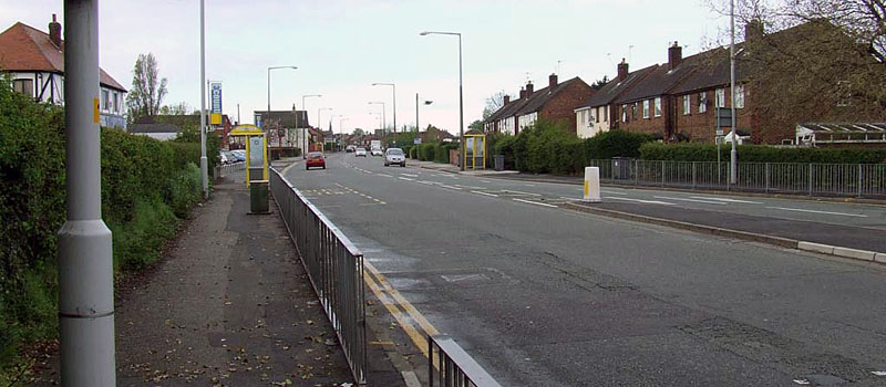
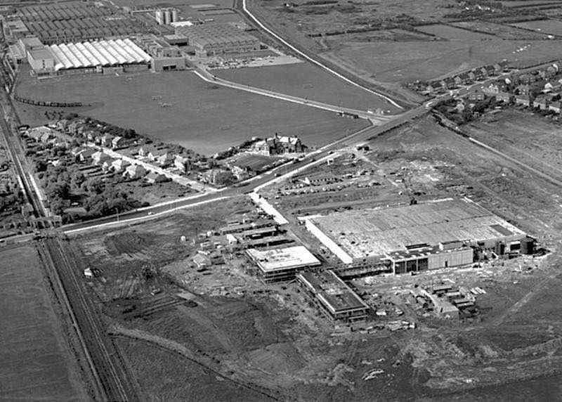
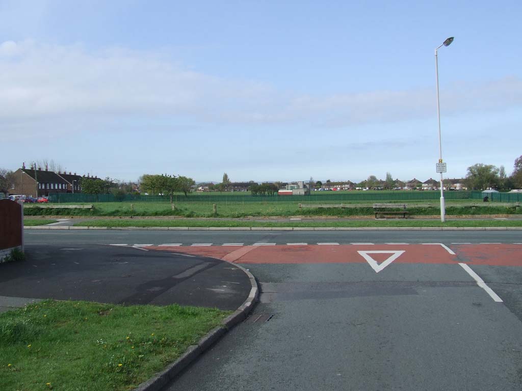
| At the end of Fender Lane, as you approached from Bidston was a large roundabout. There was a dip on the left which caused some vehicle to severely tilt as they went across, especially if driving too fast. I recall running out on hearing the smashing of glass (It always signalled a pop lorry!). We got whatever we could carry if we quickly swept up the glass before the coppers came! On the left of this roundabout lay Catton's Farm, as we knew it, a dairy farm. I always recall it as "muddy". Opposite this, on the other side of the roundabout, were three small stone cottages. To my mind they looked positively prehistoric. They soon vanished when Moreton Secondary Modern was built on the land behind in the late 50s. The Fender Farm farm buildings still remain, in 2008, but a pale reflection. The land now built upon. My home, newly built was opposite the Super Garage (2010 - demolished) which sold Shell petrol and had a fascinating workshop through a central passageway. Fender Lane was then a tiny country lane leading past the three stone cottages on the roundabout, past the "figure of 8" ponds on the left, over the River Fender and on, over the railway bridge into Bidston Village then to Bidston Hill. Now it is a dual carriageway riddled with traffic lights and new estates. But in my youth, in the early 60s, it was a road to Utopia. I would spend many an hour, day and weeks roaming the vast (it was for me then!) landscape which separated Moreton from Bidston. Spend hours sitting on the ponds watching the dragonflies zipping in amongst the reeds, the odd brown rat, fish jumping, birds singing and, on occasion, some local lads fishing. On the morning that man landed on the moon in July 1969, I went there with a good mate Lenny Wright (From Fairmead Road) in the early hours, got sunburnt by 10 am. |
 |
 |
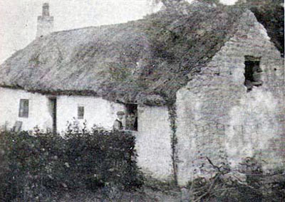
This cottage and others stood on the corner of Fender Lane and Reeds Lane. you can just see Sydie's in the background. The powers that be demolished these around 1956 to build a school that was so far back they could have left these lovely building there. I can just remember these buildings. They were directly opposite Caton's farm. In these days and into the 60s, Fender Lane was a narrow road going directly to Bidston, now its a busy dual carriageway with a housing estate on the side of the farm. I recall these fields always water logged, so hope the homes are not sinking, yet. |
|
The Armchair cottage
would have stood on the site of the first council house on the
right, numbers 12 & 14. Left, and below, was the Super Garage. This was demolished in 2010 to make way for an Aldi Supermarket, the site of the former Jet garage next door also vanished at this time. Below, the girls from the Jet, in the 60s. |
 |
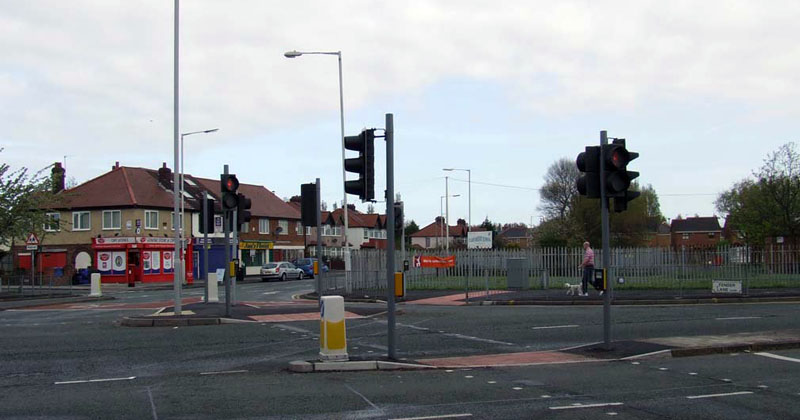 |
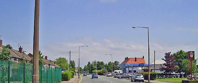
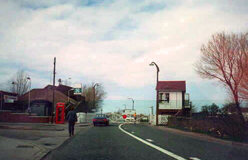
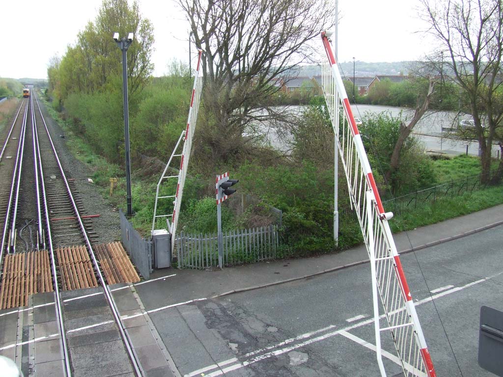
The site of what was the roundabout on Hoylake Road/Reeds Lane & Fender Lane. The Fender Lane cottages (see above) were on that corner by the person walking. The red shop is what was Sydies. This shop can also be seen in the Stone Cottage image above. If you turned right, down Reeds Lane, you travelled towards Leasowe Station with its big heavy wooden gates, operated from a signal box on the right hand side of the road. First you would pass Avondale Avenue, with Sydie's sweet shop on the right hand corner, waste land on the left. Next was Daneswell Drive, which led past the rear side of Sacred Heart. Then Saxon Road, via a pathway and round the left hand bend to Kingsmead Road and the station. After the station, on the left, was Leasowe Tennis Club, a popular 60s haunt, with Radio Caroline disco's etc. Opposite sprang up a new factory, Squibbs, which made pharmaceuticals. And round to the imposing Leasowe Hotel public house. You could then see the back of Cadbury's, more on that later, in my Wallasey page. The river Birket signalled that we were now approaching Leasowe. |
 |
 |
|
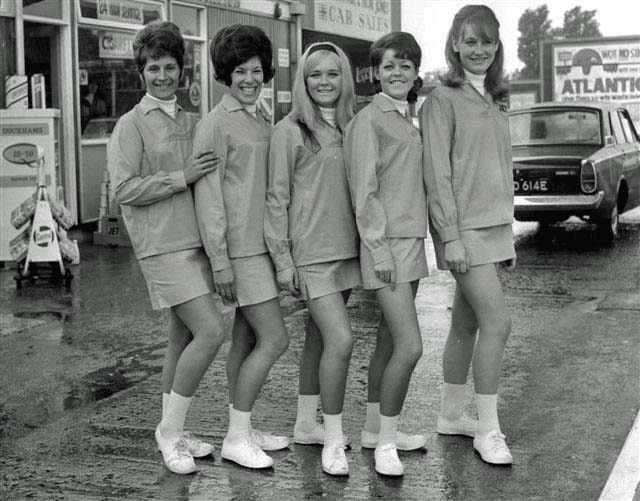
This image, above right, appeared in the Wirral News this week (November 10th 2006) as an "archive" image from the 60s. It's of the girls who worked the Stavordale Garage in Moreton, on Hoylake Road, in the swinging 60s!!! My sister (Jan) is the one on the right!! She now lives in Cornwall, married to John from High Wycombe. She has a musician son, Anthony. (Tony Haven, who is a successful 'lap guitarist'. Nice Corsair! Thanks to the Wirral News for sending me this copy. Steve Hallam contacted me from Australia in Nov 2008, he thinks the car is his old man's Corsair. The advert on the rear is for the Atlantic Garage along the road and behind the photographer was the Super Garage, Shell!! 5 garages in all occupied the road between here and Moreton Cross. When the Jet was built, some silver must have crossed palms!! |
 |
 |
We pass a group of
shops, still there in 2008, contained a chippy and the last one
being Alderney Dairy. Solid wood floors, old wooden counter, lovely!
I would be sent here for our milk. Sacred Heart School could be seen
through the railings opposite. (see below left and right.) Sacred Heart (below left) I got this info from the present Head: When I was in Infants Miss Cassidy was the Head, Junior was Mr Carolyn. Mr Conroy took over till 1975 and then it was Mr Brown (Juniors) then the present Head, Mr Freeman. |
 |
Next we
come to Danger Lane below, which led into, on the left,
Fairmead Road. Image on the left was taken in Danger Lane, looking back towards the Dairy site (grey building) (From my sister) Sacred Heart school when I was there had a prefab next to school building at the back near the grass area. I remember 5th year pupils secondary level there. They then moved to Thomas Beckets when it was brand new. I also know the school was brand new because of the strict "Keep two tiles from the walls at all times with bags and no shoes in the Gym" It was always adhered to as they looked after it. |
 2012 |
 The shops opposite the school (left) and oin the left above |
 Formerly Gates of Moreton |
 |
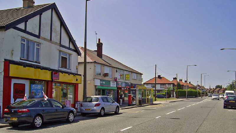
| We then past what was Gates Garage and Moreton Engineering and another group of shops, also containing a chippy, I seem to recall some sort of clothing or wool shop, and the last was a hardware store. After a hedged field we arrive at Chapelhill Road and the corner shop. On the opposite side, all the way to the Cross, was housing. Each had a low 1 foot high concrete wall, with a gap for the path. I would try to reach the Cross without having to stand on the pavements, along the wall. I was too small however, to jump the gap!! | |
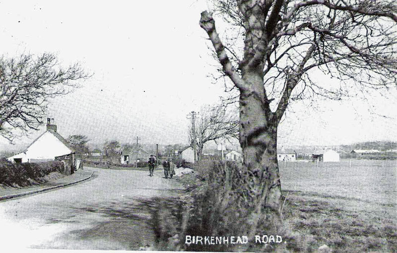 Hoylake Road, then Birkenhead Road, looking towards the junction of Chapelhill Road on the right as it was to become and on the left will eventually be Knutsford Green, a circular cul de sac. |
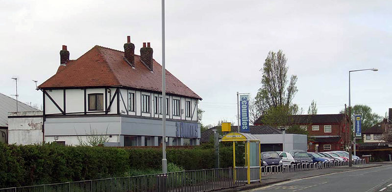
 I think this was the old cottage on Hoylake Road, but could be wrong. It was near the Atlantic Garage. See aerial pic of Moreton Cross below, the cottage is visible. See also below. Feb 2012 - Wetherspoons think this was on their present site, up the hill to where Mortimers was situated. |
Sept 2018: I think wetherspoons and I are
both wrong. Steve Casey published this image online and it clearly
shows this cottage above as standing opposite Chapelhill Road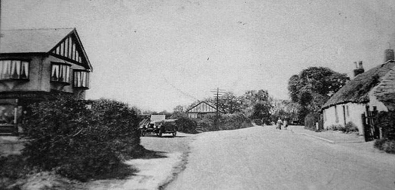 |
|
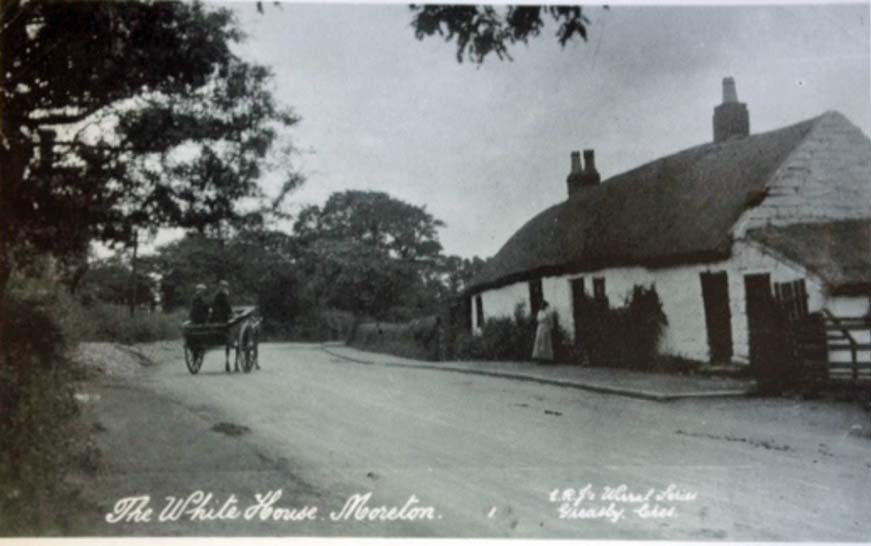 |
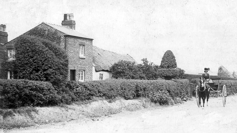
The White House is pictured in Birkenhead Road (now Hoylake Road) about 1917. This typical country scene with a lady standing outside the thatched cottage and the two men with horse and trap, was taken by ER Jones, a Greasby photographer. This was the main road from Hoylake to Birkenhead, built in 1841. The cottage was demolished between the wars and Chapelhill Road was to be on the left, by the horse and trap. So this is looking towards Moreton Cross. And the image above proves this part to be correct. |
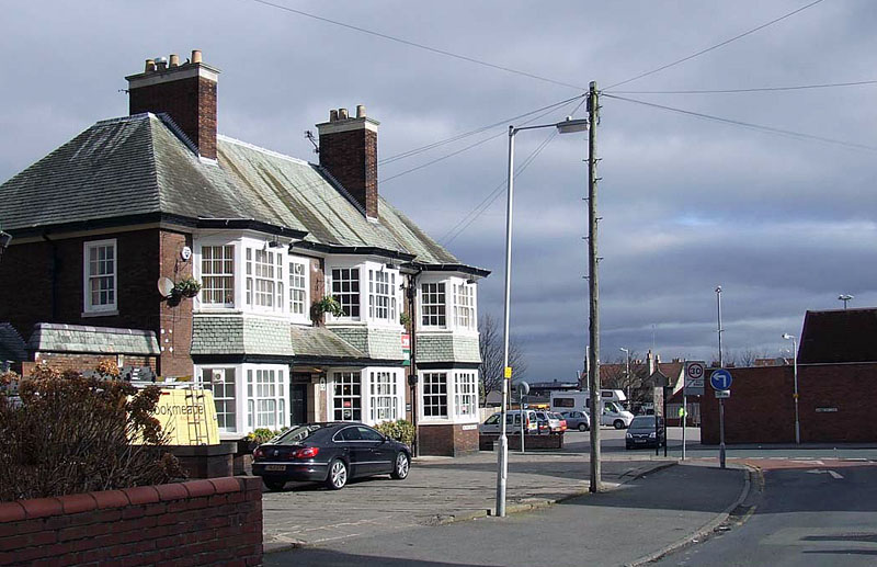
| Moreton Cross linked to here | |
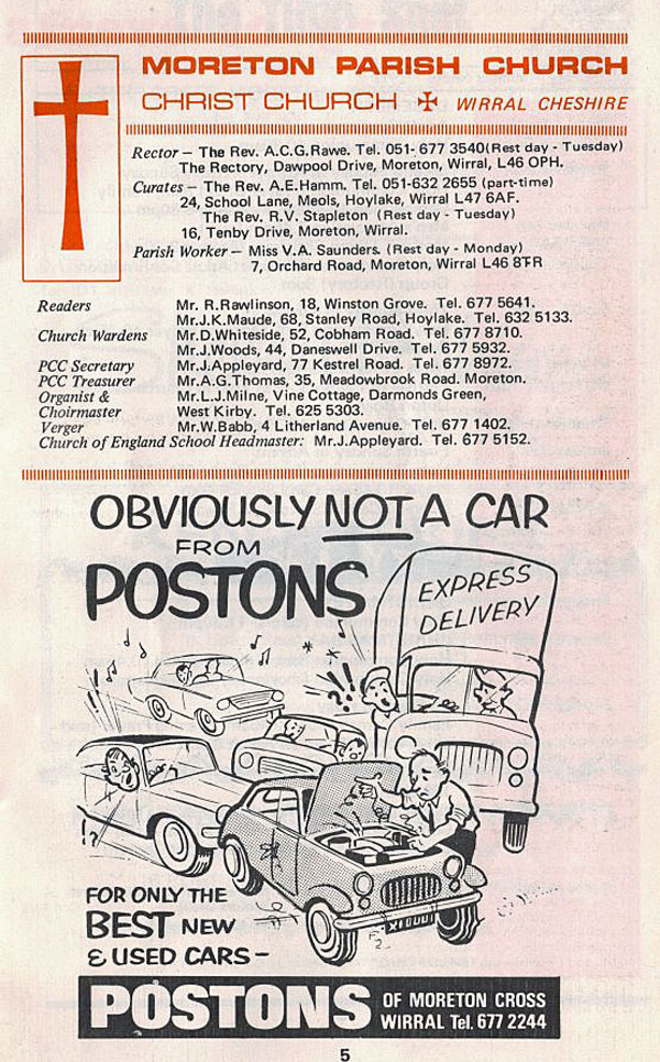
| And now, back towards the Cross, we arrived at yet another garage, on the left (I think it was Gulf but it used to be called the Atlantic Garage). Then there was an old cottage set back off the road (left), this was the fourth garage in about 1 mile of road! Passed the dentist on the corner of Orchard Road, a right chamber of horrors!! we then pass the Presbyterian Chapel and come to garage number 5 on this stretch - Poston's! I can recall petrol price for 4 gallons the equivalent today of 90p. At the time of writing, it was well over £1.30 for a poxy litre! Opposite Postons they built, in the 50s, the new Catholic Church (below). Opposite the Chruch was also the Plough Inn. Next to that was Les Turners' tobacconist, a cake shop, Lloyds Bank. All these fature heavily in the images of The Cross further on. |
 Moreton Cross - Station Road became Pasture Road |
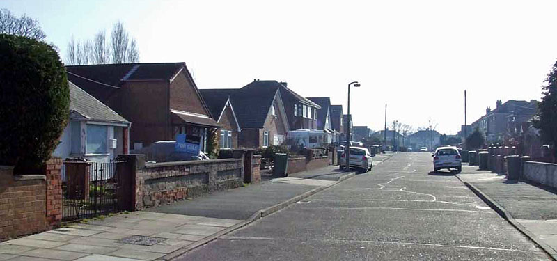
| Moreton was, when I lived there, a relatively small place where nearly everyone knew everyone else. Policeman like "Flash Harry" would lurk rather than patrol his beat and woe betide you if he caught you "messing about" - a clip across the back of the head was the order of the day. Nobody complained, unlike nowadays, it meant you deserved it! I have had recourse to revisit Moreton a few times and am dismayed to see such a nice little place has degenerated into a haven of shops selling those £2.99 hand painted ornaments, sun tan parlours and fast food joints. The atmosphere has completely vanished that I knew, to be replaced by modern, hustle and bustle, no parking spaces, like many towns the length and breadth of the country. Moreton was once described as "unremarkable - Moreton in the Mud etc". In the late 50s and 60s it did actually develop character and charm, but sadly it did not last. I suppose its called progress. Nothing stands still, does it? | As a youngster and then a young man in Wallasey I had high hopes of a good life, house, nice wife and trips with the kids to Bidston or the coast. I am not too sorry these dreams did not materialise. The latter dreams anyway. I did get the good wife, kids and house but not the rest on Merseyside! Strangely enough, although I am not being too kind to Moreton, it was still the place where I was "dragged up" as I like to phrase it. I do often manage to haul myself back up to the beautiful Wirral. In Feb 2004 I spent a beautiful, freezing, couple of hours walking Bidston Hill, subject of its own page in here. What follows now is by no means the definitive version, there is much hidden, much forgotten and much unsaid. But here is some local history. I have provided as much as I have found to date. |
The name Moreton means village on the lake. It was one of the 4 towns making up the parish of Bidston, the others being Bidston, Claughton and Saughall (The Hall of the Willows). It was bounded by Great Meols to the West with Bidston and Wallasey to the South and East. Before the embankment was constructed, it was 3000 acres of tidal lagoon between one and two metres below sea level with most of the remainder little more than one metre above. The geology was that of blown sand in drifts covering the land, and salt marshes going around reaching Wallasey Pool, below Bidston. Lingham means Heather Island and is derived from the Norse words Lyng, meaning heather, and Holm, meaning island. Leasowe - from the Anglo-Saxon Leasowes - means Meadow Pastures. The higher area of Bidston and Wallasey Village were built upon the sandstone hills, rising to 180 feet above the surrounding area. Moreton was, quite literally, the village in the marsh. There was no sea wall at all, no protection from the sea, and land went much further out to sea than it does now. Evidence of this lies in the long gone petrified forest which I shall include later. |
Ken Burnley in his book "Portrait of Wirral"
mentions a book I had read years ago, from the
library. "The Rise & Progress of Wallasey", and mentions the
optimistic tone of this 100 year old book, as it is now. I used to
call it the Rise & Fall of Wallasey! Sorry, but progress in Moreton
and Wallasey died around the same time the socialist incumbents took
residence in the Town Hall and a long time tradition of Tory Members
of Parliament were eventually ousted to be replaced by a socialist
feminist. (Who, in 2008, married her "partner"; also female.) Yes, I
am biased and not afraid to admit it. I have purchased a copy of The
Rise & Progress of Wallasey (reprint 1974). Also the advent of container shipping killed off what was left of dockland trade on the Wirral. I worked in many jobs up to when I joined HM Forces as a soldier. One of these was a trainee miller with Spillers at Pauls Mill on the docks. It was then a car park for the Warship Museum which was closed down as it has fell to the developer who are now building "luxury" flats (2007). Next will come the "marina" I suppose, then it will be fenced off so Mr Joe Public cannot wander the docks as he used to. Luxury flats bring in more revenue to the Council than Historic Museums. |
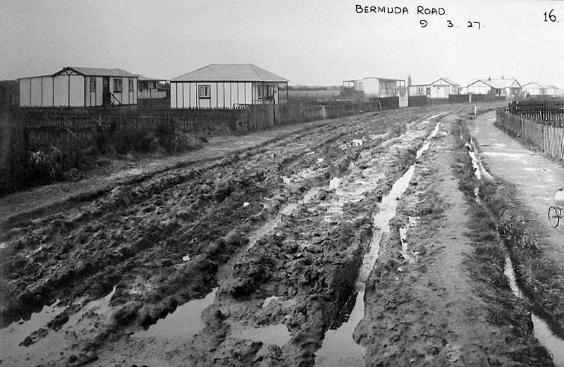
| The area was subject to flooding on account of low-lying ground. In the days before the World War Two, parts of Moreton were known as 'Shanty Town' on account of the wooden bungalows. When there was heavy rain, the area was completely covered with water. Men and boys rolled up their trousers and took off their boots and socks and waded through the water and the girls hitched up their skirts and paddled about in bare feet. Summer camping was very popular in Moreton. Some campers had their tents better prepared than others with wooden planks on the floor, table and chairs and an oil stove for cooking. Very often these would be marooned by the floods. Old caravans, tramcars or railway wagons were used as holiday homes. Other wooden bungalows were erected on stilts, such as those in field of the Fellowship House under the management of Mrs. Eleanor Burden. With the shortage of housing, a lot of them became permanent homes in the early nineteen twenties. Sanitation was a concern for the local authority and when Wallasey Corporation took over responsibility for Moreton, they took measures to rectify the problem by condemning most of the temporary buildings and building new houses. Better roads and drains have curtailed the problem today, but there is still occasional flooding and the Brigade is then called out to deal with the situation. |
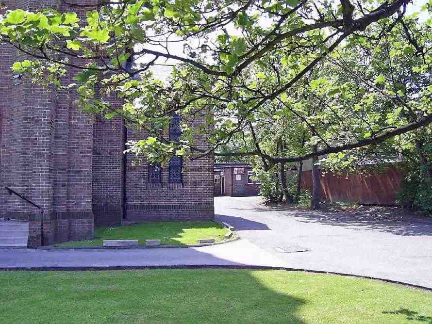 |
| Sacred Heart Church and, on the right (rear), the Social Club. I remember tale of a comic who came on stage, saw the large crucifix on the back, and commented about the last comic going down well, he got no further. I think its funny! Formerly the site of Brooklands House | |
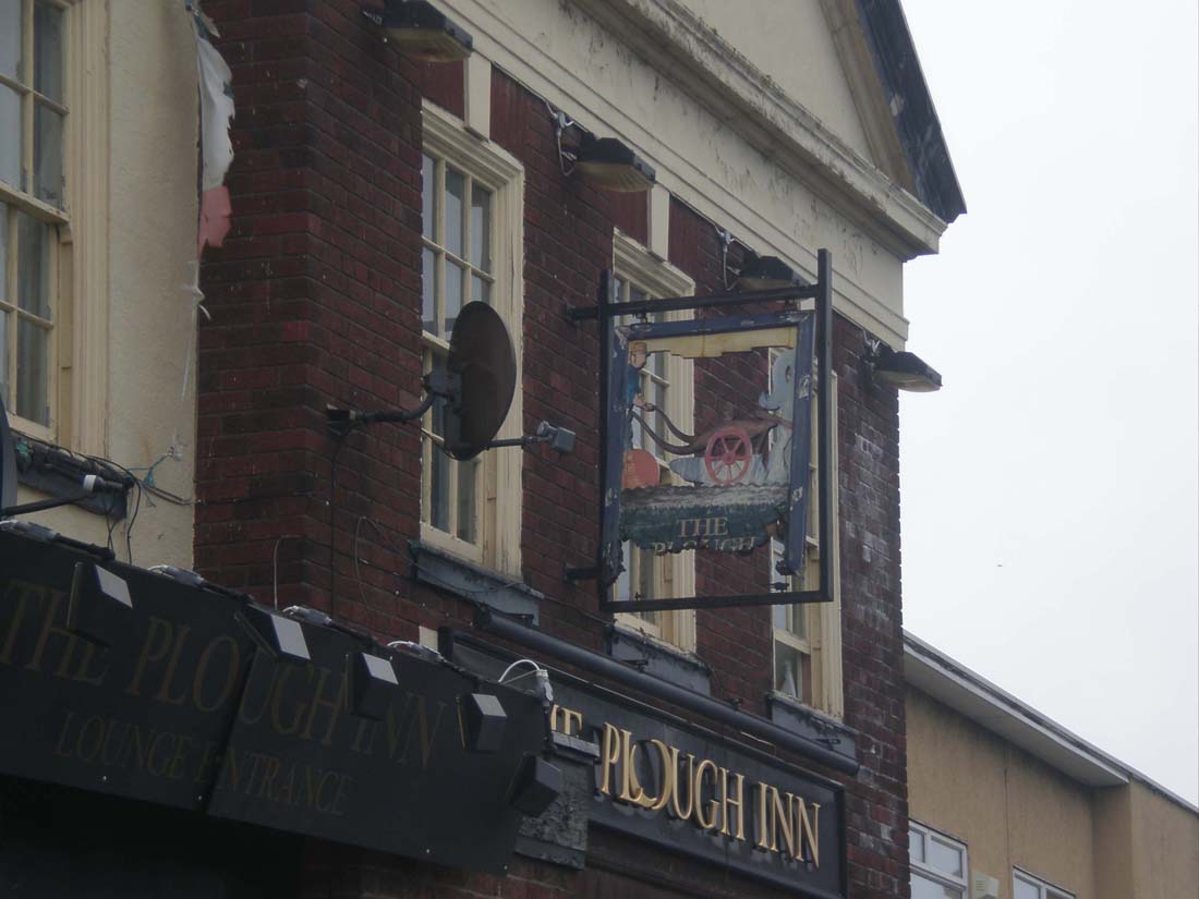 Last days of the Plough, a dilapidated dump |
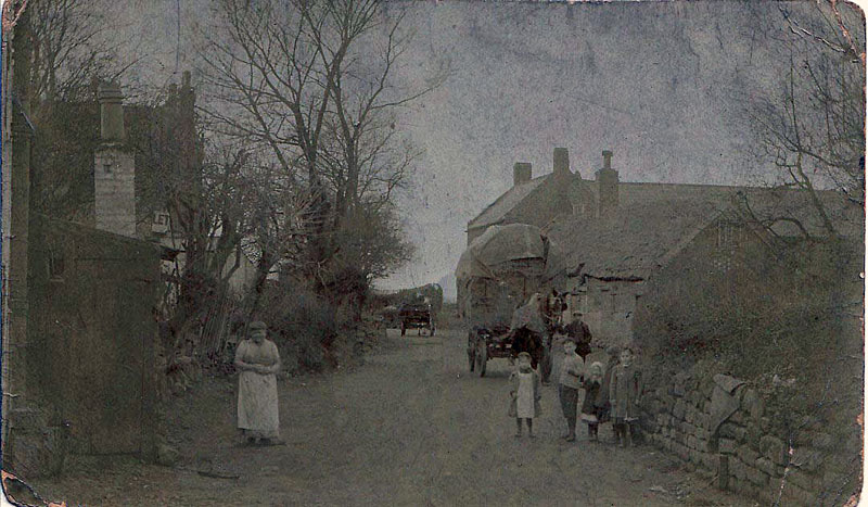
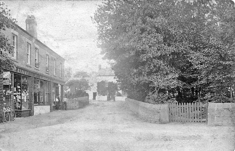 Moreton Cross approx 1904. Image: Tracy Martin The three shops were built for Titch Mason in 1901. The gate on the right is to the Plantation which was once used an a pinfold, a place to keep stray animals overnight. This replaces false info, i was put right by Dave Price of Moreton |
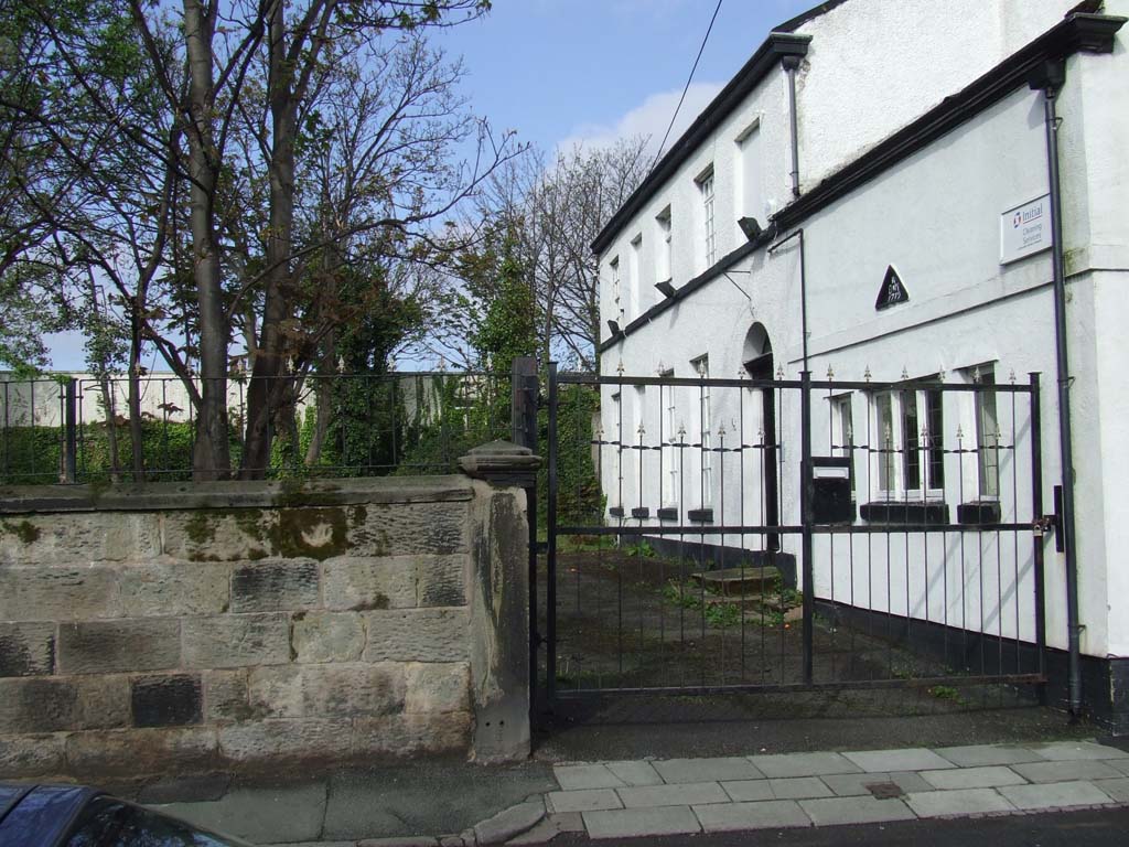
| Barnston Lane (which contains the oldest remaining building in Moreton). | |
.jpg) 1904 |
 Barnston Lane |
 Barnston Lane |
 19 Barnston Lane |
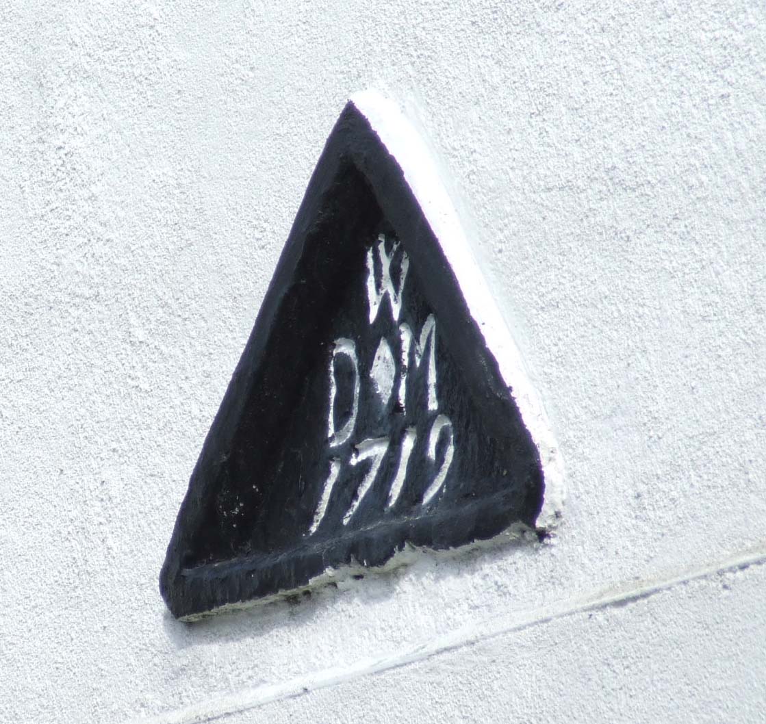 Date stone on no: 19 Barnston Lane |
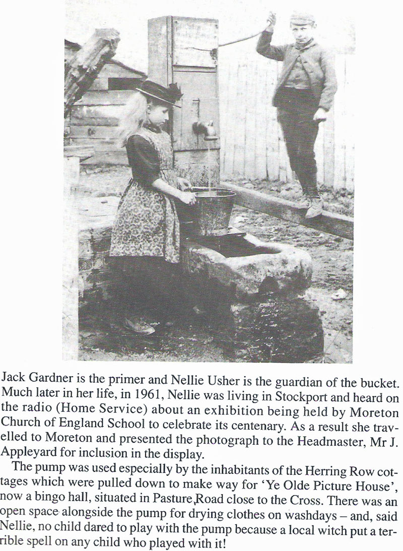
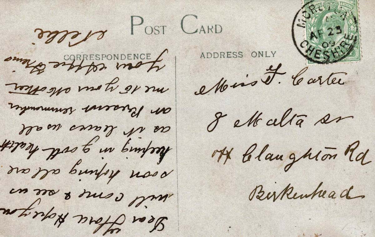
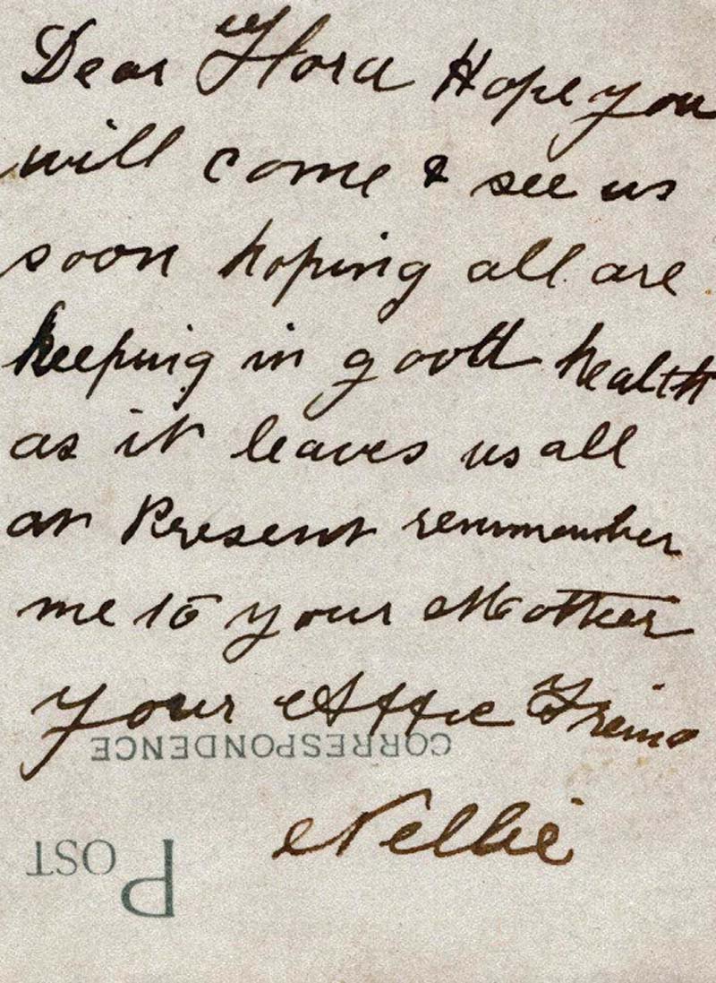
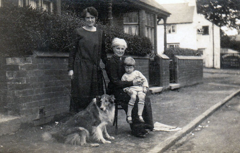 Ellen Usher was Postmistress. Here she is sitting in Barnston Lane. Further down I have an image of the Water Pump with a child, Nellie Usher, wonders if she is one and the same person. There was a Nellie Usher who then lived in Stockport in 1961, who was from Moreton |
 Ellen Usher, Sub Postmistress |
|
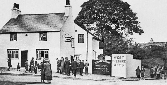
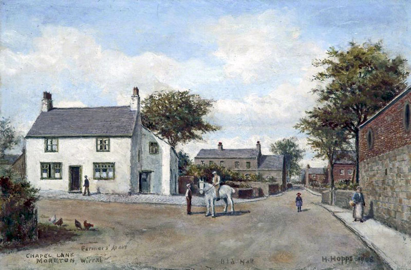 Farmers Arms by Hopps |
|
 |
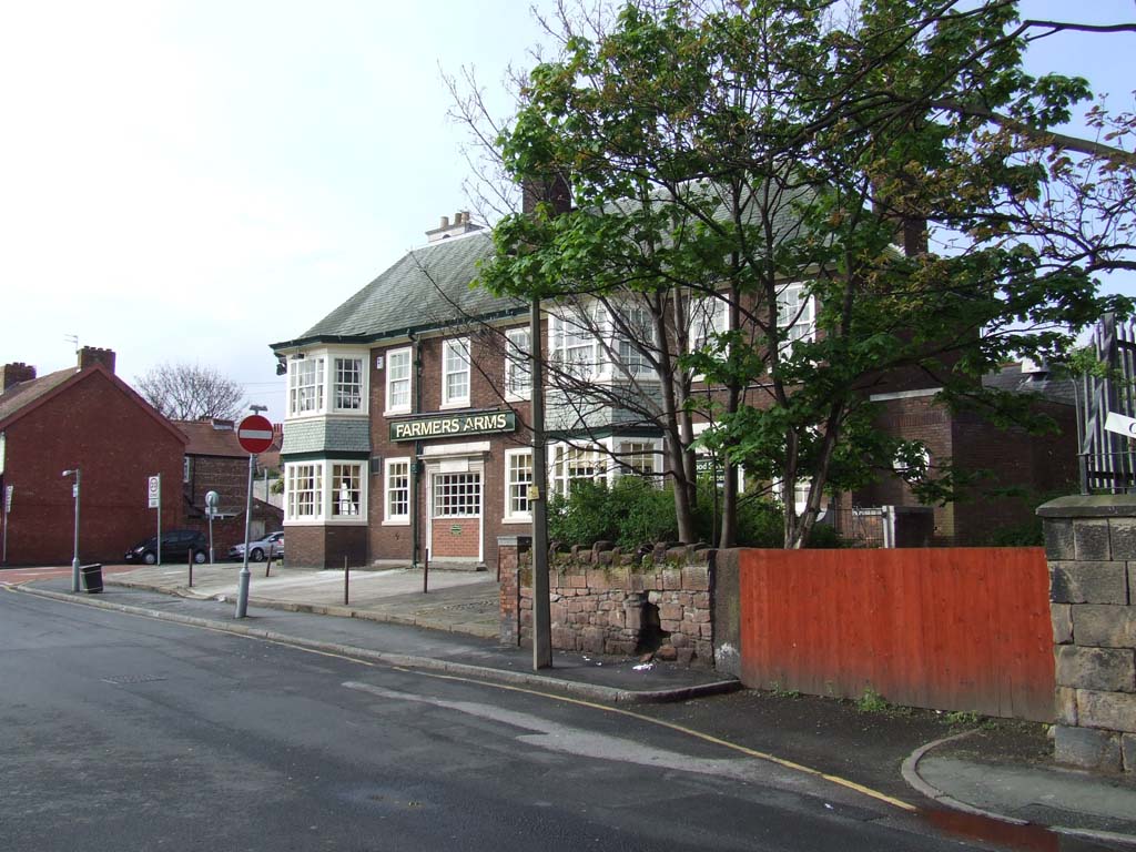 |
 Modern Farmers Arms |
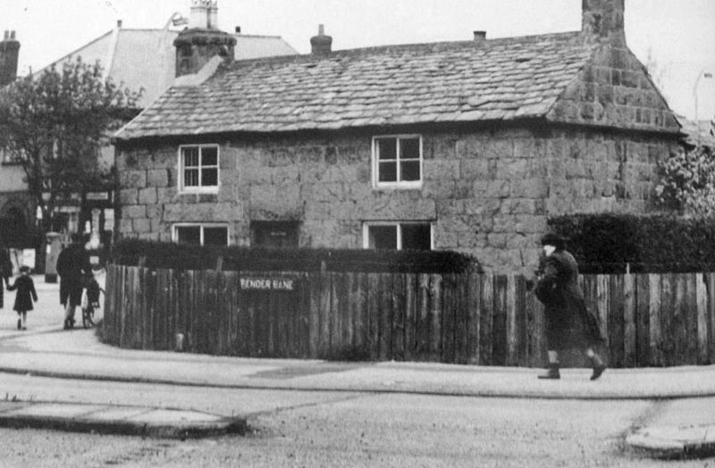
 Mary Ann's Lane later Old Maryland Lane. Thats Mary Ann on the left, Barnston Lane runs across the top of this image' in those days it was Chapel Lane. I suspect a council official wrote down the wrong name when sorting out road signs, hence Maryland instead of Mary Annes and this is actually 'old Mary Annes Lane' renamed Old Marylands Lane', I asked the council if they could change them back, didnt even reply. |
Hoylake Road
runs straight through Moreton from Reeds
Lane/Fender Lane towards Hoylake and West Kirby  Right to left, Hoylake Road 1945  1948. Flag is on old library - the 'pink building' which became the youth club |
|
 Where I lived |
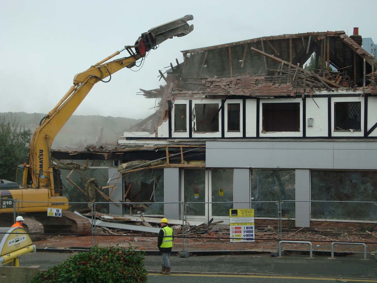
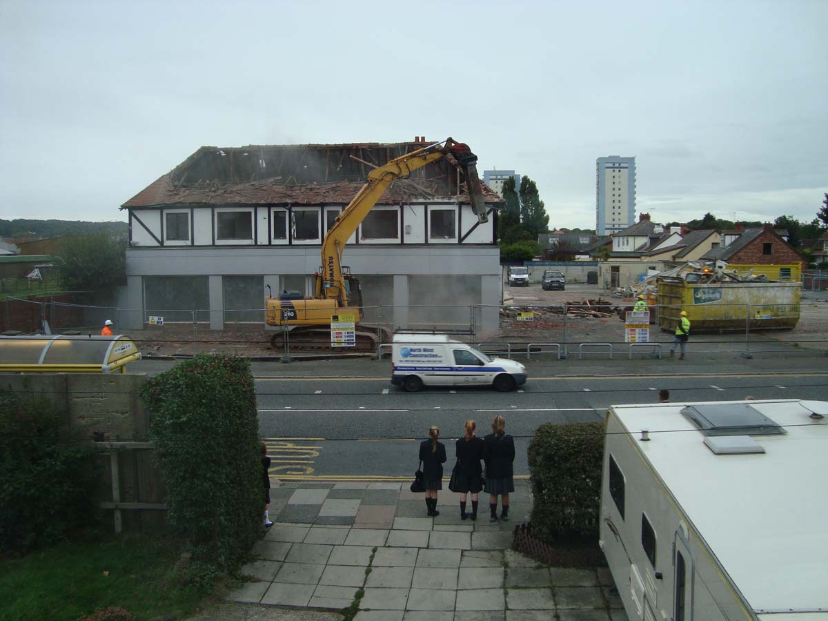 Death of a landmark, the Super Garage makes way for a Supermarket |
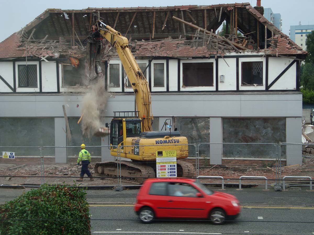 Super Garage pics by Harry Pleavin |
 |
 |
|
|
|
|
|
|
|
|
|
|
| After the Cross, Hoylake Road continues onwards | |
 |
 Mortimers Toy & Bike Shop was over there, magic place |
 Digg Lane above (2012) and right 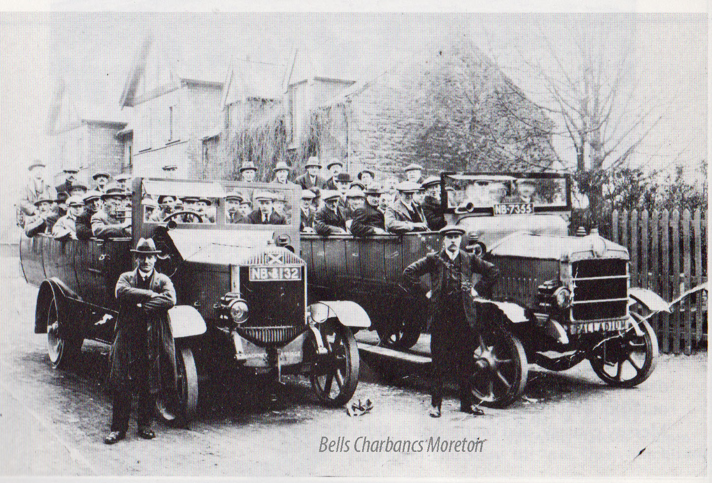 |
 |
 |
 |
|
Moreton Chapel (16th century) stood in
the plot of land bordered by Hoylake Road, Digg Lane and Netherton
Road. It is thought to have been demolished c.1690. Records of the
goods within the church in 1550 include “one chales with a ringe of
one belle”. The only representation of the chapel is of 1656 on the Kingston-Vyner estate map of Moreton, where it is shown as a low building with a belfry over the west gable and a cross on the eastern gable. An excavation in the 1980s aimed to reveal the remains of the chapel but no trace was found. A sequence of three buildings was discovered enclosed by a sequence of ditches, in one of which was a 10th silver penny (AD 955-9 Eadwig) A late Saxon (early Medieval) date is possible. A windmill (post medieval) stood to the north of the settlement core, and was recorded as a fieldname on the 1838 Tithe Map. Rifle Range, situated on corner of Leasowe Road and Pasture Road. The range was thought to have been in use since the early 1800s up until the First World War, notably by the armies of William of Orange prior to the Battle of the Boyne in Ireland. |
|
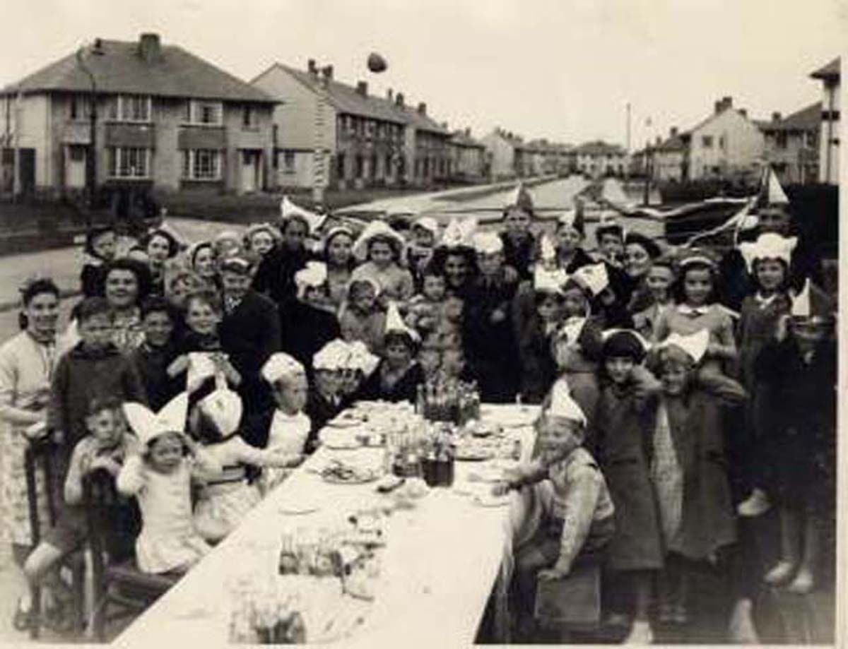
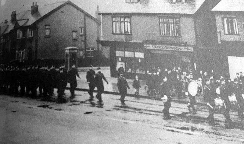 The year is 1943 and the Air Training Corps were marching past Francis Avenue towards Moreton Cross, and back again. This image was taken from the junction of Hoylake Road and Borrowdale Road. The buildings are still there but obviously shops have changed hands over the years. Does anybody know where the ATC HQ was? |
 C of E School The Moreton Church of England School was built for a cost of £745 and was opened on 21st February 1861. The bricks used to build it were hand-made from a marl pit on the stretch of road between Moreton and Great Meols (The Meols Stretch). The school was pulled down in 1975 |
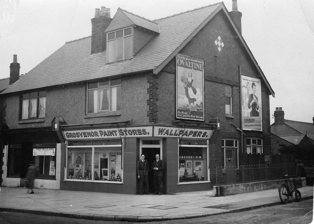 Grosvenor Paint Store. (Now another 'parlour shop' this time for doggies!!) corner of Joan Ave. From Jim Shipley: The two people standing in front of the Grosvenor paint stores are my father Arthur James Shipley on the left, and shop owner Stan Wess on the right. Judging by the age of my father in the photo it was taken just after the war. My father worked there from an early age and his initial duties involved delivering paint and wallpaper on the black delivery bike in the picture. I actually remember riding that bike long after it was withdrawn from use. It had no gears and weighed a ton. I remember that the rear part of the shop had a peculiar machine which was used for cutting the border off the rolls of wallpaper. He was also kept busy doing displays in the shop windows and keeping up with the needs of the many local painters and decorators. When Stan Wess died, the business was bought by Ken Maddox and my father remained there as shop manager. I recall that Ken also briefly had a paint and wallpaper stall in Birkenhead market. Image sent by Jim Shipley (You may note I have fixed the crease!!!) |
|
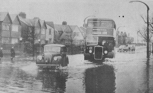 Top of Bermuda Road/Hoylake Road - prone to flooding (1956) |
 Travelling from Moreton Cross we arrive at the junction of Bermuda Road & Hoylake Road |
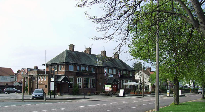 Grange |
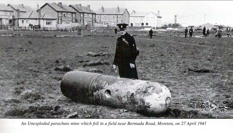 There was an air-raid over Moreton on 11 September 1940. Bombs fell in fields and a Centre was hit |
 |
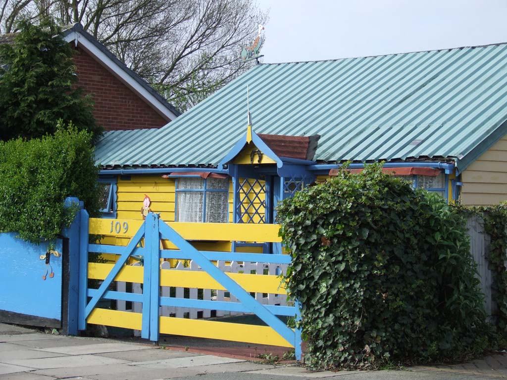 Not long after I took this of the last Chalet in Moreton, it vanished, now a bungalow |
 Top of Bermuda Road, that building used to be a chippy |
 |
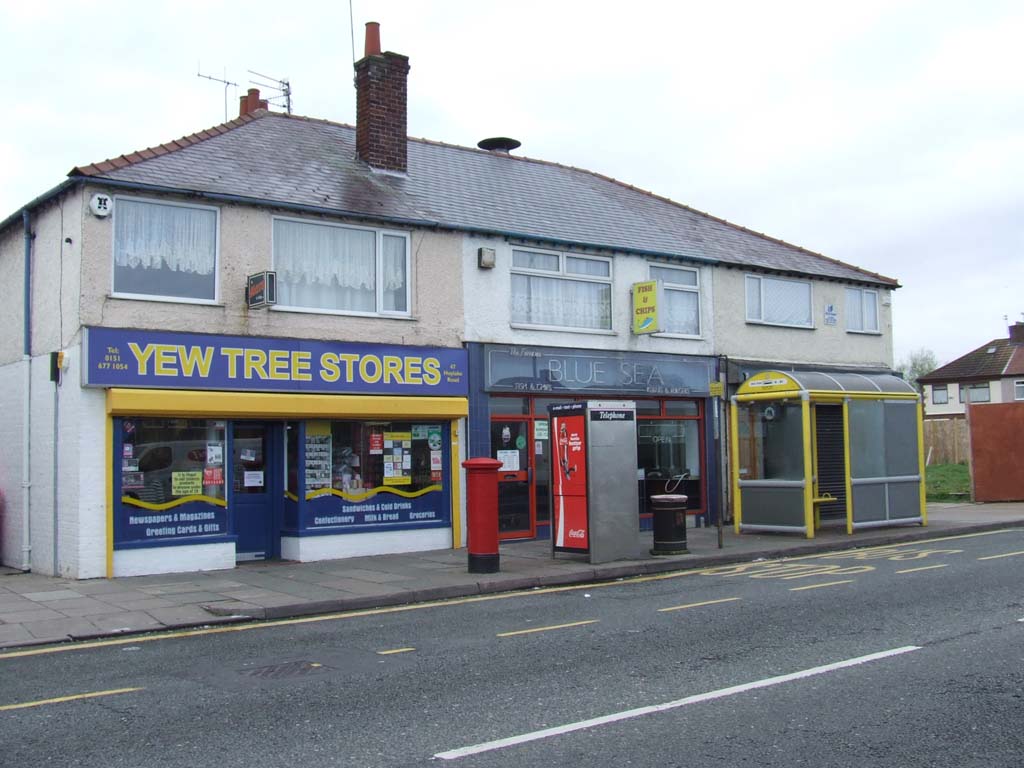
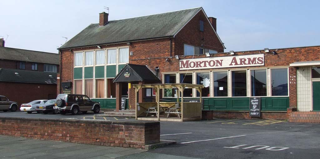
| At the 'other end' of Moreton from where I lived, and immediately before the Meols Stretch began was a chippy (above). This was here. I do not think I ever used it but suppose many people have memories of their favourite chippy in Moreton, and there were a few Like Whites by the library, the one on the corner of Pasture Ave/Pasture Road, opposite Morton Arms. The Blue Sea (Cypriots ran it) on Hoylake Road and the one opposite Sacred Heart School. | |
| Pasture Road - From The Cross to Shore | |
 |
 Site of the Moreton YC |
 |
 Pasture Avenue and Crescent |
 Came here, to Pasture Crescent, to show location of image on the right. |
 1945 |
|
Cole's Bus Service was the first motorised bus service in Moreton. Initially running between Moreton Shore and Moreton Station, the service was extended from the station to Moreton Cross when Birkenhead Municipal Transport started their service to Moreton Cross in 1920. The Crosville service started in 1925 with Wallasey joining, in 1928. Cole's service last ran in 1926. Although Moreton has been occupied since Roman times, the first road into Moreton was not built until 1841, from Meols, the railway followed in 1865. The railway shelter on the Liverpool bound side was used by Moreton FC as a changing room. On 1st August 1928, Moreton became part of the Borough of Wallasey. |
|
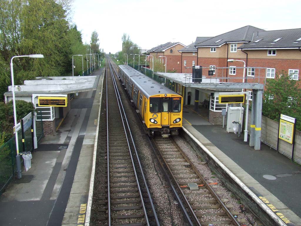
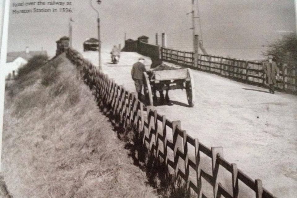 Moreton Station |
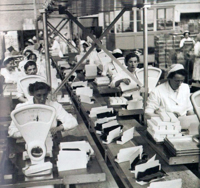
 Formerly Cadbury's, changed its name a few times since then! lower left: ladies packing in Cadburys |
 |
 |
 Above and upper right - Ditton Lane, it has never been adopted by the council for some reason. Reeds Lane buildings can be seen far to the rear. |
 |
| Reeds Lane to Leasowe | |
|
|
 |
 Image taken from where Sydies was. Another of Moreton's chippies was in that last shop |
 Formerly Moreton Secondary Modern |
 1987 |
 |
 |
 |
 |
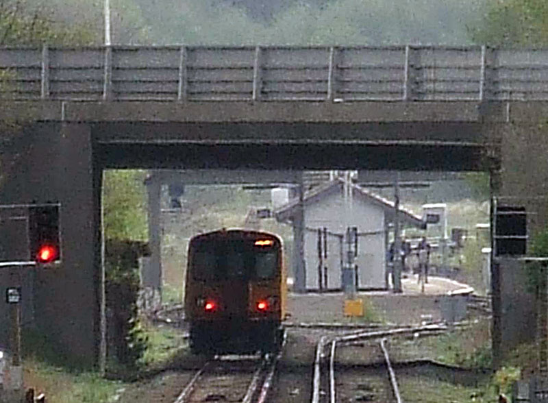 |
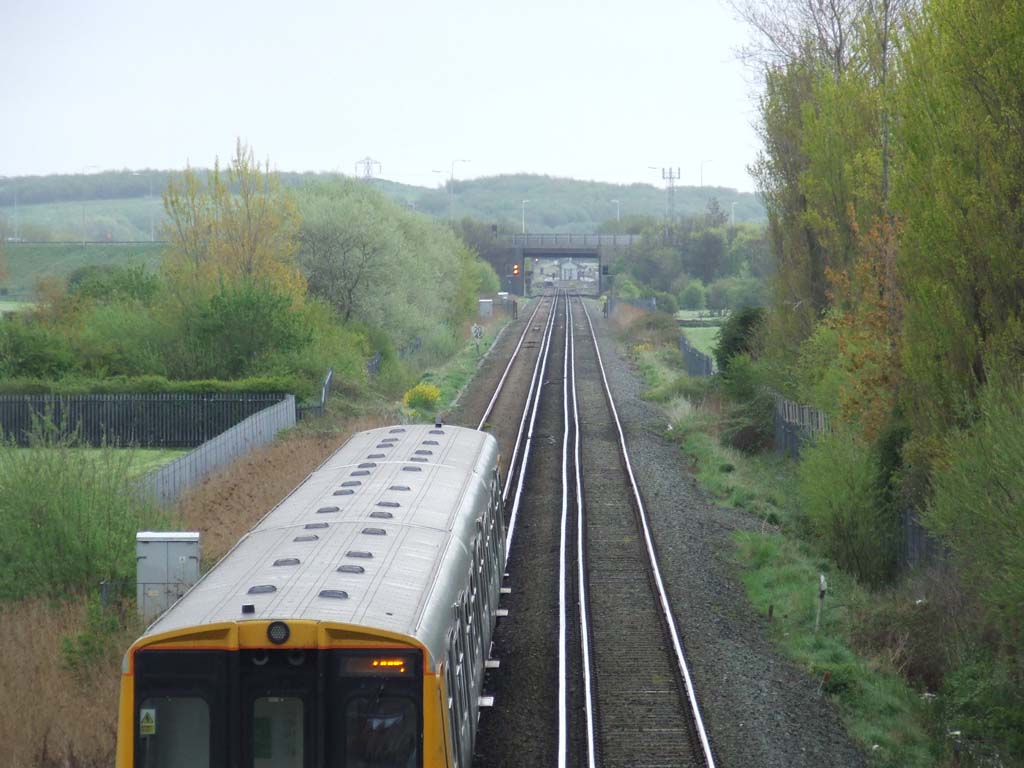
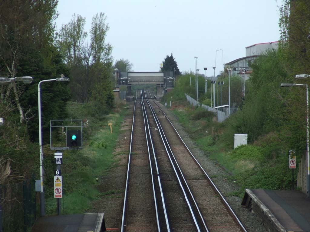
| Looking towards Moreton Station from Leasowe Station | .. and in the other direction towards Bidston |
 Rear of what was Cadbury Factory next to River Birket and Leasowe |
 The building of Squibbs on Reed Lane |
| Other Images of Moreton | |
 |
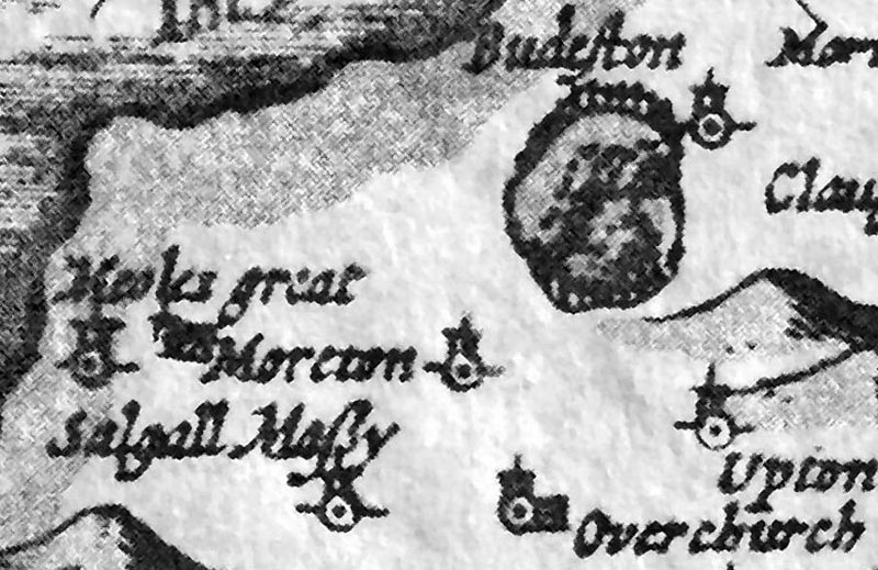
Moreton in 1611, also visible is Budeston
(Bidston) Hill, Great Meoles, Saughall Massey, Upton & Overchurch. Birkenhead,as
a place,
did not exist at this time. |
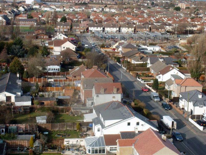
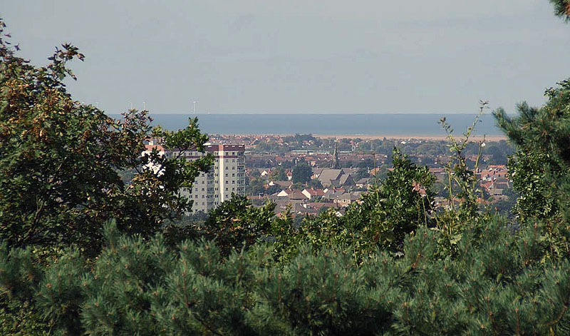 Moreton from Bidston Hill, Stavordale Flats, The Cross and Christ Church etc Sept 2009 |
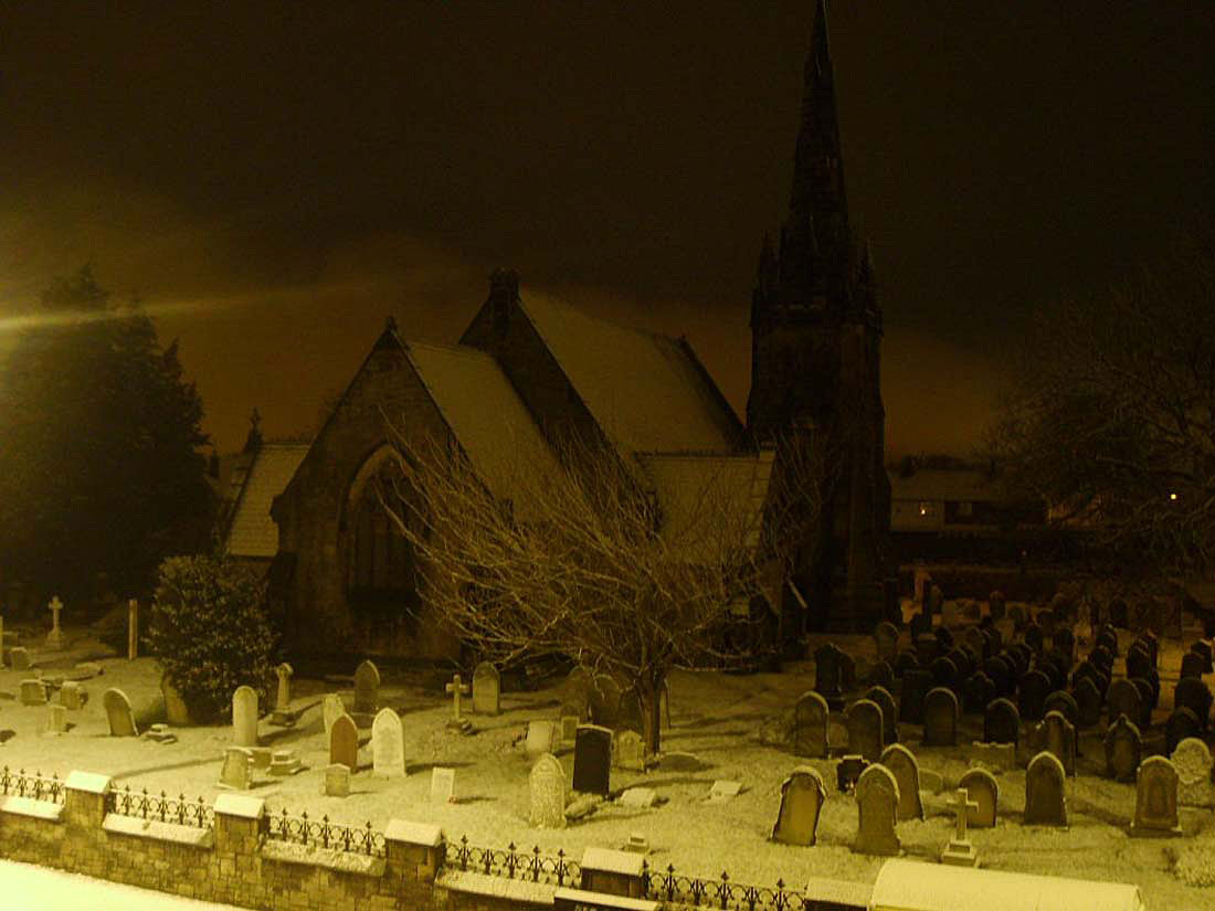 This superb image was taken around January 2005 by Louis Throttler. Christ Church Moreton |
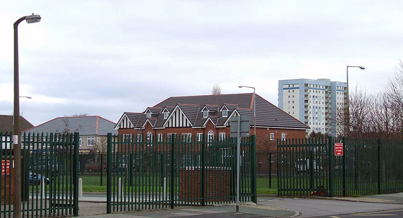
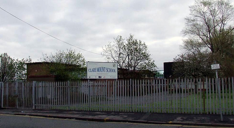
This area was Barnston Lane Primary School. Nov 09: Lisa Simmons emailed me with this information: This is actually a community centre now, my daughter's dance school hire it every Thursday, they also host a slimming club, have various groups for elderly, dog training classes, yoga classes all sorts goes on here. It is next door to the Wirral Boys Boxing club, which is an old wooden hut and has been there for years, and years!! Moreton Schools |
 |
 Moreton Post Card 1923 |
 |
 |
 |
 |
 |
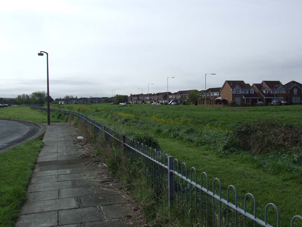
 Lingham Park 2008 |
 Eastway |
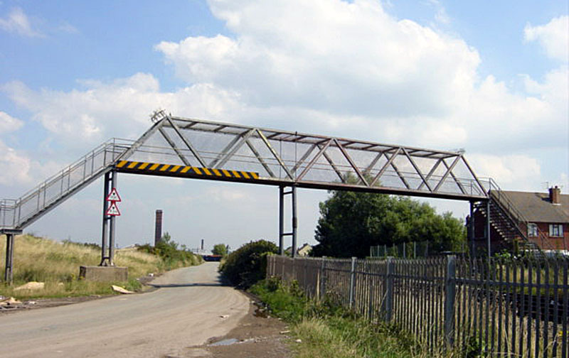 Footbridge from Curlew Way to Lingham Cottages/Leasowes Light |
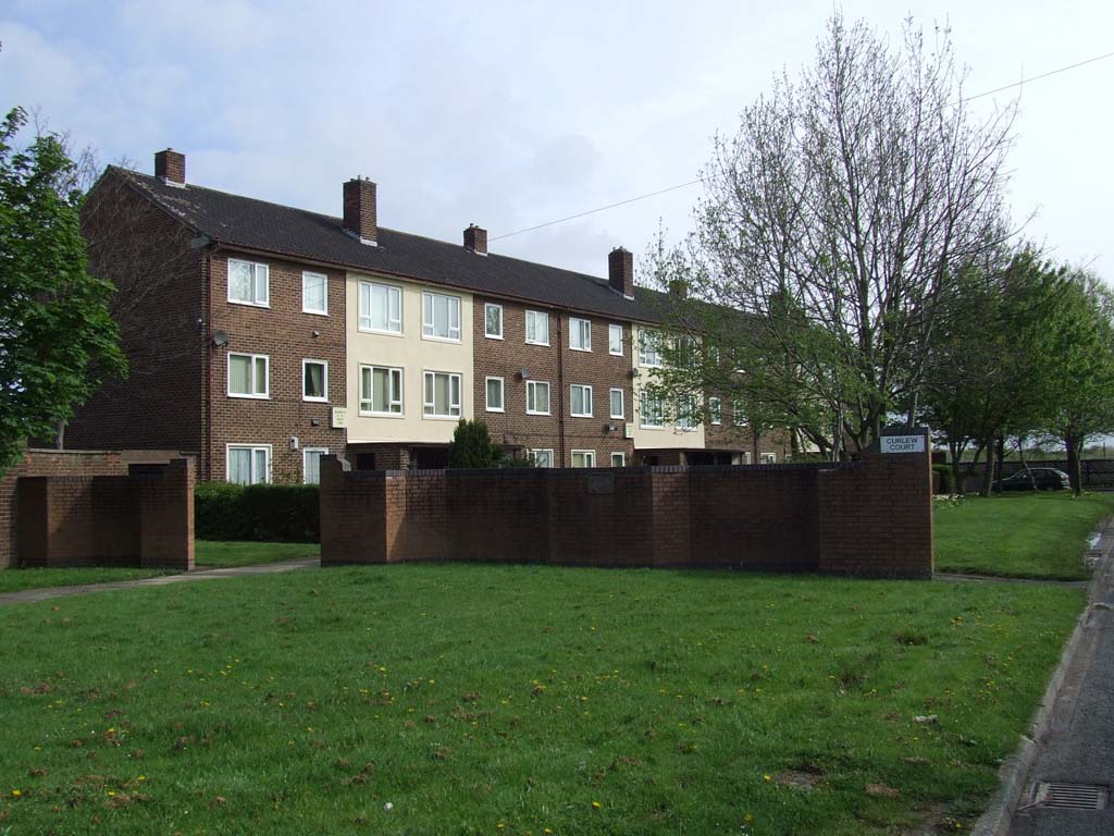 Curlew Way Flats |
 Curlew Way, the home on the left housed the Gooding family. I courted Tricia. I believe that Tricia still lives in the Northwest & sister Carol is in Australia. They had lovely parents and a brother Jack. |
 |
 |
 Arrowe Avenue, all down the left there used to be chalet style homes Arrowe Avenue (Feb 18th 2008) I was asked to visit this street for a couple of shots for an ex-pat! Down the left hand side here, and possibly the right, were wooden chalet type houses. Sammy Aspey, a school chum, lived in one of them. October 27th 2008, an email from Ann Shepherd (nee Westcott) to pass on to me the sad news that Sammy Aspey died suddenly last year. |
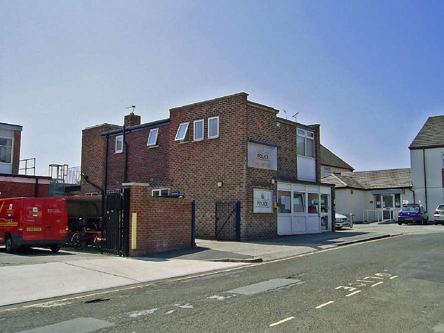 Cop Shop |
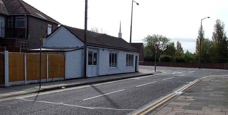
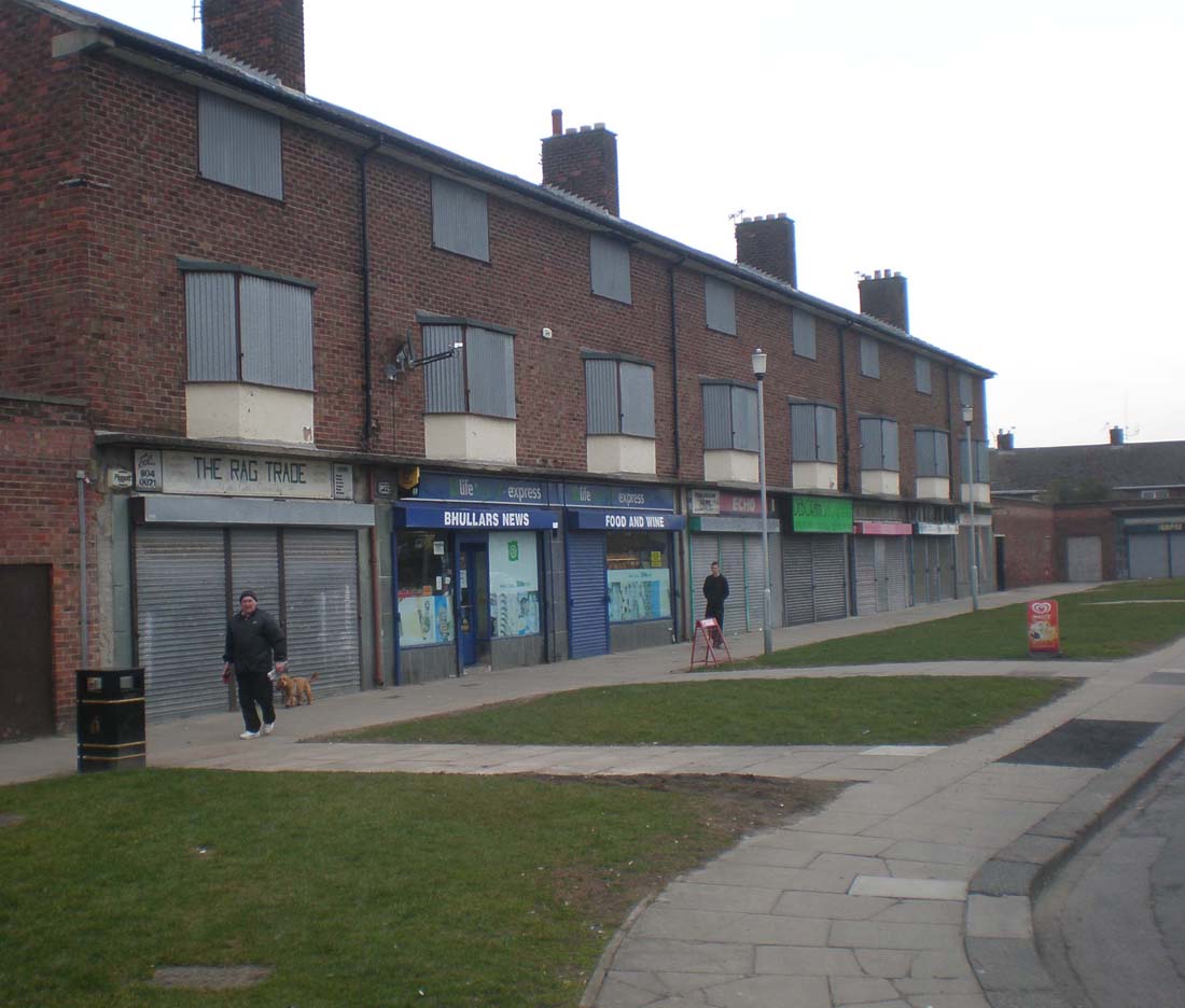 Once thriving shops, now a druggie den and drinking club!! I think they were demolished a couple of years later on. There was a greengrocer at one end, Nancy? Kilvington was the proprietor. Further along a chandlers, selling soaps, paraffin pegs and all sorts, quite an odorous shop. Skilbecks was a chemist, and there was a newsagent, and tobacconists. At the far end there was a butchers. (Info from Andrew Giliver) |
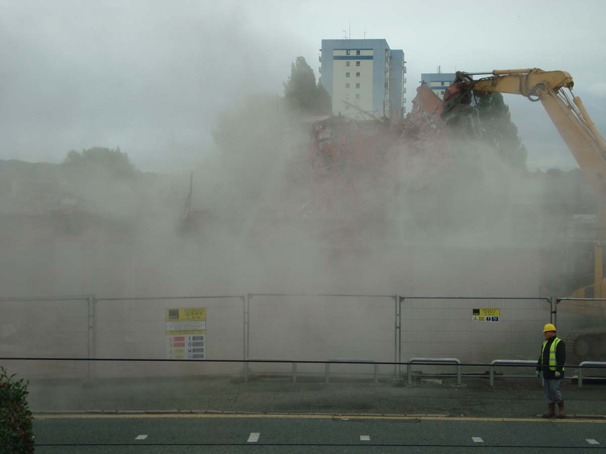
 Stavordale Road from the Flats. Note building of the Aldi Supermarket |
|
 Ternway |
 On Ternway, this view was once fields and agriculture, all the way to Meols. Now, yes, more houses. Area is collectively known as The Carrs and has been for a VERY long time (since Vikings!) |
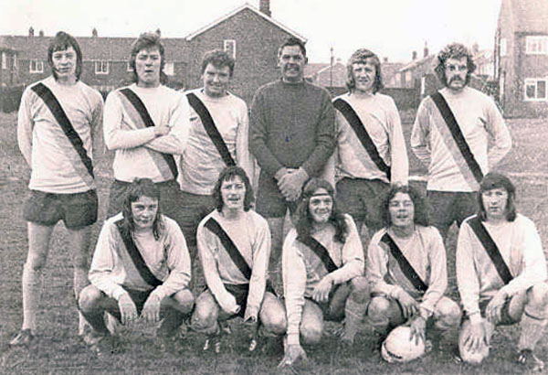
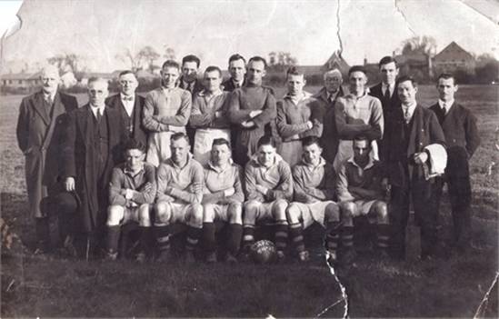 Moreton AFC was on Upton Road |
|
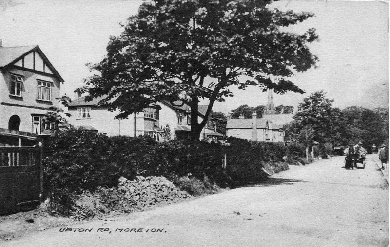
 Upton Road looking towards The Cross |
 |
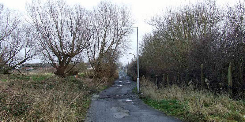
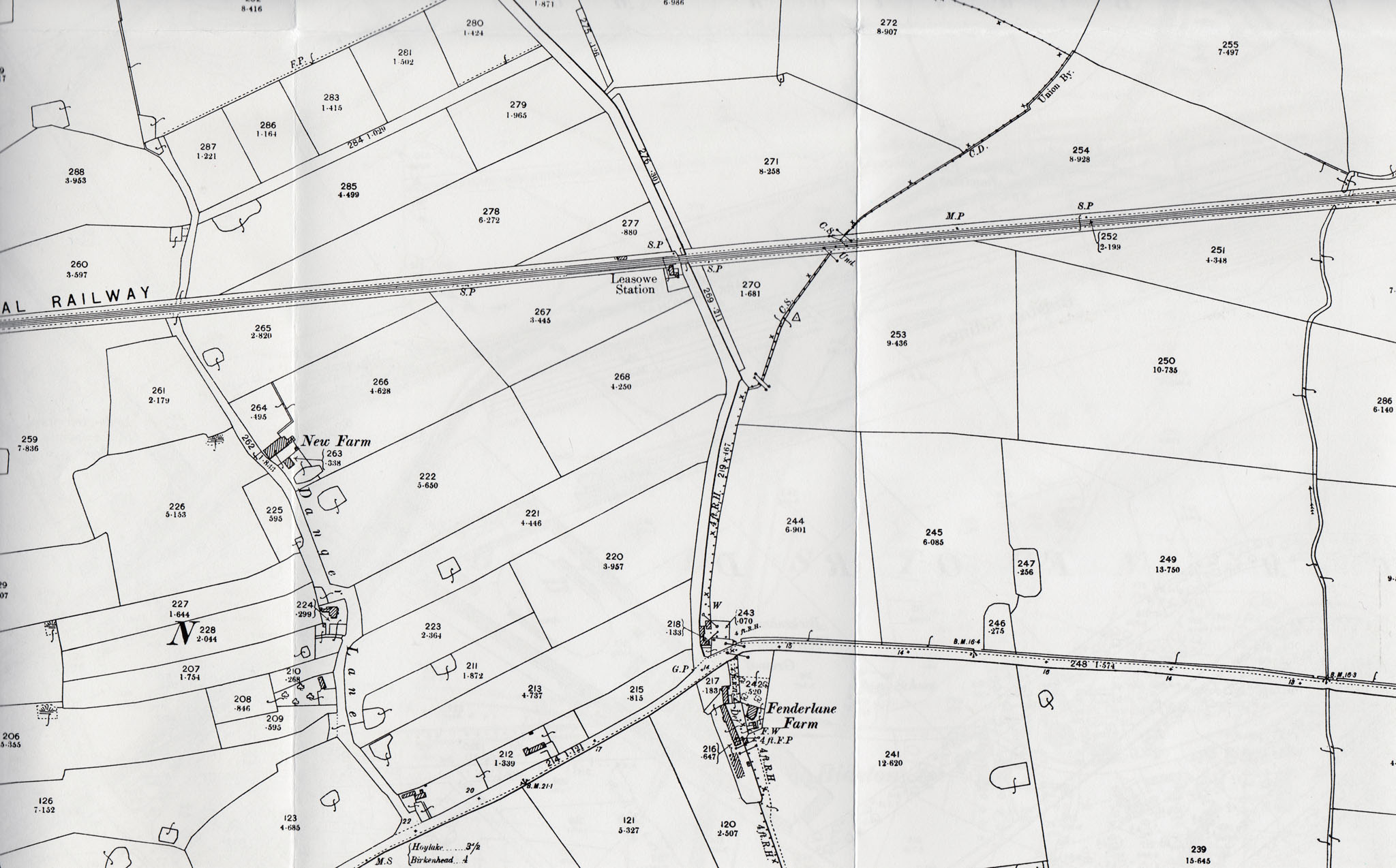 Fender Lane Farm & Danger Lane areas |
|
|
http://oldwirral.net/frank_mason.html |
|