![]()
![]()
Bidston - The Hill
|
Kenneth Burnley, in his book Portrait Of Wirral describes Bidston Hill thus: Mention of Bidston Hill conjures up, for me, fond memories of long childhood hours spent playing in its woods, picnicking on its springy turf, and hiding in its secret places. And always, the feeling that this was no ordinary place. And indeed few other parts of Wirral can offer so much of interest in such a small area. Where else in a few hundred acres can you find open, gorse-covered heathland with fine land and sea views, pine woods and rhododendrons, a lighthouse, an observatory, a windmill, rock carvings, and a fascinating seventeenth century village?
And
Harry Neilson wrote:
I distinctly
remember a walk over Bidston Hill when a child with an elder sister, about
the year 1868. A fresh breeze was blowing and the sails of the mill were
turning round in full swing, grinding corn. A cart, laden with sacks of
flour, stood just ready to leave by the stony cart track to the road below
while the miller stood by chatting to the carter. As we stood watching,
the loaded cart moved off and the miller asked us if we would care to look
inside the mill. His invitation was gladly accepted and in we went. My
first and lasting impression was of the loud buzzing noise of the
machinery, very like the sound of a swarm of angry bees but much louder,
and my next, the whiteness of everything inside the mill, caused by the
coating of fine white flour dust which nothing could escape, not even the
miller himself. |
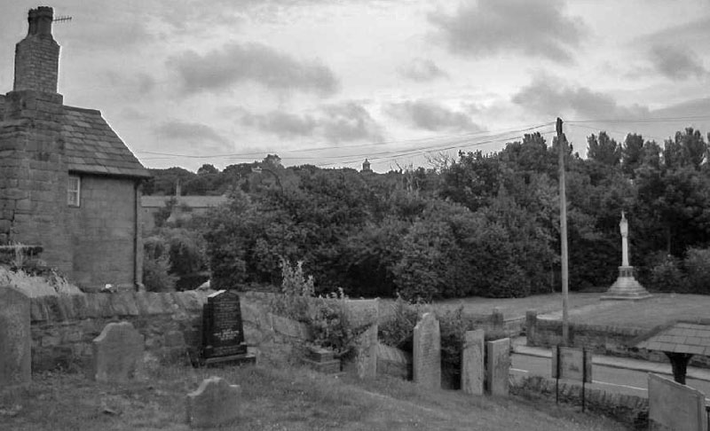
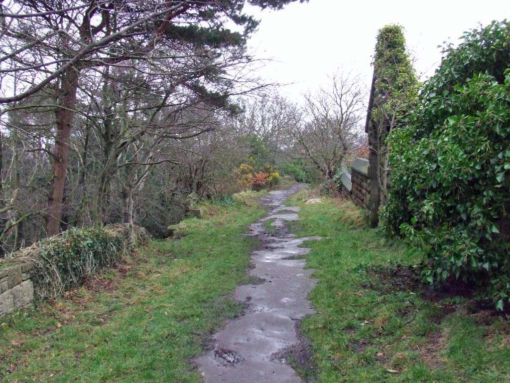
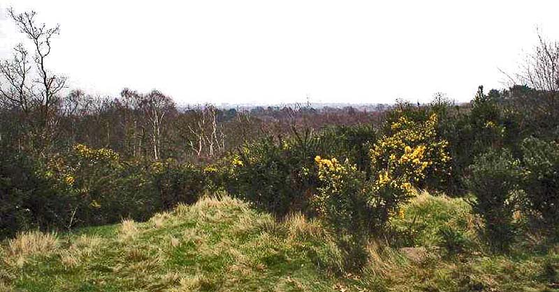
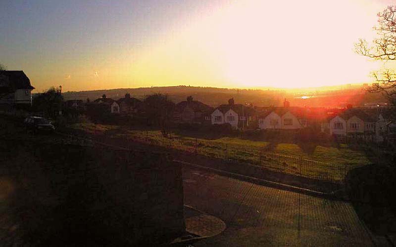 Bidston Hill from St Hilary's Brow, Wallasey - December 2004 |
|
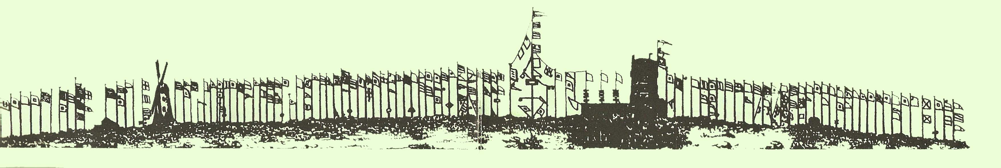
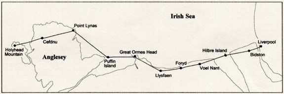
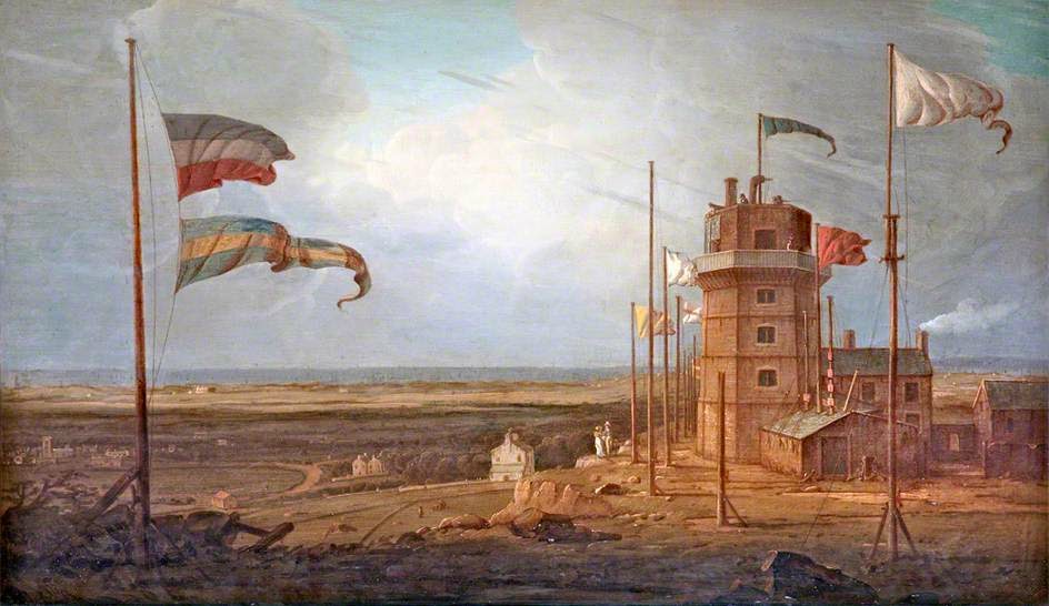
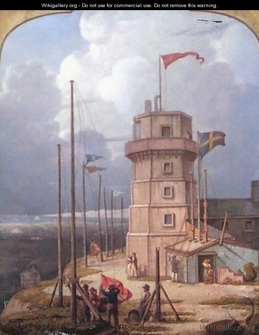
A Brief History of the Hill 1609 The first reference to a wooden windmill on Bidston Hill appeared in manuscripts. 1763 A signal house on Bidston Hill was first mentioned — although Bidston had probably been used as a lookout from pre-Roman days. A telegraph service was set up to give early notice of the arrival of ships in the Port of Liverpool. Over one hundred signalling poles were erected, extending from north of the lighthouse to beyond the windmill, belonging mainly to the merchants in Liverpool. As the ships carrying their cargoes were spotted out to sea, the relevant flags were raised and could be spotted from Liverpool. The advance knowledge of their ships’ arrivals enabled the owners to hasten the unloading of their cargoes. 1771 The first Bidston lighthouse, an octagonal structure, was built. The Government established a chain of stations fitted with semaphore signals, between Bidston and Holyhead, in order to ’give alarm upon any intelligence of an enemy'. It took only eight minutes to transmit messages from Holyhead to Liverpool. |
|
 |
|
|
1791 The wooden windmill was destroyed in a gale and was replaced by the
present one.
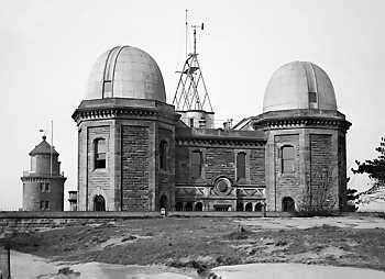
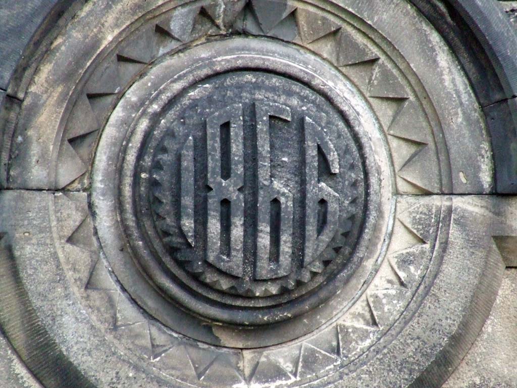
1866 Land was purchased
from a local landowner, Mr Vyner, and Bidston Observatory was built, faced
with sandstone excavated from the site, There was an equatorial telescope
in the west dome, which was used mainly for the observation of comets, and
a transit telescope in the east dome, which was regularly used for the
determination of time from the stars. These telescopes are now in
Liverpool Museum. There was a large instrument room - the through room on
the ground floor — which contained two warm air chambers. Each of these
could hold up to one hundred chronometers which were tested over several
months at varying temperatures and had to be very accurate before they
were considered safe to take to sea. Sextants, barometers and thermometers
were tested in the basement. One o'clock was still indicated to the
citizens of Liverpool, but now by the One O'Clock Gun. This was situated
at Morpeth Dock, Birkenhead and was connected by telegraphic line to
Bidston Observatory. It was fired from here by the staff each working day,
except for a six year break during the Second World War. It was also fired
at midnight to mark the beginning of the 20th century. The original cannon
was a relic of the Crimean wars, and after it was replaced by a naval
Hotchkiss gun, was on display in the Observatory grounds for many years.
1929 The Liverpool
Observatory ofthe Mersey Docks and Harbour Board and the Tidal Institute
ofthe University of Liverpool amalgamated becoming the Liverpool
Observatory and Tidal Institute. Two tide predicting machines were now in
use, and the tidal expertise of the institute received worldwide acclaim.
Weather forecasting at Bidston ceased, although observations continue to
be made to the present day. 2006: Windmill gets a new roof. 2013: Proudman Institute building demolished. This history was published by the Centre for coastal and Marine Sciences. |
 This is an Oliver Silk original dated 1923 of Bidston Hill 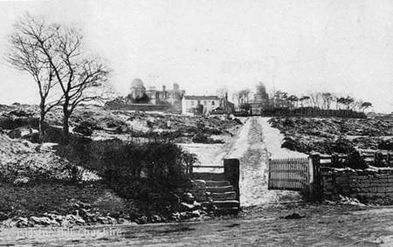 Bidston Observatory circa 1932. Lighthouse to the right and a remarkable LACK of trees 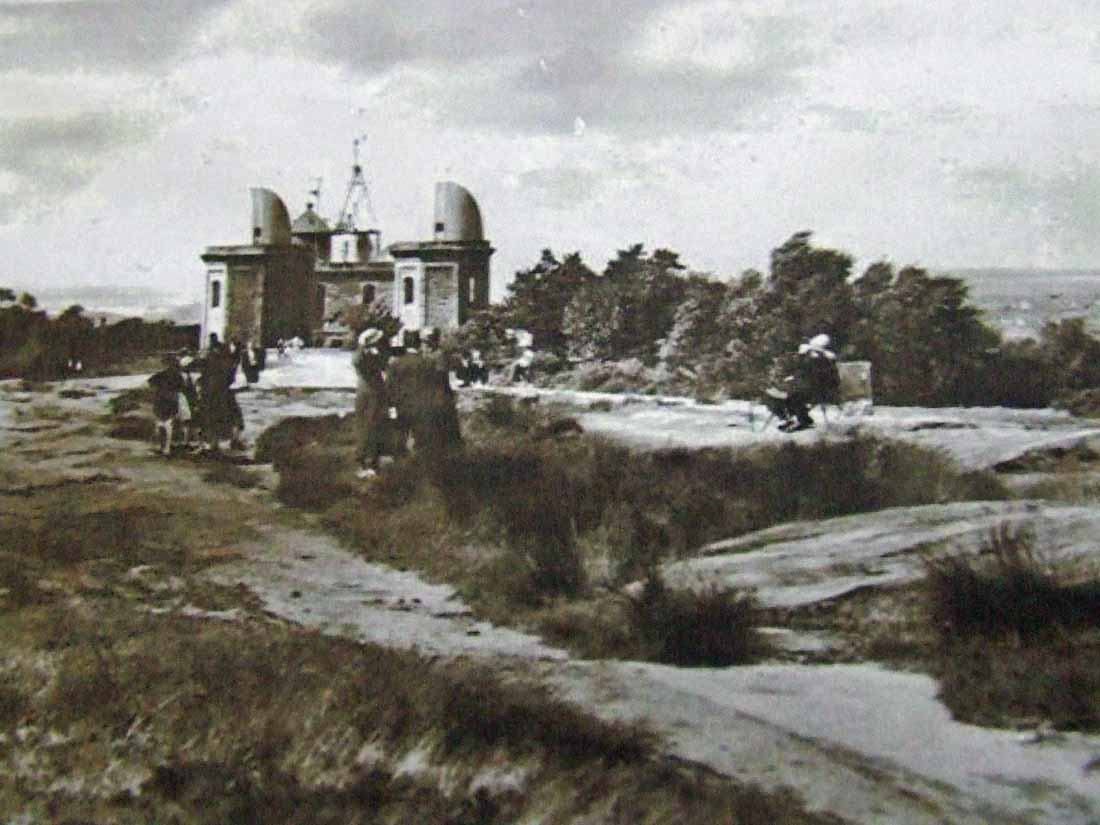 dated 1937, Image: Tam O'Shanter's cottage 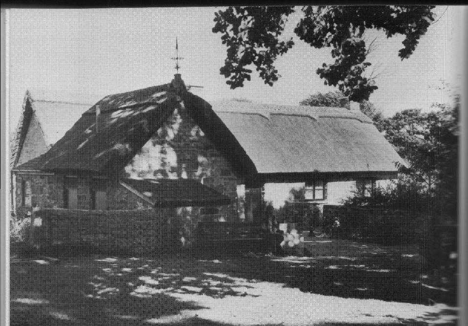 Tam O'Shanter's cottage |
|
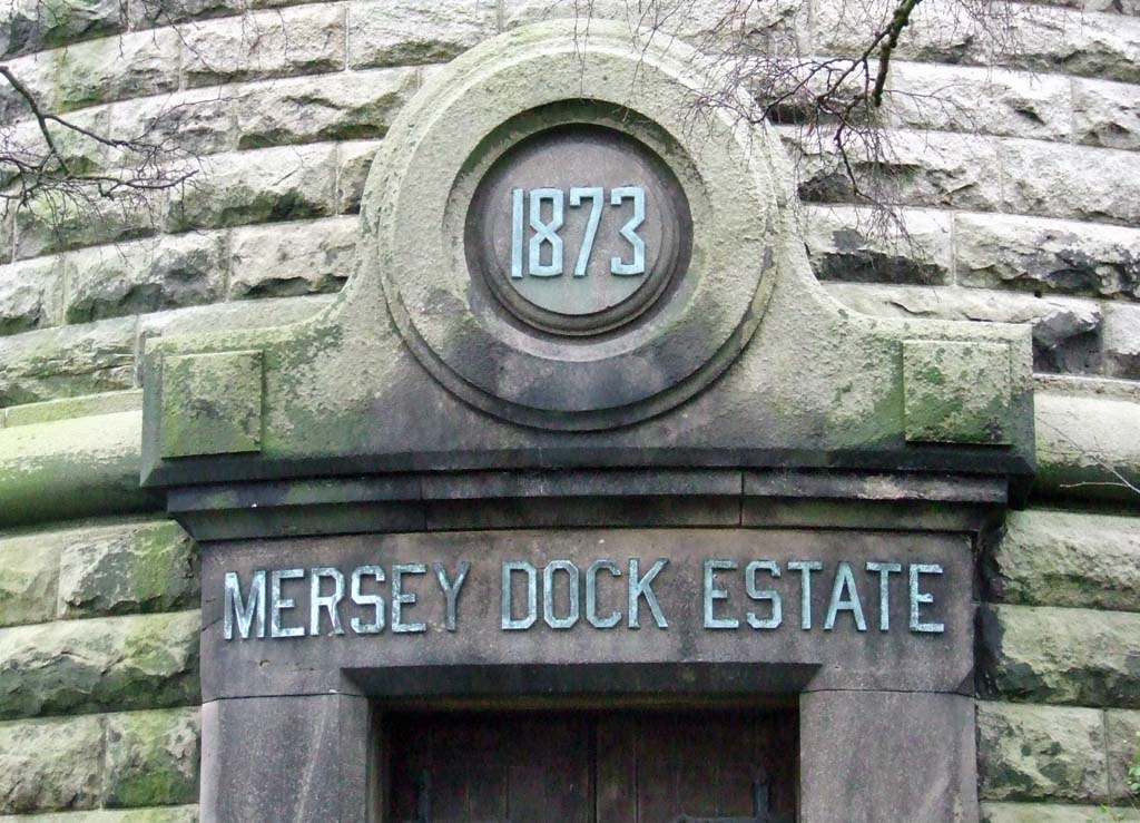
Further information to aid identification of incoming vessels was provided by the poles on the single storey outbuilding next to the lighthouse. Metal shapes were raised on the poles corresponding to the number of vessels in sight according to their rig. A flag was flown when the number exceeded three. From the lighthouse the poles indicated in order: snows, brigs and ships. The pole at an oblique angle on the end of the building was used to indicate a vessel in distress in the Rock Channel by means of flying a flag at half-mast. Flag sheets illustrating the lighthouse and its signals together with a key were published from about 1780 until the 1830s, when the semaphore (below) had established itself. The lighthouse and signals also appear on items of Liverpool pottery of the same period. Extracts from records dated 18 July 1827 give details of the sale of Bidston Lighthouse and Observation property from Robert Vyner to the Trustees of the Liverpool Docks. In 1841 Bidston Lighthouse had a female lighthouse keeper. In 1867 or 1872, the Bidston Lighthouse was demolished and rebuilt and a temporary light operated from the roof of the Telegraph Office. The light on the second Bidston Lighthouse stopped working on 9 October 1913. http://www.mersey-gateway.org/server.php?show=ConNarrative.64&chapterId=367 |
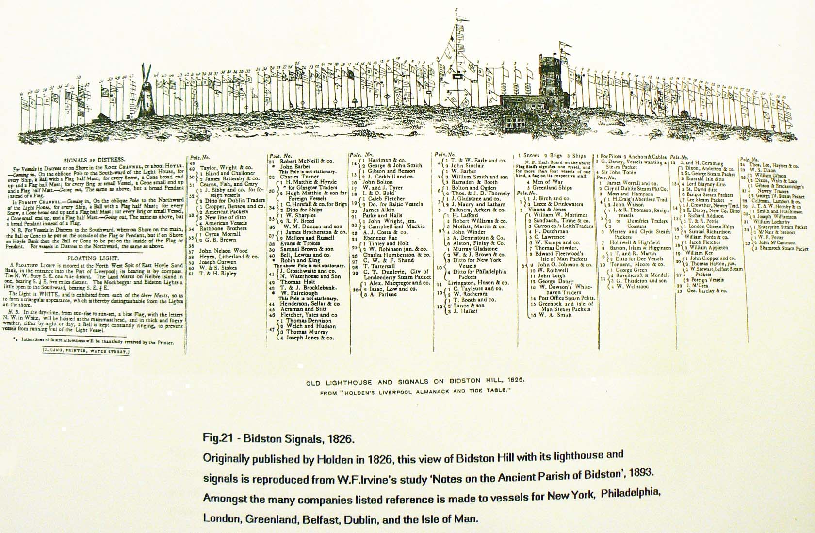 This image can be downloaded and enlarged to read text of flag identification |
 Semaphore Route to Liverpool |
|
|
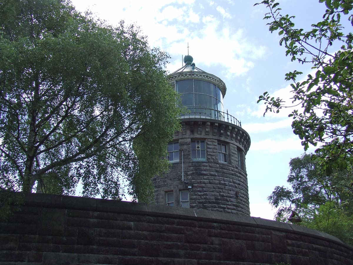
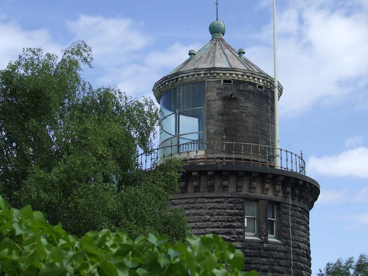
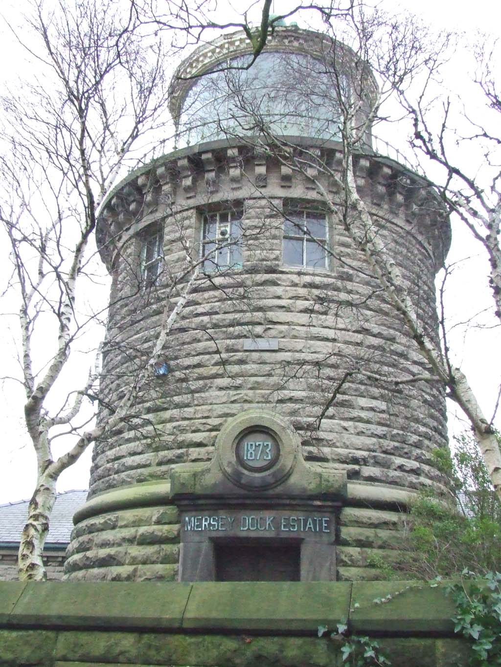
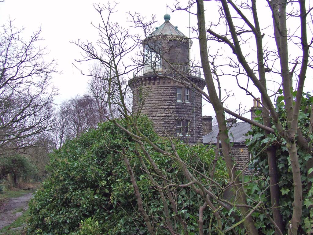
Bidston Lighthouse In 1771 Rock Channel to the north-west of Liverpool was the main approach to the River Mersey and in the same year Bidston Lighthouse was built on the northern coastline of the Wirral on the other side of the Mersey by the Liverpool Corporation as a navigational aid for vessels in the Rock Channel. It had the largest parabolic (plane curve) reflector, at 13½ ft (4.11 metres) in diameter. Built on Bidston Hill, the lighthouse also acted as a lookout and signal point using flags to signal the arrival of vessels in the Mersey Estuary to their owners. A flag or shape was given to each owner of a vessel at a certain point on a specified flagpole. This was raised when one of the owner’s ships was identified. By 1825 there were fifty flagpoles. From 1763 a Signal Station was located on the Hill eventually consisting of over 100 flagpoles sited all along the ridge of the Hill. Mostly used to send messages to the merchants of Liverpool of incoming ships, some were also used to warn of enemy warships and ships in distress. The most visible hole that remains is approximately 30 yards north of the Windmill. In 1771 the first lighthouse was built, it replaced Lower Mockbeggar light, which collapsed on Moreton foreshore. An octagonal building, it formed part of the chain of semaphore signals along the N. Wales coast. A message could be sent from Holyhead to Liverpool in 8 minutes! http://www.bidstonlighthouse.org.uk/history/census-records/ - interesting site |
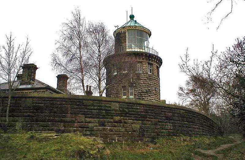 Bidston Lighthouse |
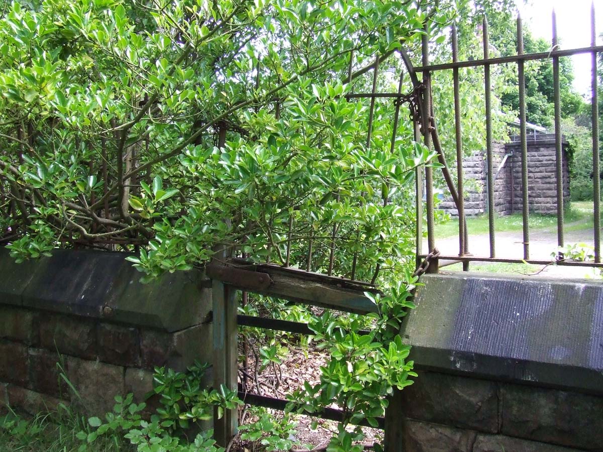 The old gate that led into the Light House, disintegrated and chained - 6th June 2012 |
 I had to climb a tree for this image of the Lighthouse entrance, at my age - phew!! (2004) |
 The original Bidston Light. Image from http://visitbidston.blogspot.co.uk |
 Bidston Light from http://visitbidston.blogspot.co.uk |
 Feb 2004 |
 |
 |
 |
 |
 |
 Bidston Lighthouse on Bidston Hill. July 2003. |
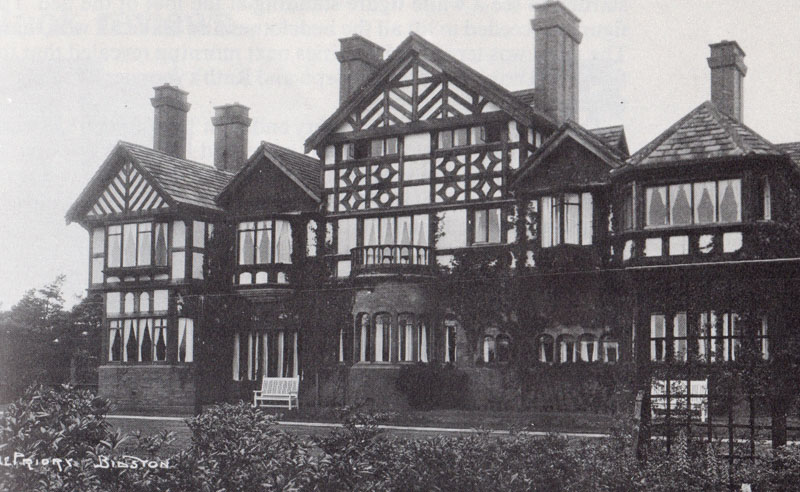
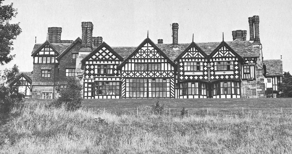 Royden Court, formerly Bidston Court |
 |
|
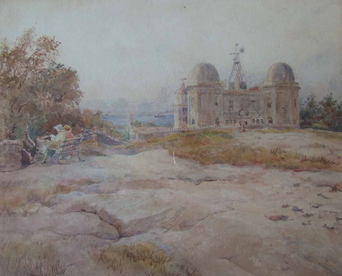
| Observatory | Above - The Priory Bidston |
 Bidston Hill 1904, from a copy at Tam O'Shanter's Cottage; as is the right image (1904) |
|
 |
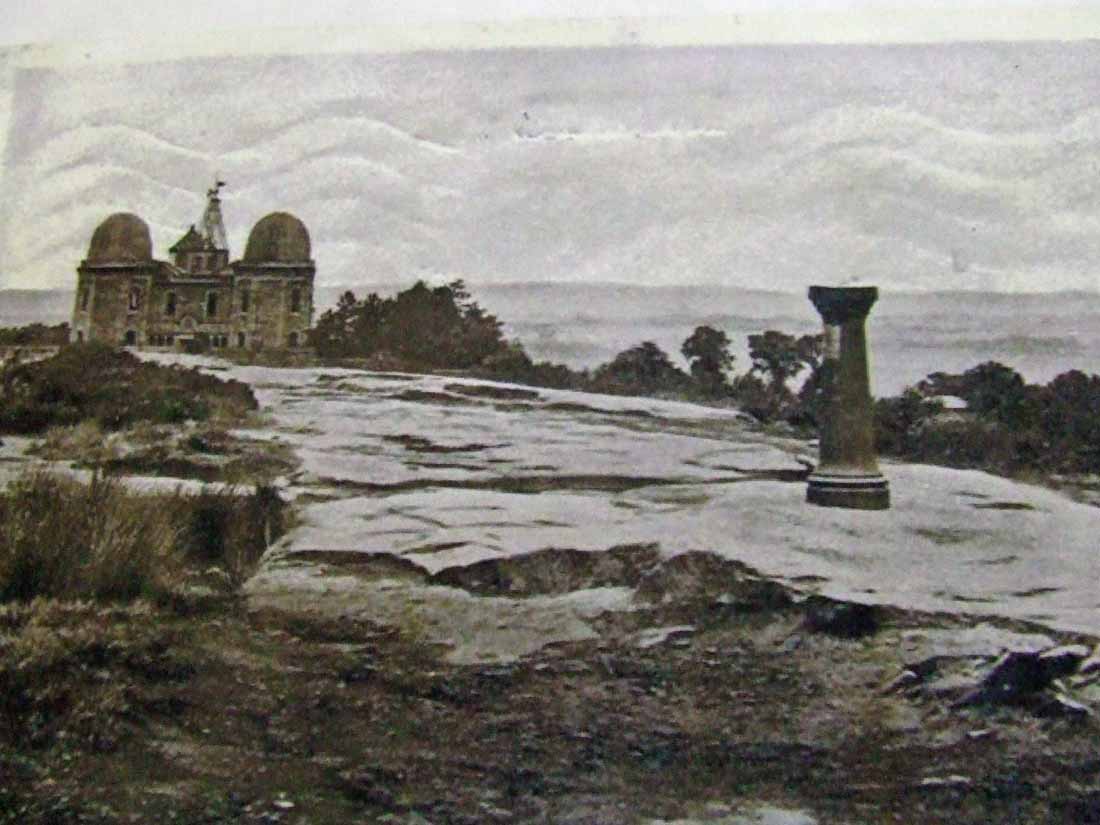
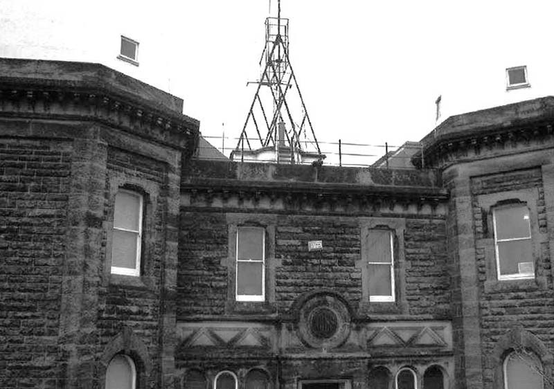
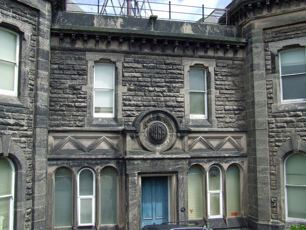
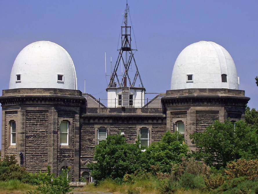
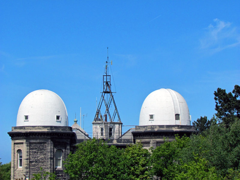
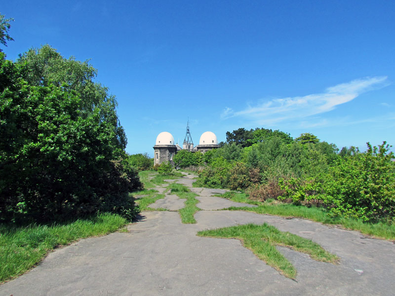
 Bidston Observatory |
|
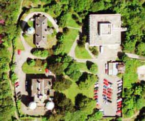
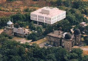
Top left is the lighthouse. Bottom left is Bidston Observatory. Top right is, or was, the Proudman Oceanographic Laboratory (now demolished) |
 Feb 2004 |
 2012 |
 |
 |
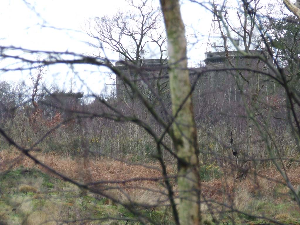
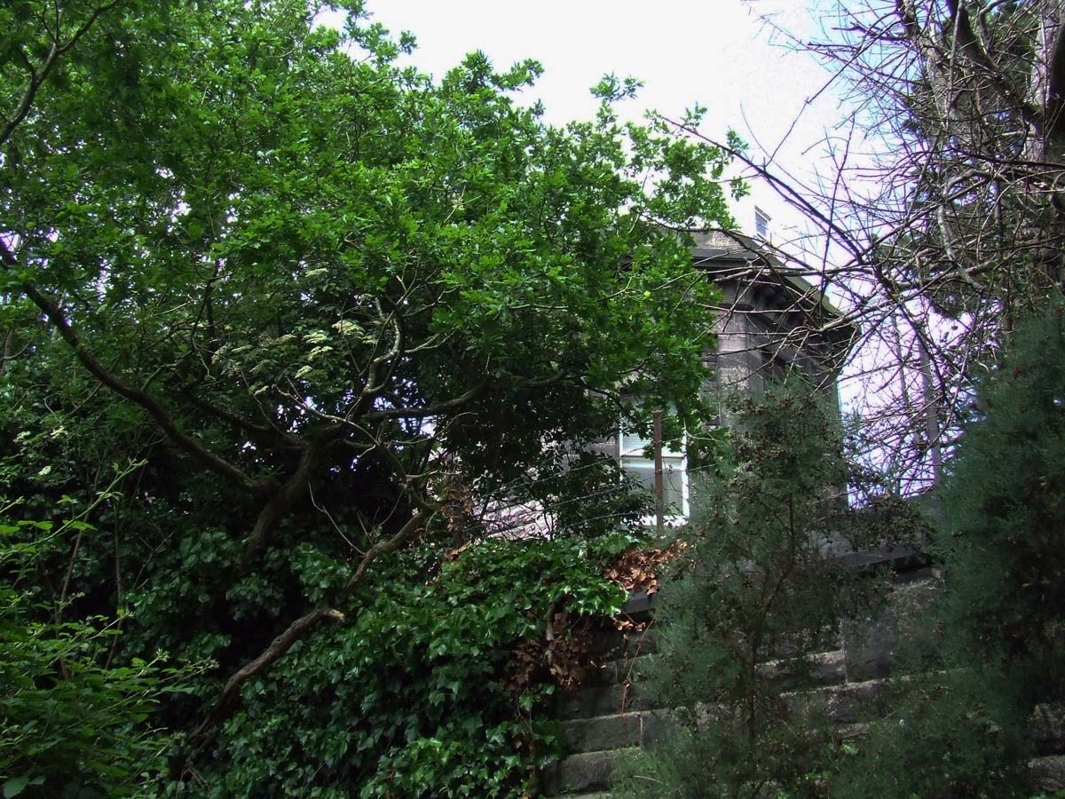 Observatory over the wall, the dome is 'lost' in the bright sky |
 |
 Looking back towards Bidston Village, by the lighthouse |
 |
Bidston, from the Breck, in Decembers cold light |
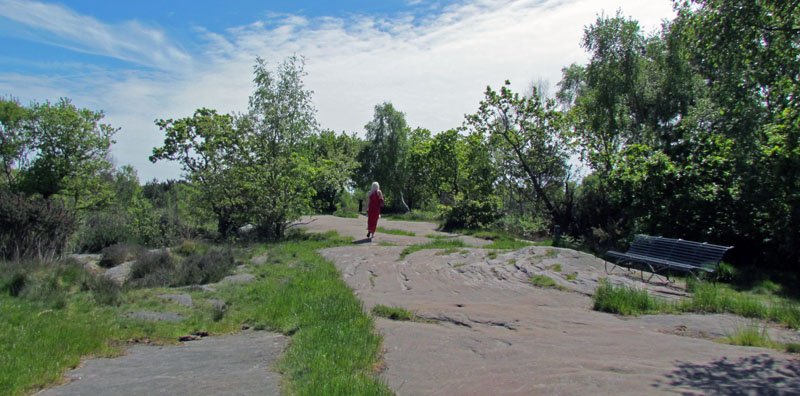
| Along the Top of the Hill | |
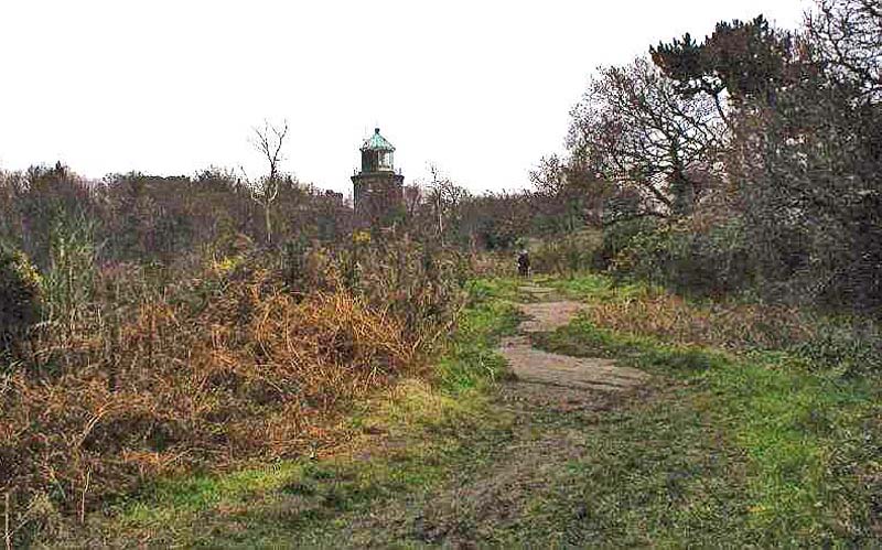
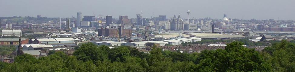
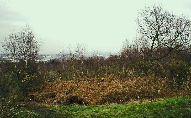 Looking from Bidston Hill towards the Mersey and the Pier Head in the distance. Taken from the north end of the Hill before the lighthouse. |
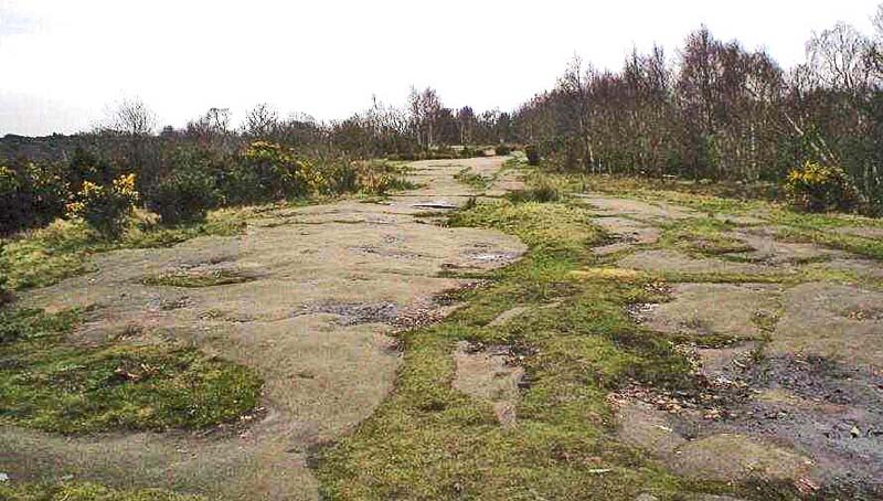 Heading on past the Observatory, we are now walking towards the Windmill, not yet in view. Note the large rock formations, dominant on the Hill. |
 Along the top of the Hill, looking towards Rock Ferry & Lairds |
 Docks & spire of St James Church |
 |
 |
 I had to take this. A young blonde lady, in evening dress, walking along the top of the Hill with a glass in her hand, containing an alcoholic beverage judging by her unsteady gait. Time approx 1330 hrs 23 May 2015 |
 Former drink fountain by the Observatory - May 23rd 2015 |
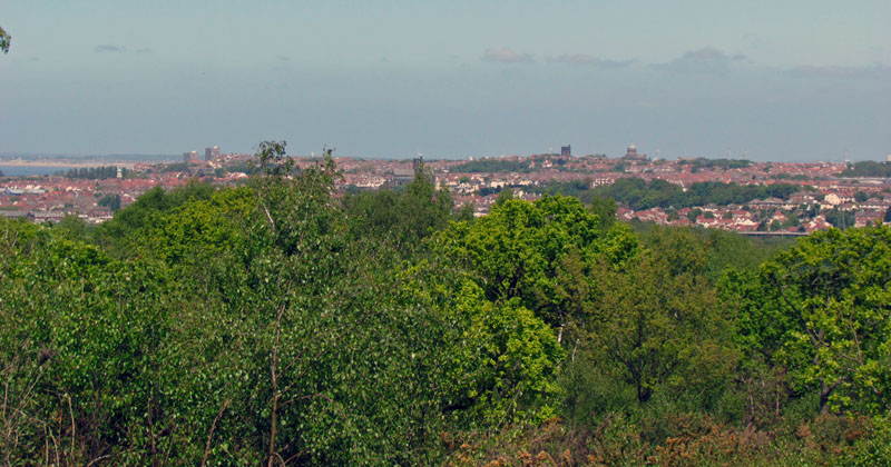 |
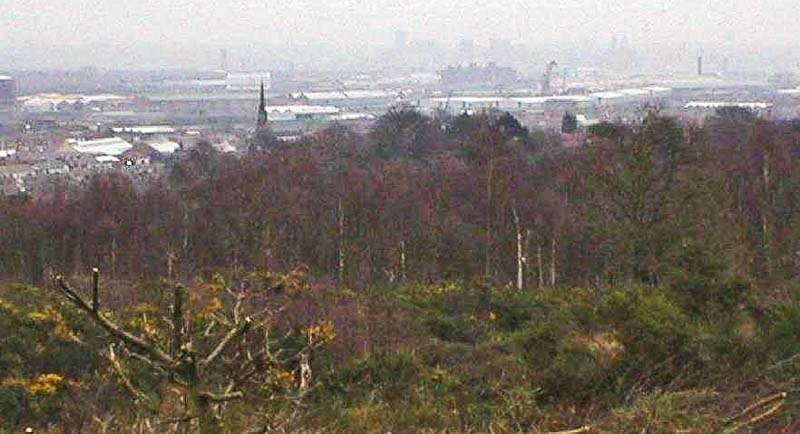
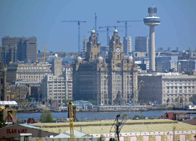 View towards Liverpool |
 |
 |
 |
|
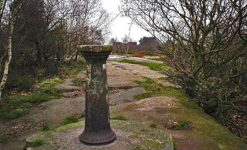
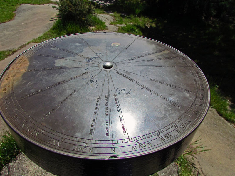
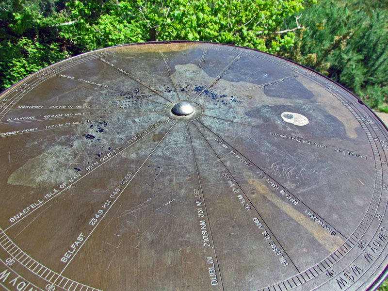
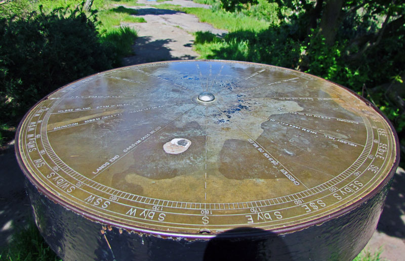
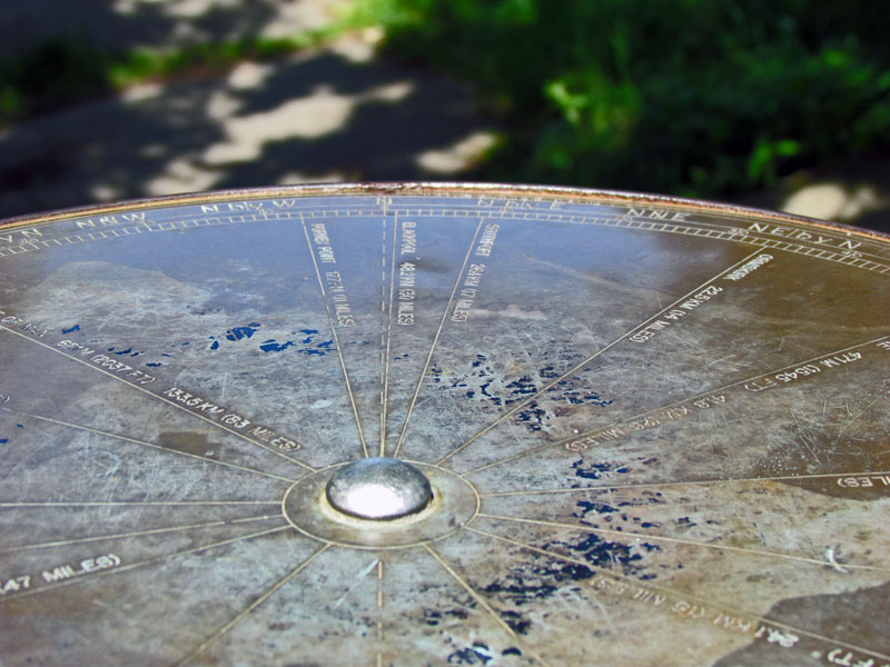
| The Bearings Pedestal | |
|
1904 |
 2004 |
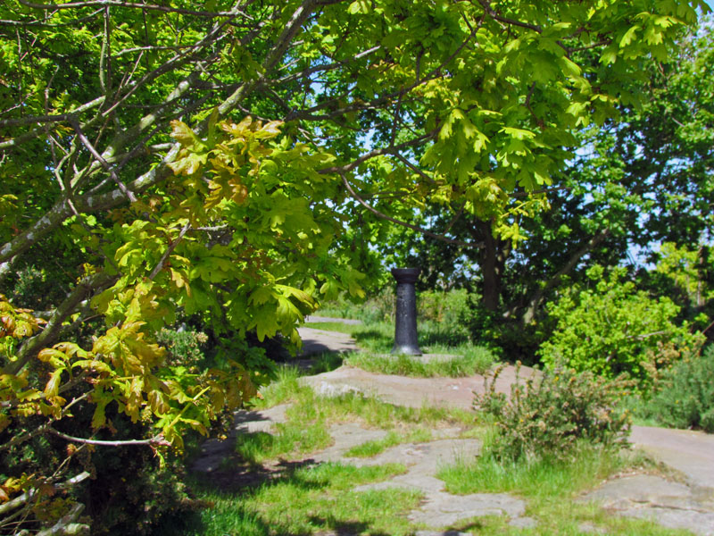 |
This is taken from the same place as in the 1904 image; you can clearly see the difference, even from the 2004 image, although that was in winter! |
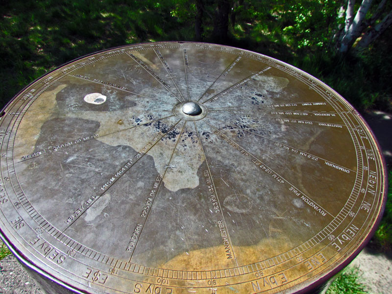 |
The trees all around no
longer allow the viewer to see the results. These images were taken by
me on 23rd May 2015 and cover all four 'sides' of the plate. Left: The apex of Bidston Hill. I recall, in my youth, this had a glorious flat brass dial upon the top, giving directions and distance to various landmarks in the north west. I did hear that the original brass disc had been found but it was not going to be replaced as a replica was to be made instead, as brass is quite valuable. When a child, I could use the brass disc to align myself with many features on the horizon. Mawl Famr, Snowdon, Blackpool etc etc. The same view now is blocked by the trees. |
 |
 |
 |
 |
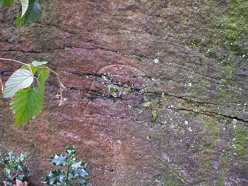
| Carvings | |
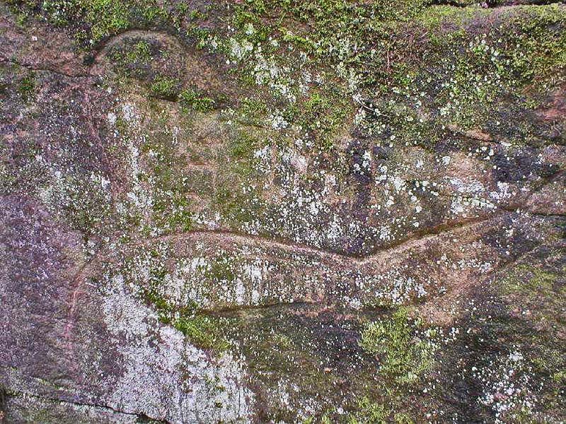
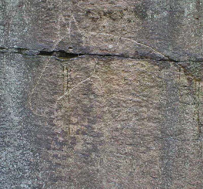
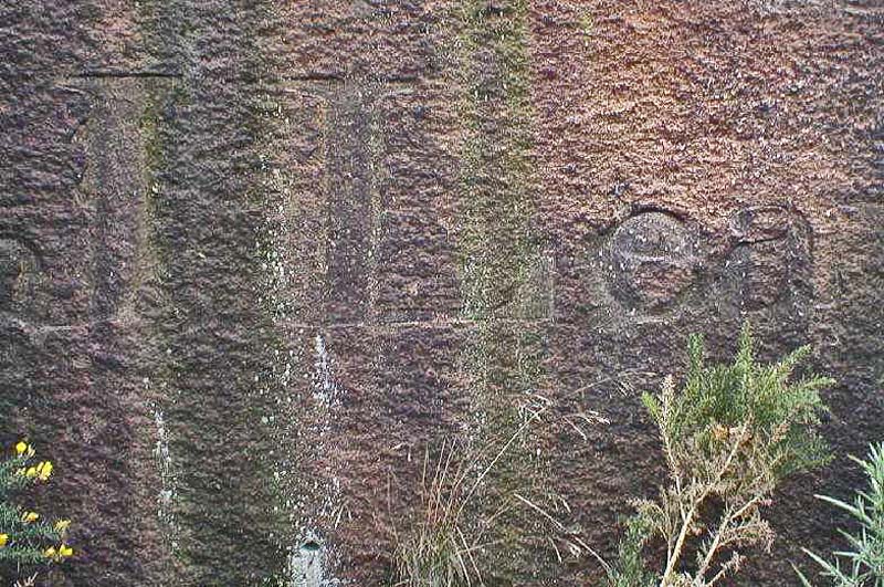 Carving in rock face near Observatory - J Lea. This was done by a young lady a couple of hundred years ago, just look at the detail? |
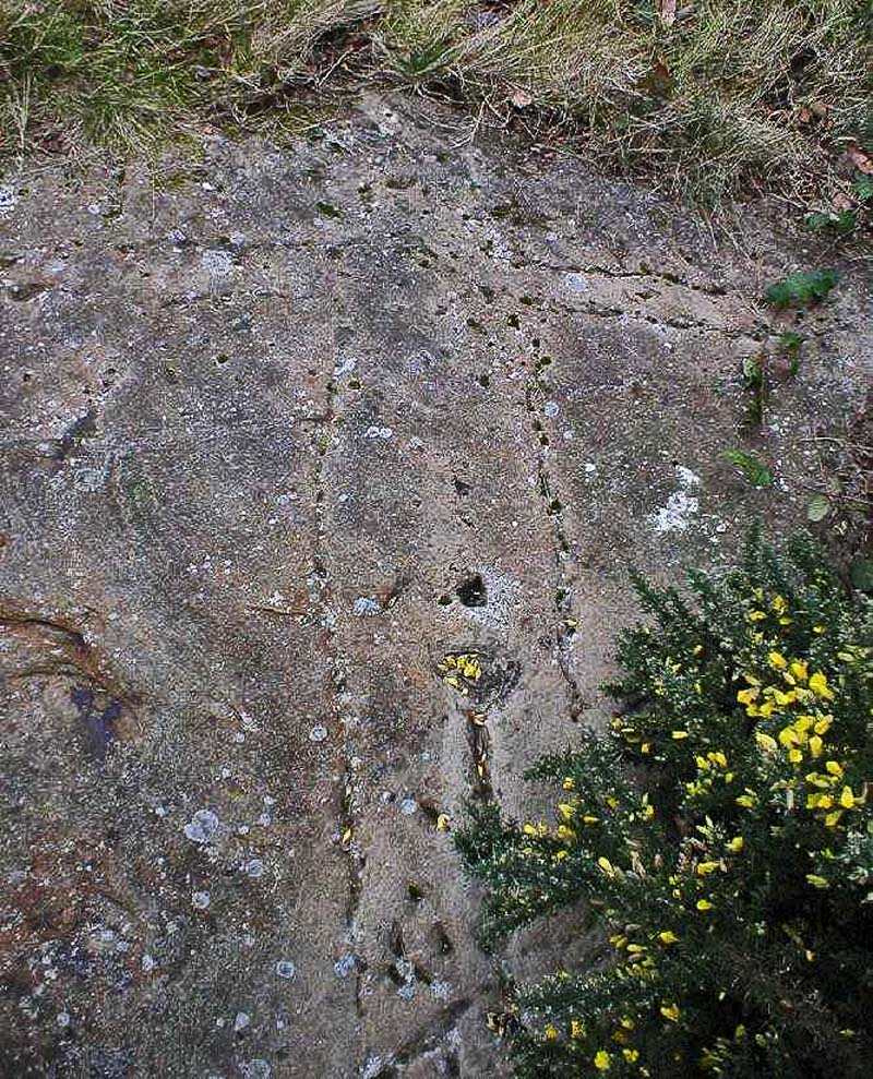 |
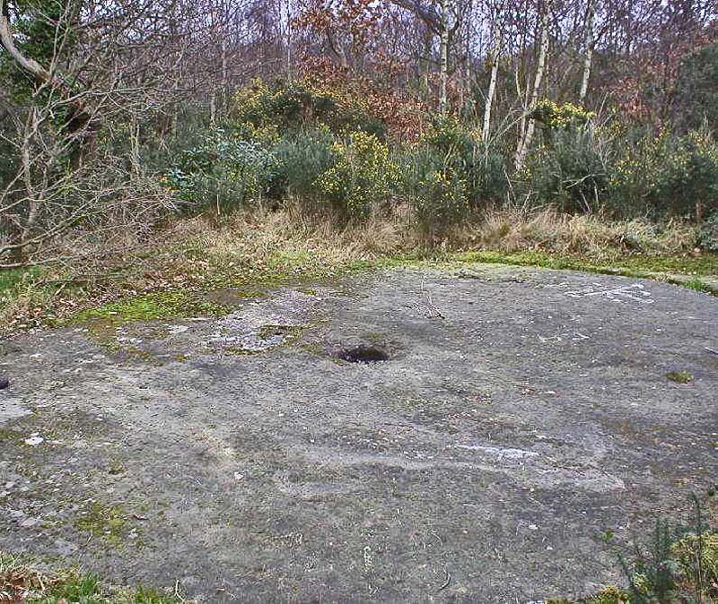
| The 'Cock-Pit' is another
strange feature on the Hill to be found at the very northern end near to
Bidston Hall. Consisting of a narrow circular trench, approximately 10
inches deep and 20 feet in diameter cut into the bare sandstone
surrounded by tall gorse bushes. Thought to be the site where
cock-fighting took place, it could also be the remains of a small gorse
mill where gorse was crushed for animal feed. An old, disused mill would
have been an ideal location for this illegal 'sport'. |
 |
 |
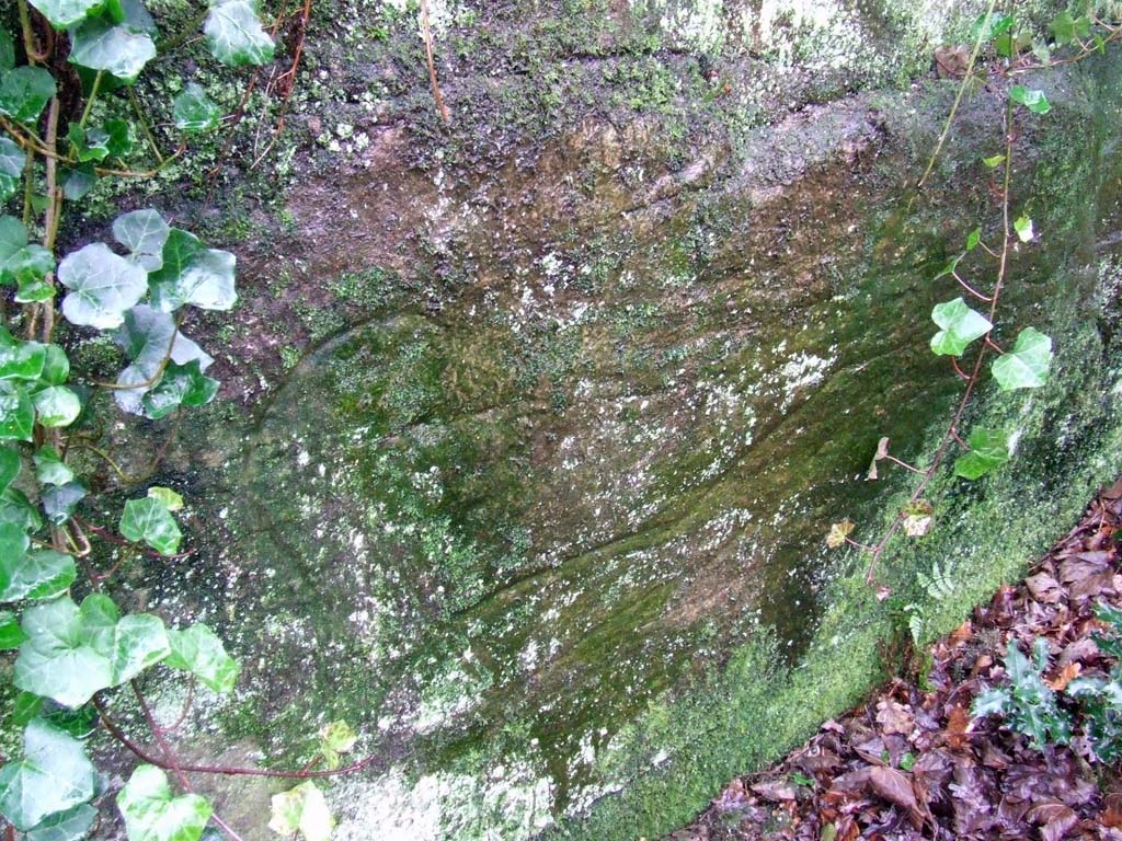 |
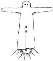
| Probably the oldest feature on the Hill is a four and a half foot long carving of a 'Sun Goddess', (above) carved into the flat rock north-east of the Observatory - it is supposed to face the direction of the rising sun on midsummer's day and was thought to have been carved by the Norse-Irish around 1000 A.D. Another ancient carving of a horse can be found on the bare rock north of the Observatory, just before the path turns down to Bidston Village. | Other, more recent rock carvings can be seen on the vertical rock face just south of the Observatory. |
 |
 |
 |
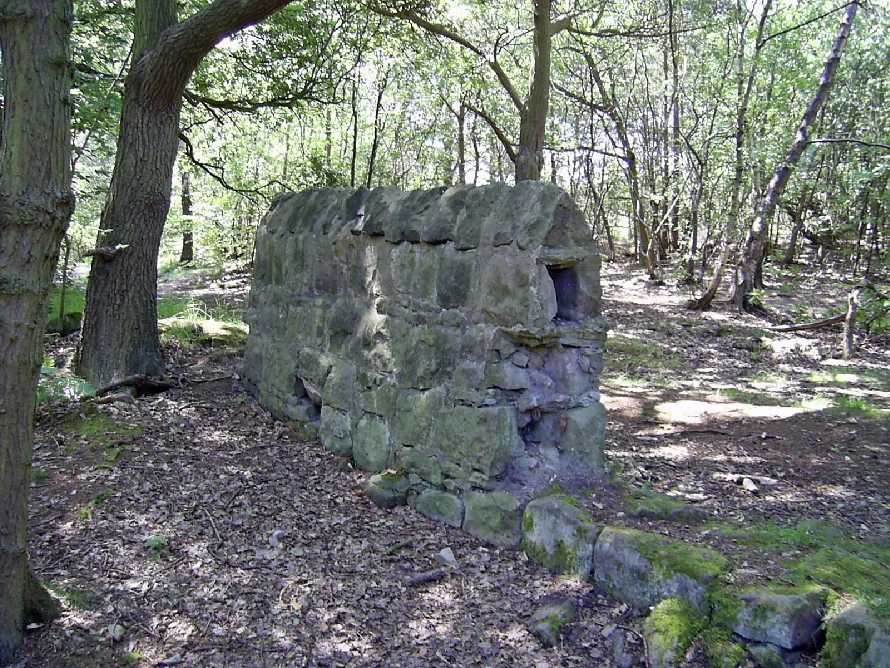
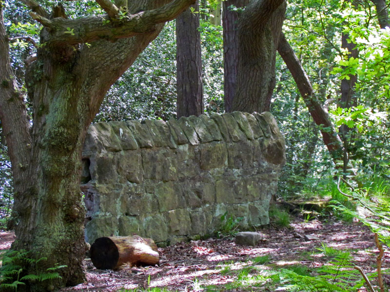
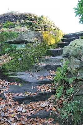
Myths Bidston Hill is one of the rumoured resting places for the Holy Grail and could be mentioned in the tale of Gawain in his account on travelling near the Wirral, there are also links to Joseph of Arimethea in the area too. On the hill top one can hear the sound of water rushing on the rocks near the Observatory, this has led to speculation that there is an underground water source and possibly further tunnels linked with Mother Redcaps and the tunnels in New Brighton. There are thought to be several entrances concealed on Bidston Hil and the nearby village. The hill has long been linked with occult and the the stone steps leading from the wood to the top are called "The Witches Steps". There are various "mummer" carvings on the rocks facing the east, one barely visible, adjacent to the Observatory wall, is a form of a man with a noose around his neck and dagger at his throat; this has led to speculation that this points to a ritual sacrifice, although it is thought these carvings date only from the 18th century. Eleanor Road is thought to be part of a Roman road linking Wirral with Chester. The bunker was built in an existing system of tunnels already in the area. https://www.facebook.com/HiddenWirralTours/ What we must remember is people are easily led, especially 'back in the day' and most myths are just that 'myths'. But interesting stories nonetheless. |
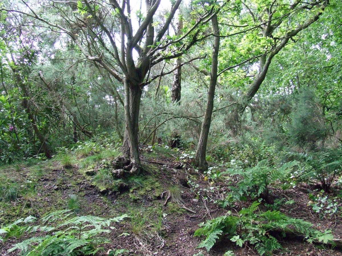
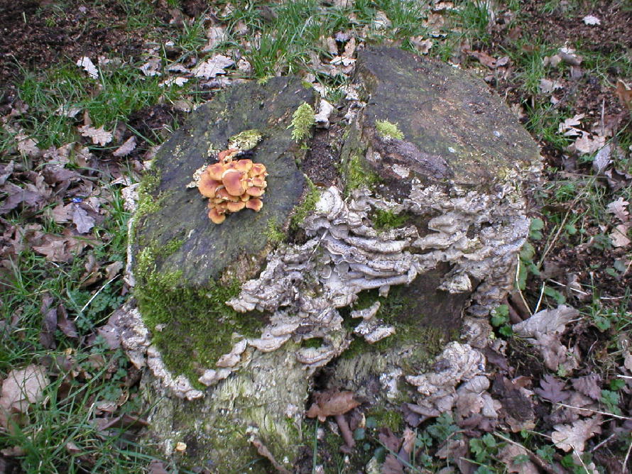
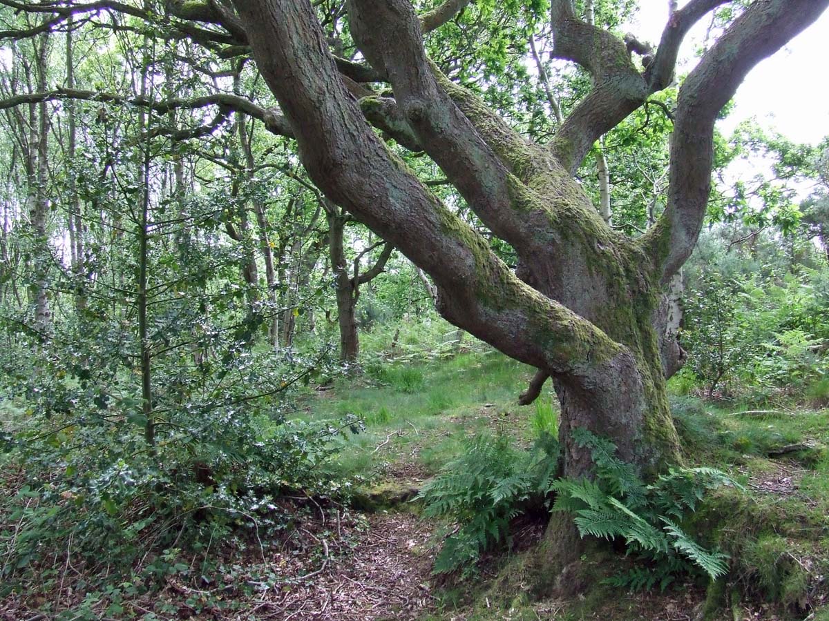
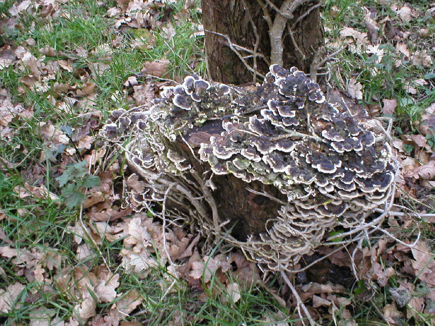
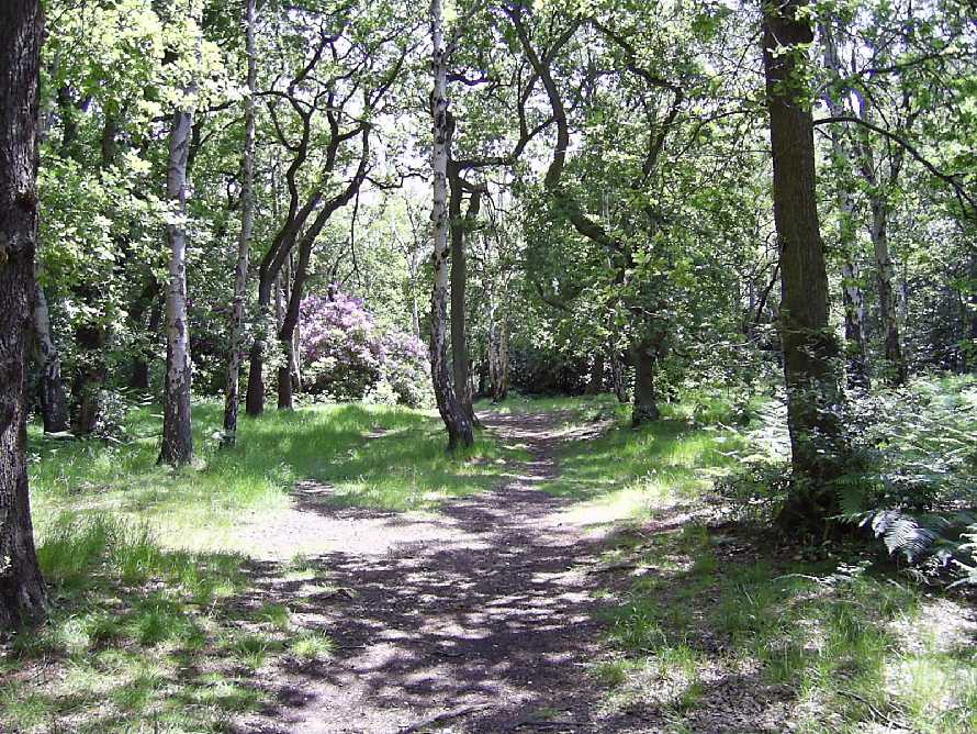
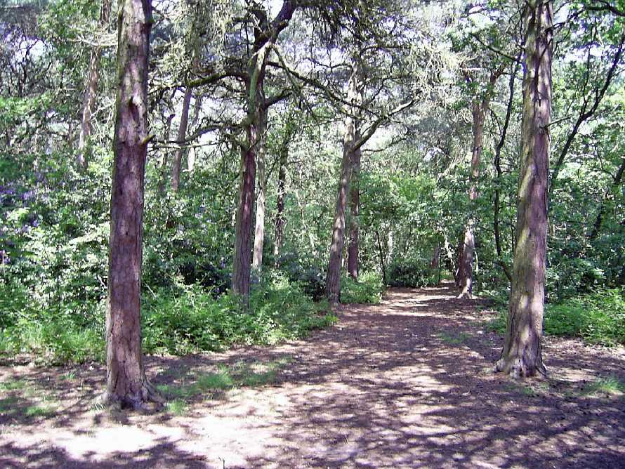
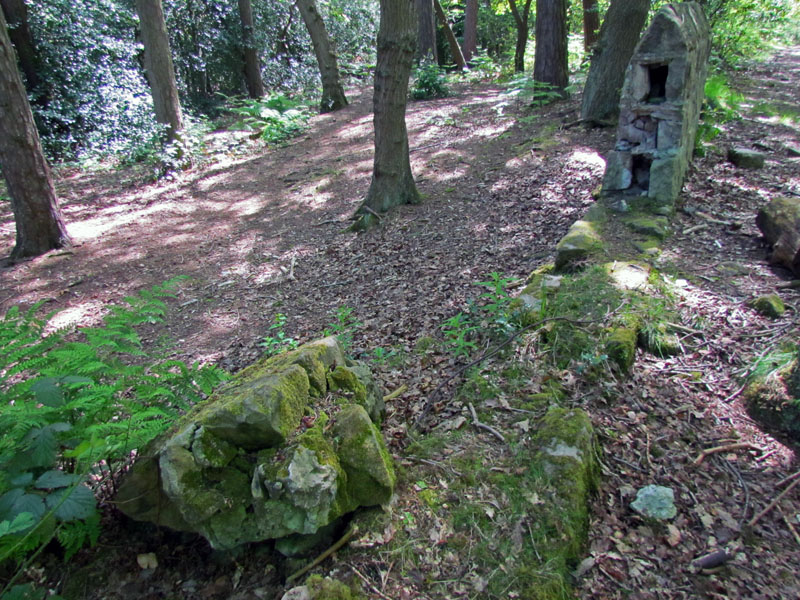
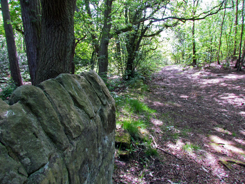
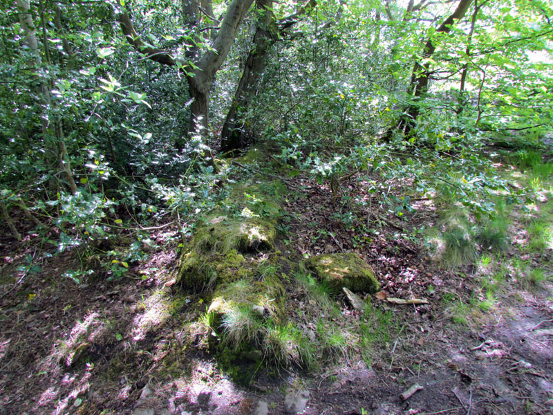
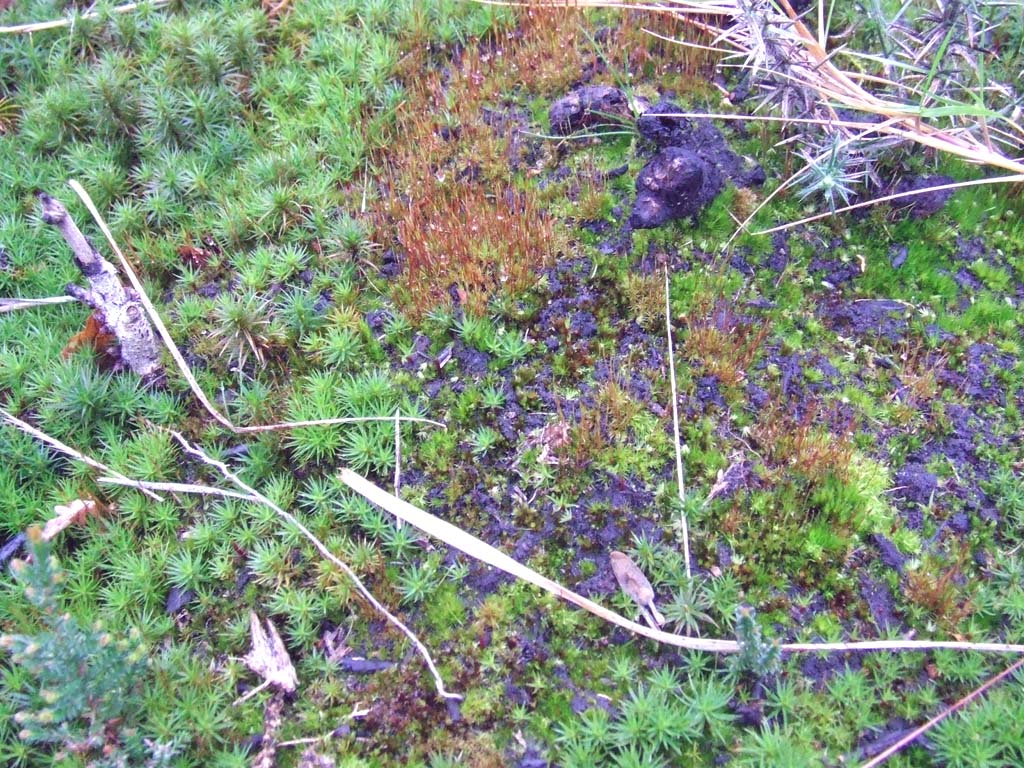
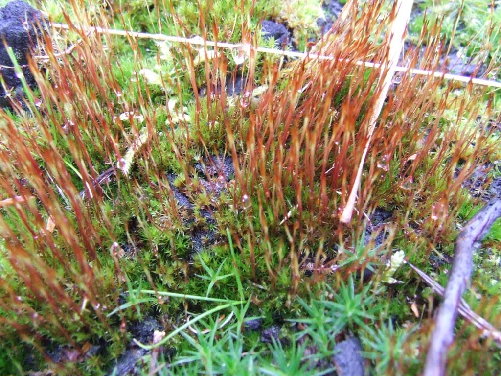
| Woodlands along the sides of the Hill | |
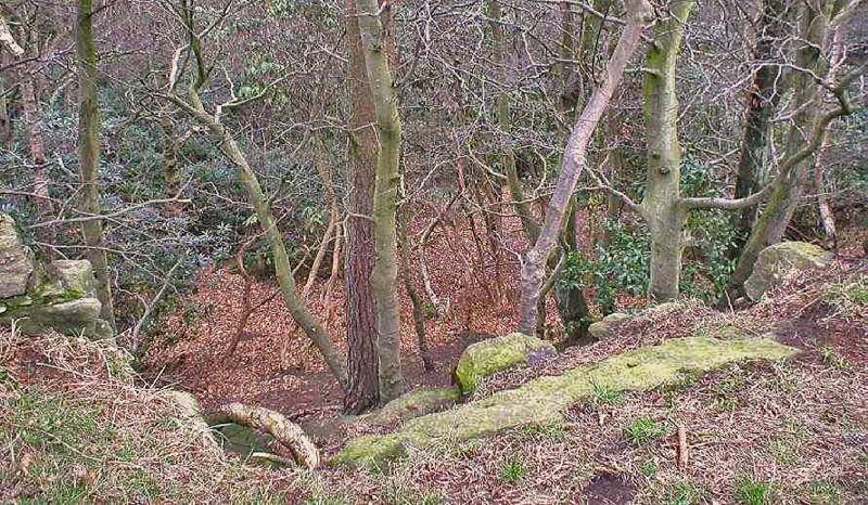 A collapsed stone wall showing downwards to the western side of the Hill where I would spend many an hour just wandering along the paths and gullies, clearings and ferns. |
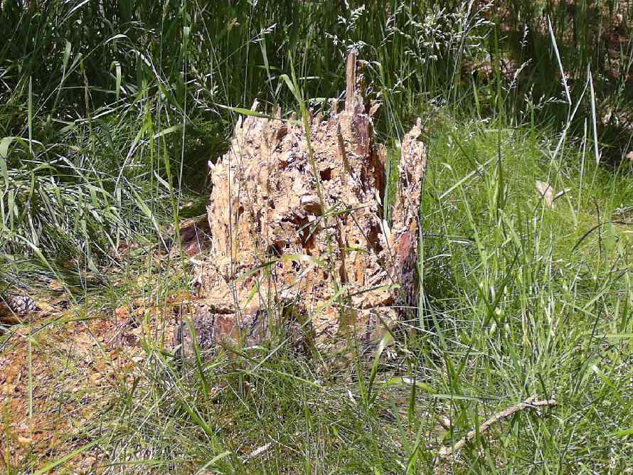
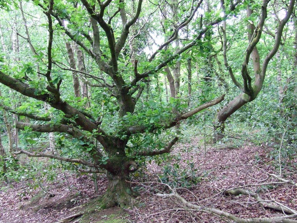 There are still parts of the Hill untouched by paths etc. I went through a bit and found some lovely old trees - June 2012. |
 |
 |
 6th June 2012 |
 |
 |
 |
 |
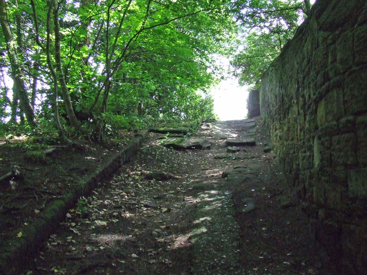 The ancient path from Eleanor Road to the Lighthouse. Just after I had gone down from here some moron raced up here on a trials bike (he was later seen going onto the Ford Estate). |
 |
Remains of a stone and mortar wall deer park enclosure which runs from the Observatory region towards the Mill but below on the Flaybrick side of the Hill and again on 23rd May 2015 below. This could be the same wall built by the Stanley Family in 1407 to enclose a deer park. |
 |
 |
 |
 |
 |
 |
 |
 |
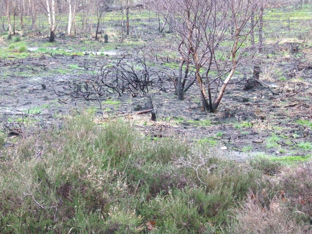
| The Hill management is undertaken by the Rangers & volunteers based in Tam O'Shanters Cottage on Flaybrick Road. They clear areas allow regeneration. | |
 |
Penny-a-Day Dyke, Bidston Hill
|
| Regeneration | |
 |
 |
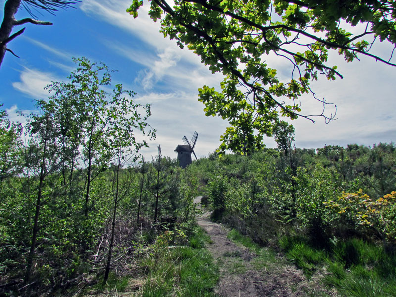
| The Mill | |
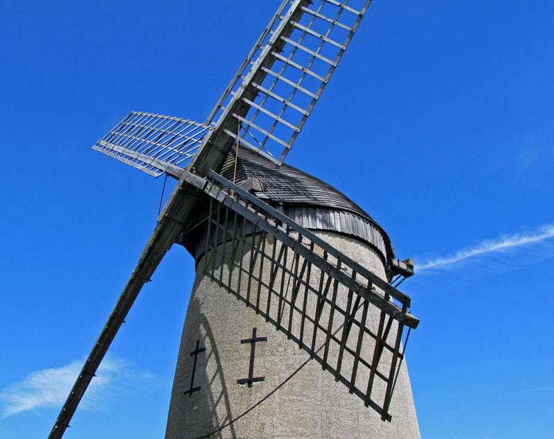 |
This image was taken on 23rd May 2015. The Mill has its own page on this site. |
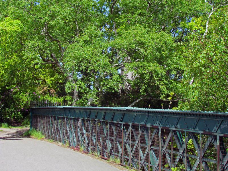
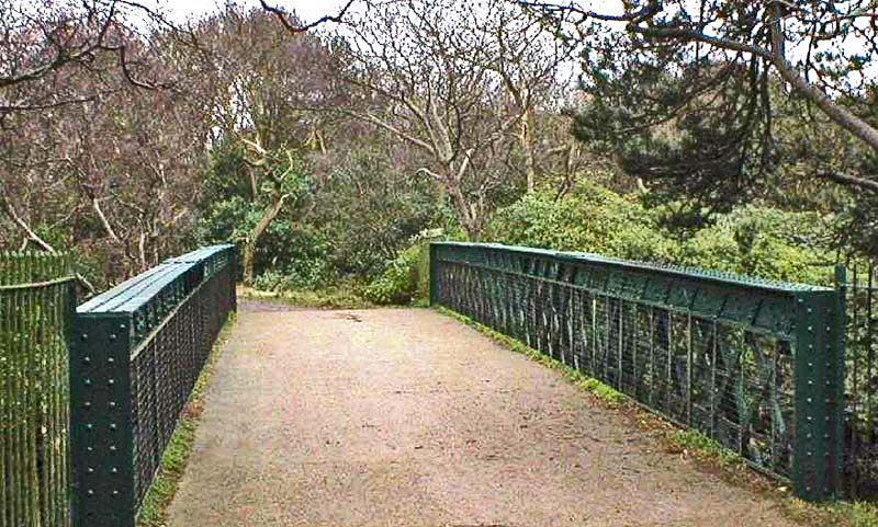
| The Bridge | |
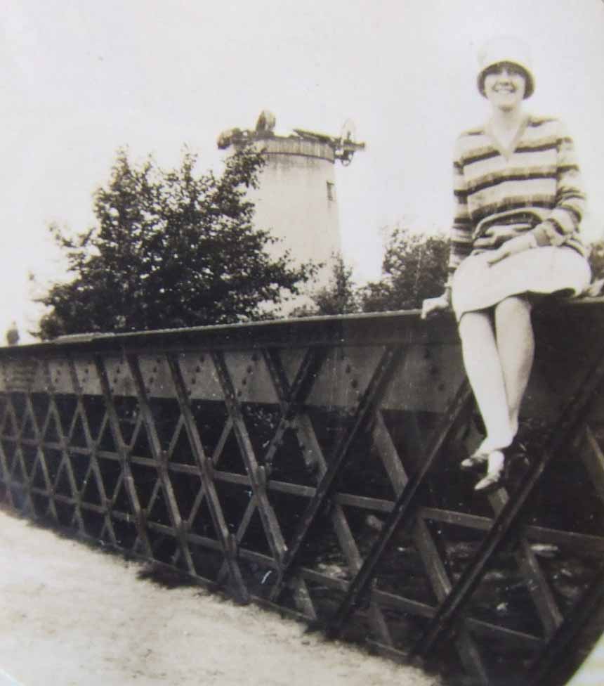 |
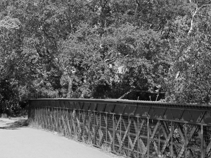 Thanks to Bill Hislop for letting me photograph this image (left) of an 18 year old young lady (ancestor) taken in 1918. The Mill is roofless due to a recent severe gale. The same image (above) on 23 May 2015 |
 |
 |
| Going to the Village | |
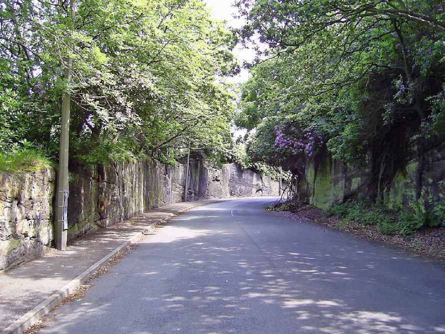 |
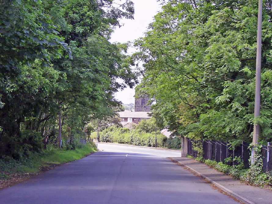 Boundary Road leading to the Village |
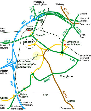 As you can see from this Proudman map, the village was "cut off" from the mainstream of traffic. In July 2003 I visited Bidston to take some photo's. It is now a through road into the local council estate and subsequently, very busy. I find this inexplicable as the Village is a conservation area. |
|
| Dirty deeds afoot
on the Deer Park on Bidston Hill taken from Wirral Journal Autumn 1987 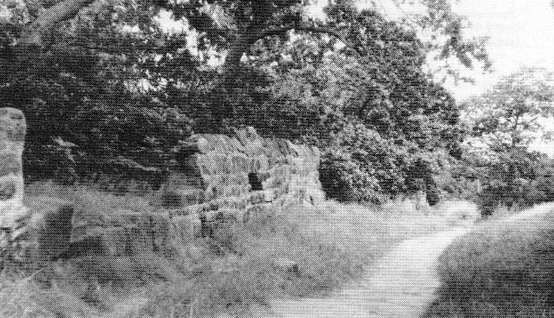 The Deer Wall on the Hill and a recent image below 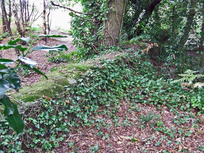 |
Four hundred years ago the deer park at Bidston was the scene of a
bitter feud between its rightful guardians and a bunch of local rufflans
who were determined to trespass and kill for their own gain. Wirral at
the time had several such parks - at Bidston, Neston, Shotwick and
Hooton - these being enclosed lands with hunting privileges granted by
the Crown. ‘The Deere Parke’ at Bidston is clearly marked on a map of
1665, and traces of its boundary can still be seen today in the old wall
running across Bidston Hill and known locally as the ‘Penny-a-day-dyke’.
The temptation for local folk to trespass into the park to hunt deer and
other game must always have been great, and so it was that in 1596 Lady
Margaret, Dowager Countess of Derby, made a complaint to the Star
Chamber against a group of local villains - Edward Ravenscroft of
Prenton (‘gent.’), John Hocknell and Henry Hocknell (‘gent.’), Nicholas
Millar and Thomas Woodburne of Prenton - ‘being all or most of them men
of very evil disposition & behaviour’. Lady Margaret complained that
these men ‘unlawfully combined, conspired & confederated themselves
together & with divers other persons to vex, disturb, disquiet and
interrupt your said subject her lawful & quiet possession & occupation’
of the manor and park of Bidston. The specific misdeeds were carried out around August 1595 when the gang ‘in a very riotous, routous, forcible, disordered and unlawful manner’ broke into the park in several places and, in a similar manner, ‘hunted, killed and despoiled’ the deer within. William Fells, the park bailiff, had ‘in a friendly manner and in sundry times requested to desist & give over the said misdemeanours & abuses’; but to no avail. Ravenscroft and his cronies continued their forays into the park. In September matters came to a head when William Fells was away in London ‘attending your subject’s affairs’. The vagabonds, aware of the fact of Fell’s absence, ‘did in a forcible & outrageous manner pull down the pales of the said park in divers parts & places’ and let loose two brace of greyhounds which ‘did then & there spoil and kill a great number of the said deer.’ Meanwhile Fell had returned to Bidston and, being informed of the situation by his wife, caught the greyhounds; he also came across Nicholas Millar and, with the help of Richard Taylor (‘constable of the said Town of Bidston’) captured ‘& did stay the said N.M. in his said outrage.’ However the rest of the gang were ‘lying in wait & ambush not far from the said park . . . being all of them armed weaponed & arrayed with divers unlawful weapons, as long staves, swords, rapiers & daggers & divers other unlawful weapons as well defensive as invasive.’ They set upon William Fells and the constable ‘giving unto them divers & sundry perilous and dangerous blows & strokes, putting them in great peril & danger of their lives’, and managed to release Millars ‘using divers very violent, menacing & threatening words unto the said W.P. & the said constable, that if they should seem to resist them, that they would kill & slay them.’ Fells and the constable had no choice but to let the men go free. There followed throughout subsequent weeks a continued reign of intimidation and terror on Fells; Ravenscroft even wrote to him ‘challenging him thereby to the field to fight with him.’ So it was that Lady Margaret wrote to the Crown to ‘grant unto your said subject your highness’ most gracious writ of subpoena to be directed unto the said E.R., J.H., H.H., N.M., & T.W. And your subject as nevertheless she is in duty bounden will daily pray for your highness’ long, happy & prosperous reign over us.’ The harassment caused by these troubles evidently took its toll upon Lady Margaret, for she died less than eight months later. |
| May 2011: Unconfirmed rumour is that the lighthouse & cottage have been sold to a former member of the Observatory. If true, he intends to open the lighthouse to the public, probably on days to coincide with the Mill open days. I hope this is true as the views are amazing. Oct 2014: I have no further news on this. |
 |
![]()
Water fountain:
http://www.firehydrant.org/pictures/glenfield-kennedy.html
Other Sites
http://visitbidston.blogspot.co.uk
http://www.uboat.net/boats/u480.htm
http://www.uboat.net/allies/merchants/ship.html?shipID=3328
I also thoroughly recommend the books of Kenneth Burnley, local Historian and lover of The Wirral