![]()
| The Wirral Hundred or The Wirral Peninsula |
Updated: 29 Sep 2017 "From Birkinheven unto Hilbre |
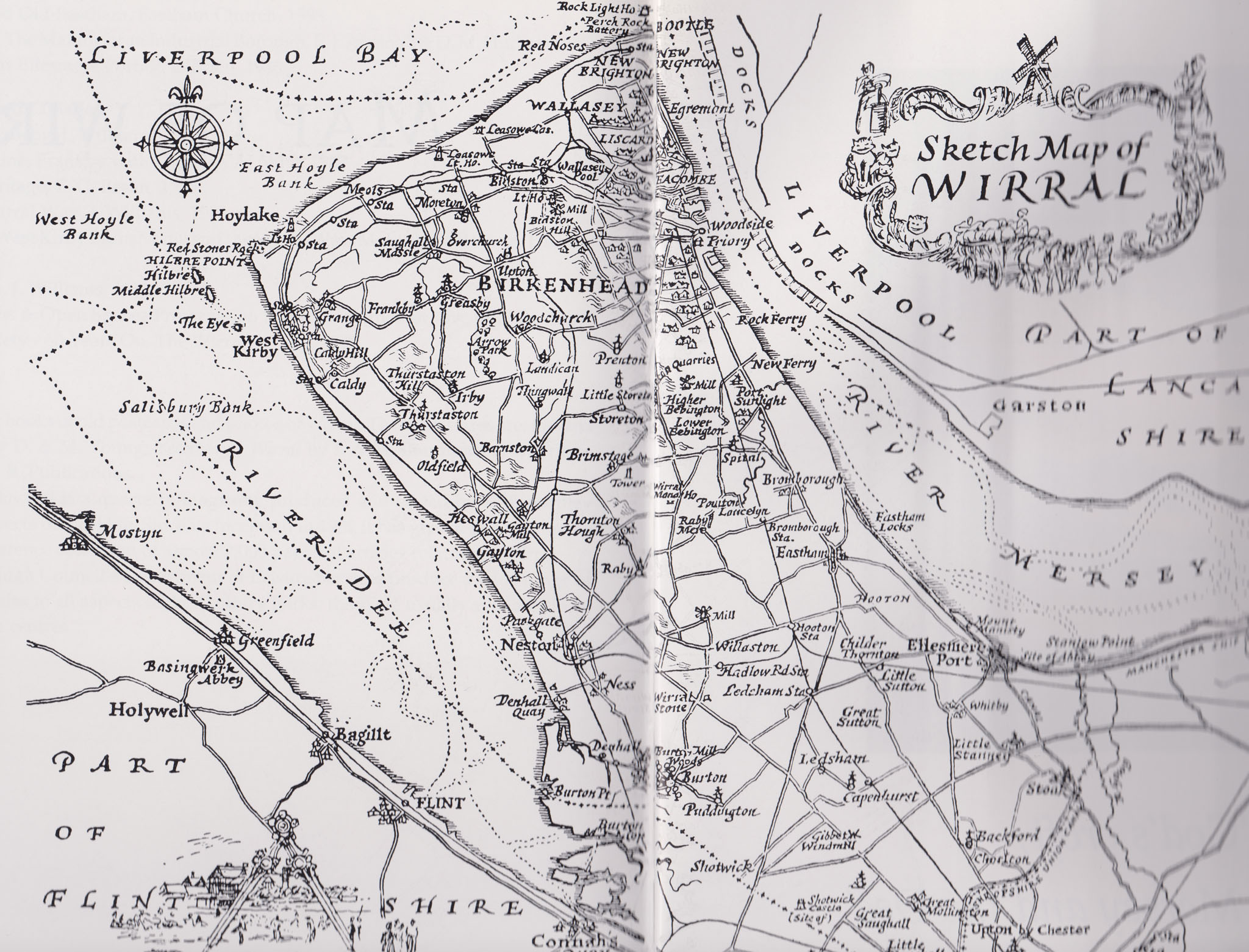 Drawn in 1950. downloaded can be opened to large scale |
|
| Trying to describe my old
Wirral home I felt at a loss for words, some regions were dilapidated old
dockland sites, run down factories and overcrowded housing. Yet other regions
are beautiful in their wildlife, flora and views. Even the weather was on our
side! Having grown up on the Wirral and now exploring its ways, I am dismayed at
just how much I actually missed! I left the Wirral in 1981, along with my wife and children, leaving for Germany and the Armed Forces. I left the Army and settled in Sutton Coldfield in 1994 and go back home whenever I can, life is short, too short, what will I miss before I'm gone? Although I have called this site wirralhistory.net it is primarily about where I grew up North Wirral. l think it may be best left to the expert on the Wirral to describe it. Kenneth Burnley, in his book Portrait of Wirral, says this: What is the Wirral Peninsula? To many who work in Liverpool it is merely somewhere to come home to in the evening, somewhere to live, somewhere to shop. To the stranger it is “somewhere in Cheshire — or is it Merseyside now?’ To many who live in Liverpool it is somewhere to spend a sunny afternoon. |
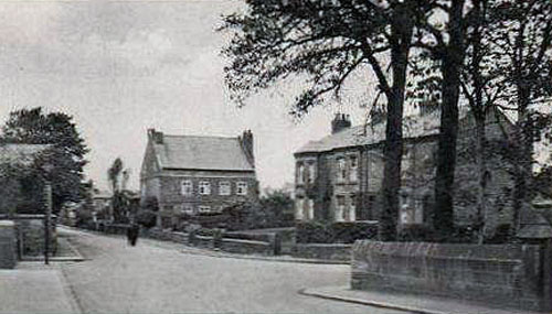
 Bidston formerly a Tithe Barn |
|
To me it is standing on Caldy Hill under a clearing sky after a dull, wet day and hoping for a rare glimpse of Snaefell or the Lakeland summits across the wild waters of the Irish Sea. It is the hustle and bustle of Birkenhead Market on a Saturday afternoon, or waiting on Woodside landing stage in the damp gloom of a November morning for a ferry to Liverpool. My Wirral is Burton Marsh on a grey February morning, the Welsh peaks shrouded in mist; or the golden tints of Dibbinsdale woods on a bright October afternoon. It is the springtime greenery of silver birch on Thurstaston Hill, and carpets of daffodils dancing in the April breeze in the woods of Arrowe. Or dark winter days on the Mersey when sea, land, and sky merge to form one grey shroud. And rare days in the depths of winter when snow and ice drape the Dungeon falls and only the song of the robin pierces the silent woods. In my Wirral are breezy cliff-top walks above the wayward Dee, the romance of smugglers still in the air; and the deep cuttings of an old railway, now a country park, rich in wild flowers, birds and animals. My Wirral is to sit on the springy thrift covered turf of Hilbre Island, the only sound being the call of the curlew and oyster-catcher sounding across the lonely sands of the Dee estuary. |
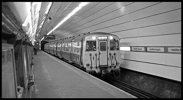 Underground railway |
|
To me and to all those who know and love Wirral it is all of these and so
much more. This, perhaps, is the attraction of the piece of land which
lies between the Rivers Mersey and Dee. Within its area of a hundred or so
square miles are flour mills and oil terminals; seal colonies and salt
marshes; housing estates and mansions; shipyards and nature reserves; a
colourful history and a wealth of wildlife. To the outsider, Wirral is generally considered to be a suburb of Liverpool. In fact, many often lump them together as one, and do not realize that 1 1/2 miles of water separate Birkenhead and the rest of Wirral from their neighbour. Until the boundaries were changed in 1974, the whole of the Wirral Peninsula was part of the county of Cheshire. Schoolchildren were often taught that the shape of the peninsula resembled the spout of a teapot, a hen’s tail, or a cow’s horn. Overnight, Wirral was put into the new county of Merseyside, along with Liverpool and a large slice of Lancashire. A sad change, some would say - a loss of identity for a part of England with its own unique character. Cheshire lost its coastline and its teapot spout when it lost Wirral. But Wirral did not go into Merseyside without a fight from some quarters. South Wirral, including the un Cheshire like towns of Ellesmere Port and Neston, remained in Cheshire. So, administratively at least, the peninsula is now divided and even has two postal divisions: Wirral, Merseyside; and South Wirral, Cheshire. (This has now, in the 21st Century, been reversed and what was once an "L" postcode is now a "CH" postcode - and a good thing too! - mk). Seven years (1981 book published) have passed since reorganization, but still many folk cannot accept that Wirral is part of Merseyside. |
  |
|
In name, but not in character, they say. For
Merseyside has an image, and that image is not a particularly good one.
For the true Wirralian, his home is “over the water” from Liverpool and
the rest of Merseyside. Indeed, looking at the map, Wirral is indeed an
island from the rest of the county. Yet the majority of Wirral people work
in Liverpool and use its shops and cultural facilities. Many were indeed
born on the Lancashire side of the Mersey, or come from families who
originated in Liverpool. The homes of many Wirral folk are nearer
Liverpool city than many Liverpudlians’. Perhaps the relationship is
similar to that which exists between Britain and Europe; in it but not of
it. In both cases that narrow channel of water is more than a physical
barrier — it is also a psychological barrier. But what of the name Wirral? Anglo-Saxon records show the peninsula as “Wirheal”, a combination of the Anglo— Saxon words wir (a myrtle tree) and heal (an angle, corner or slope). From this it would appear that bog myrtle was once plentiful in this area, although it is no longer found today. The peninsula has often been referred to as “the Hundred of Wirral”. A “hundred” was a division of a shire or county, probably instituted by King Alfred, which was itself sub-divided into tithings or towns. |
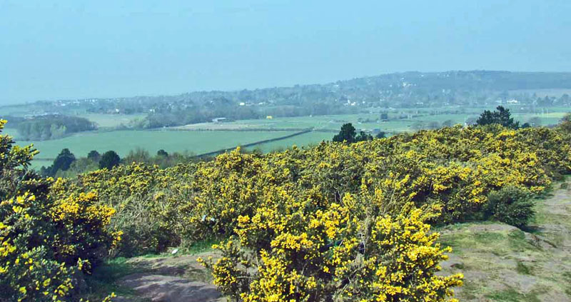 Caldy From Thurstaston Hill - April 15th 2007 |
| The origin of the word is uncertain; some say that it
was a district able to provide one hundred able-bodied men of war, others
that it was an area composed of one hundred families. The title persisted,
and was frequently used by writers and historians, until the early years
of this century. Alas, it is now simply “Wirral”, “The Wirral Peninsula”,
or, incorrectly, “The Wirral”. The situation of the Wirral Peninsula,
enjoying the benefits of a mild climate, easy access to the sea, and
seclusion from the more traumatic events of history, has attracted men to
make their home here down the ages. We know that Stone Age man lived here,
from finds on Thurstaston Hill and elsewhere. During the Bronze Age, and until the time of the Romans, Wirral was occupied by a powerful Celtic tribe known as the Cornovii. The Celts probably gave us place names such as Liscard, Noctorum and Landican. The Romans occupied Chester about A.D. 70, and traces of their occupation in Wirral have been found from time to time, In 1834 workmen quarrying on the bill known as the Arno, in Oxton, found a number of small coins bearing the heads of Antoninus and Victorinus. Storeton Quarry may have been used by the Romans, for its stone was used to sculpture monuments, the remains of which have been found and can be seen in Chester Museum. |
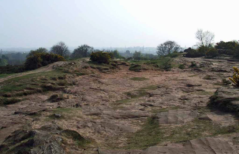 Top of Thurstaston Hill - April 15th 2007 |
| Coins have been found at Neston and at Hooton. The
greatest evidence of the Roman occupation in Wirral is, however, the large
number of articles found along the shore at Meols, indicating an extensive
Roman settlement. It appears that this settlement was connected by road
with Chester, some twenty miles away; the route is uncertain, but it
probably left Chester by the line of the present Parkgate road as far as
Mollington, and then continued past Capenhurst to Ledsham. Its course from
Ledsham is less certain, but a roadlike surface has been excavated at
Street Hey, near Willaston, and there is a lane near Raby which is on the
line to Meols. Part of an ancient road, possibly Roman, has also been
discovered in Greasby. There may have been another Roman road running from
Monks’ Ferry, on the Mersey shore, by way of Bridge Street towards Bidston
and the coast at Meols. In 1850 a bridge was discovered by workmen converting Wallasey Pool into docks; this appeared to be Roman in origin, and may have been part of this route. The bridge was of solid oak beams supported by stone piers, its ends resting on solid rock at the sides of the creek. The length of the bridge was about one hundred feet. From the depth of the silt burying the bridge (about thirty feet), it must have been buried for centuries. The Romans left about A.D. 410, and Wirral was occupied by the Britons, who lived undisturbed for about two hundred years. The Anglo-Saxons under Ethelfrith, the Anglian king of Northumbria, laid waste Chester in A.D. 613 and soon took over most of Wirral, with the exception of Wallasey. The first settlement was probably at Willaston, and from here the early settlers established a branch to the east named Eastham, one to the south named Sutton, and one at Hinderton to the west. Many Wirral villages owe their names to these people, especially those ending in “ham” or “ton”, both meaning a home or homestead. |
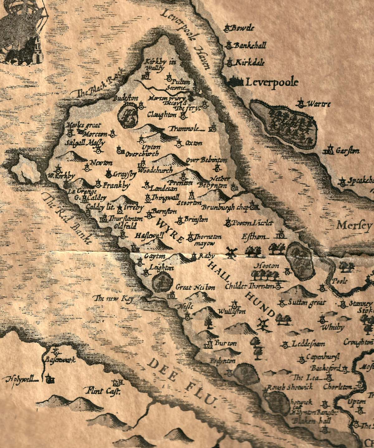 Wirral 1611 |
|
All was peaceful in Wirral for over two
hundred years, but in the latter years of the ninth century the Norsemen,
the Vikings of the North, invaded our shores. We gain an insight into the
character of these wild people, from the Anglo-Saxon Chronicle: They reached a waste city in Wirral, which is called Legceaster (Chester) They besieged the fort from outside for some two days and took all cattle that were without there, and slew the men they were able to intercept without the fort, and burnt all the corn, and with their horses devoured the pasture in the whole neighbourhood. The Norsemen were apparently attracted to Wirral because of its excellent harbours and proximity to the sea, for there is little evidence of their having occupied the rest of Cheshire. They settled along the Dee side of the peninsula, and along the sea coast, giving their villages names such as West Kirby, Frankby and Irby. They also introduced their own system of local government, and met at Thingwall, an area of high ground in the northern part of the peninsula. At their annual “Thing”, or parliament, new laws were made, and other business of the area was transacted. In spite of their ways, it seems that the Norsemen soon settled down and became one people with their English cousins. The Doomsday survey of 1085-6 shows that Wirral at that time was more densely populated than most other parts of England. Even so, the survey shows only 405 heads of families in the whole of the peninsula. Forty eight manors were surveyed, with a total value of £51. There was very little woodland: one at Mollington, a large area at Tranmere, and a small one at Prenton. This shortage of timber was soon rectified, for Wirral was afforested from Norman times until the middle of the fourteenth century. At least, plenty of tree cover was provided for the preservation of game. It is most unlikely that the whole of the peninsula was covered with trees: Randal de Meschines, fourth Earl of Chester. . . converted Wirral into a forest. It does not follow, as assumed by the few authors who have directed their attention to this Hundred, |
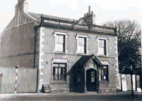
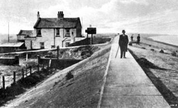
 Original Railway Inn, Meols which was pulled down in 1930 for this replacement |
| that tree planting on an extensive scale was then carried out. It is certain that a very large part of the country was wooded from the earliest times, and a Norman forest was little more than a waste or wilderness in which game could flourish undisturbed. Under an order by Edward III in 1376, Wirral was disafforested forested. Today the area is short of woodland once again. Roads, housing and neglect have left just a few small areas of woodland; Dutch elm disease has taken its toll of thousands of roadside and hedgerow trees. Wirral’s proximity to Chester had a profound effect on the history of the Dee side of the peninsula during the fourteenth, fifteenth and sixteenth centuries. Hundreds of years before Liverpool’s rise to fame as a great port, Chester was providing facilities for trade with Ireland, Spain, and Germany. Seagoing vessels would “lay to” at the mouth of the Dee, awaiting favourable winds and tides. But the Dee started to silt up from Chester northwards towards the estuary. Harbouring facilities moved to Burton, Neston, Parkgate, Gayton, Dawpool, West Kirby and Hoylake. |
 |
| The Dee side overshadowed
the Mersey side of the peninsula for over three hundred years.
Adventurous plans were proposed to overcome the silting-up of the
estuary. One was put forward in 1857 by Sir John Rennie, who planned to
cut a ship canal, 20 feet deep, from a point between Thurstaston and
Heswall, to run along the length of Wirral to Chester. This and other
schemes came to nothing. Deeside was dying, and Merseyside was being
born. Liverpool was growing as a port of international importance,
offering good communications by road and canal to the rest of the
country, and a safer, more sheltered harbour for shipping. The growth of Liverpool signalled the start of a new era for Wirral; an era of tremendous growth and rapid change. For as Liverpool grew as a centre of trade and commerce, its merchants and businessmen looked across the Mersey to the sandy shores and green fields of Wirral, and many “crossed over” to make their homes in Birkenhead. Ferries, trains, docks and commerce soon followed. Between 1810 and 1841 the population of Birkenhead leapt from 109 to a staggering 8,ooo. As the Mersey side of the peninsula became more industrialized, many moved out of the dirt and grime to the greener parts of Wirral. Growth was naturally greatest along the rail routes, the opening of the Hoylake line in 1866 enabled city weary Liverpool businessmen to live within sight, sound and smell of the sea. This growth has continued to the present day and shows little sign of slowing down. Rural, land based communities are disappearing under the spreading tide of suburbia. Nine hundred years ago there were about 2,000 people in the whole of Wirral; its population is now approaching half a million. Two hundred million years ago the area of land we now call Wirral was part of a flat, sandy delta between the Welsh hills on the one side and the Pennines on the other. |
 Parkgate, once a port, below the River Dee (somewhere out there!) Feb 18th 2008  And the river front. Parkgate's famous Ice Cream is that canopied building on the right |
| There was no peninsula as such. Geological pressures in the earth’s crust gradually formed the layer of sandstone rock called Triassic sandstone, which was again subjected to stresses which pushed large areas upwards to form rocky outcrops. The outcrops now form two approximately parallel ridges which run down the length of the peninsula from northwest to southeast. Grange and Caldy Hills (256 feet) form the northernmost part of the western ridge, which includes Thurstaston Hill (298 feet), Heswall ( feet, the highest point in Wirral), ending at Burton (222 feet). The only significant break in this sandstone ridge is between Caldy and Thurstaston Hills. It is thought that the sea once flowed through this valley to Moreton and Bidston Marsh, making an island of this north western corner of Wirral. In fact Telford and Stephenson, the canal and roadway engineers, produced a scheme in 1825 to project a canal through the valley to Wallasey Pool on the Mersey shore. The Dee outlet would have been at Dawpool, near Thurstaston, thus linking the Mersey with the Dee. However, the silting-up of the Dee estuary, and the opposition of the Liverpool Corporation, who had a monopoly of the Mersey, prevented the scheme from being put into practice. |
 Caldy/Thurstaston |
| The sandstone ridge which runs down the eastern side of the peninsula is
neither as long nor as continuous as its western counterpart. From New
Brighton in the north the ridge rises to 188 feet at Wallasey; between
Wallasey and the next high point of Bidston Hill (231 feet) is the valley
formed by Wallasey Pool. The ridge continues south from Bidston Hill to
Prenton (259 feet) and ends at Storeton Hill (229 feet). Much of this line
of hills is now built over, but the Deeside hills are for the most part
open, unspoilt heathland where the public are free to roam and enjoy the
glorious panoramic views across Wirral and its surroundings. During the Ice Age, great ice fields descending from the Scottish Highlands, the Lake District, and Northern Ireland pushed along the floor of the Irish Sea and were forced by ice masses from the Welsh hills to travel south eastwards across Merseyside. The moving ice fields had a dramatic effect on the landscape of the area. They reduced the area of coastal land, which originally extended much further into the Irish Sea, and deposited large amounts of boulder clay, pebbles, mud, sand and other detritus all over the area. |
 USS Pennsylvania off Wirral |
| The effect of this depositing was to fill in
many of the hollows and valleys, changing the landscape from an
undulating, hilly area into a relatively flat one. Since the Ice Age, the
greatest natural factors in changing the landscape of Wirral have been
coastal erosion and siltation. Until recent times, the flat, low lying
lands of north Wirral were constantly under threat of inundation by the
sea, being protected only by a belt of sand dunes. Archaeological finds,
together with evidence for the existence of a forest on the coast near
Meols, suggest that there was human habitation perhaps extending several
miles further beyond the present coastline, where the waters of the Irish
Sea now lap. On the other hand Overchurch, several miles inland, literally
means “the church on the shore”, which suggests that the sea has
alternately advanced and receded over the centuries. At Shotwick, ten
miles upstream from the mouth of the Dee, sea water came up to the wall at
the edge of the churchyard. Now the water is four miles distant, barely
visible across the acres of marshland. There is evidence, too, that the
Hilbre Islands, a mile off the coast in the Dee estuary, and only
accessible at low tide, were once part of the mainland. Between the
sandstone ridges lies an extensive area of gently undulating land, much of
it agricultural, but in the northern part, suburban. There are few rivers in Wirral. The Fender and some smaller, parallel streams such as the Arrowe Brook and Greasby Brook, drain the northern part of the plateau into the River Birket, which itself flows into the Mersey at Wallasey Pool (now part of the dock system). In the south, the Dibbin and the Clatter drain into the Mersey via Bromborough Pool. |
 |
| Wirral’s weather is rarely extreme, neither is it monotonous. It can vary from day to day, from hour to hour, and even from place to place; a bright, sunny day in Hoylake often turns out to be dull and wet in Birkenhead. Although the peninsula is on the same latitude as parts of Siberia and Canada, the prevailing westerly winds, more or less constantly blowing from over the warm Gulf Stream, have a modifying influence on the climate. Mildness is a characteristic of Wirral’s weather throughout the year. The growing season for plants is also extended by maritime influences and lasts from mid-March until late November, a fact borne out by the success of the market gardening industry which flourishes along the northern coastal strip. Snow rarely falls, and when it does, lies only for a very short time. The average yearly sunshine for the north Wirral coast is around 1510 hours, which is about 200 hours more than the average for England and Wales as a whole. Wirral is also fortunate in that the mountains of North Wales to the west tend to absorb much of the rain before it reaches these parts. The prevailing westerlies keep the atmosphere relatively free from pollution; some idea of the purity of the air reaching Wirral can be gained by realizing that the wind has just travelled across two and a half thousand miles of ocean! |
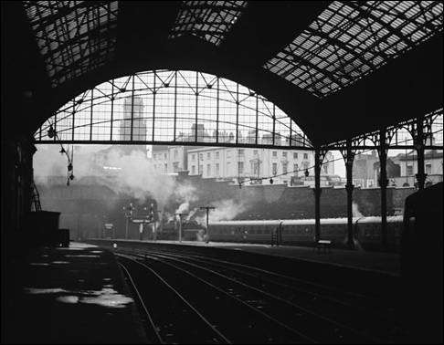
 Woodside (pre 1918) |
 Early morning on The Wirral |
|
| Whilst Wirral’s weather benefits in many ways from its proximity to the
sea, not all of the maritime influences arc beneficial. The peninsula is
exposed to the full force of the wild gales which sweep in from the
north-west during the autumn and winter months. Wind speeds of up to 90
m.p.h. are not uncommon during these gales, and many’s the time that ships
have been blown in from the Irish Sea to be broken to pieces on the Hoyle
and Burbo sandbanks. Even in summer, the sea breezes tend to keep
temperatures near the coast several degrees lower than those inland. But
if the west wind is beneficial to Wirral, the same cannot be said of the
east wind. To the east of Wirral lies the industrial heart of England, and
the wind blowing from that direction brings with it the smoke and the
smells of a thousand industries. On days when the east wind blows, it is
often impossible to sec across to the opposite banks of the Dee or the
Mersey, let alone the prospects of distant hills and mountains normally
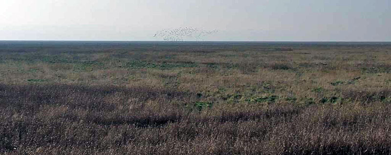
visible when the atmosphere is purer. The variety of wildlife found in and around the Wirral Peninsula belies its proximity to a large industrial centre. A wide range of habitats. field and hedgerow, marshland and woodland, coast and estuary, heath and moorland, and of course the suburbs account for the wealth of plants, birds and animals to be seen in Wirral. The bird life of the coast is of particular interest, the Dee estuary and marshes attracting bird-watchers from far afield to study the great flocks of waders which gather here in their thousands during the autumn and winter. The coast too provides a habitat for several rare plants, one in particular being unique to Wirral. The peninsula is laced with a network of public footpaths and bridleways almost out of proportion to its area. These give access to fields and woods, cliff tops and heaths, providing the walker and nature lover with unlimited opportunities for exploration. The whole of the coastline, from Wallasey to Burton, is accessible although much of it is man made, concrete embankment. |
Settlement Place Names
Origins of Place Names. For example 'Mellr' meaning Sandbank or 'Kirk' meaning a church. The
names of the villages
and towns around Wirral are derived from a variety of different languages and
inhabitants. The
information below shows just some of the words used to name villages and
settlements around the
Wirral peninsula & Cheshire. |
Wirral
has changed dramatically in the last fifty years; even in the last twenty.
Villages are no longer independent communities based on the land. Even
outside the built-up areas of Wallasey and Birkenhead, many villages are
surrounded by housing estates, and are struggling to maintain their
identity. Vast council housing developments such as those on the slopes of
the Fender Valley at Ford, Noctorum and Woodchurch cover what was once
rolling farmland and woodland. A motorway runs right through the heart of
the peninsula. Dutch elm disease has taken its toll of thousands of trees
in Wirral, as in the rest of the country; once shady byways are now open
and bare. Large areas of urban Wirral are decaying. Many historically and
architecturally interesting buildings have disappeared, bulldozed to
fulfil planners’ dreams, or left to decay beyond repair through lack of
interest. Local authority administration has become faceless and
friendless and more bureaucratic since reorganization in 1974. At the land based end of the Wirral lies Chester. Beautiful County town and location for the biggest Roman fortress outside Rome. |
Caer: Fortress Capel: Chapel Carreg: High Rocks Carnedd: Cairn Castell: Castle Coed: Wood Cwm: Valley Dinas: City Glan: River Bank Hamps: Dry stream in Summer Llan: Church Llyn: Lake Llys: Hall or Fort Mawr: Big Môr: Sea Mynydd: Mountain Os: God Pant: Hollow Pen; Bryn: Hill; Head Plas: Palace Pont; Bont: Bridge Porth: Harbour Pren: Woods Pwll: Small pool of Water Tre: Hamlet; Village; Town Treath: Beach Ynys: Island |
| Emperor Vespasian had this huge
fortress built, not by "bog standard" Legionnaires but by elite marine
Legionnaires for which there was to be a special purpose. The Romans did
not even write a history of Deva Chester). The fortress covered 61
acres. The Roman 2nd Legion was tasked with the building of this
fortress. This Legion included what we now call civil engineers and
supported by thousands of auxiliaries. Deva was perfectly placed
strategically and could easily be supported by sea, along the River Dee.
Deva covered the wilds of the Welsh countryside and the Pennines to the
east and the Lancashire hills to the north. The defensive palisade
consumed 31000 tons of timber; 100 wagon loads a day, for 2 years. The
defensive wall covered 5 times are area of Wembley Stadium. The bath
house covered 300 square feet off what is now Eastgate Street. The water
was piped in by aqueduct from a natural spring 1 and 1/2 miles away.
Much was lost by the teeth of mechanical diggers in the 1960s when a
large shopping complex was built. All they left was a tiny yard square
fragment of a mosaic floor that covered many many square feet. AD79
inscribed lead water pipes have been found. The only example found in
Britain. A huge amphitheatre was built just outside the main walls for their brutal games. Agricola was the Governor of Britain and almost certainly had Deva fortress as his base and it is thought that a massive force was to be assembled here in Deva to take on the total occupation of the whole of the mainland, including Brigantia to the north and beyond. Agricola had just obliterated a whole Welsh tribe in retaliation for a Roman Cavalry Regiment being wiped out by the same tribe. He launched his offensive from Deva. |
Saxon Terms: 350AD - 1000AD Bourne: Stream Burn: Stream Bur: Fortified Place Burg: Large village Croft: Small enclosure Cot: Small hut Delph: Ditch, dyke or stream Den(n): Pig pasture Eg; Ey; Ea; Eig: Island Fall: Area cleared of trees Fen: Fen Field: Field Ham: Village Hurst: Clearing Ing: People Lake: Lake Ley; Lea: Clearing Mere: Pool Moor: Moor Moss: Swamp |
He occupied a large governors residence and his entourage and bodyguard, totalling some 2000 personnel. It fitted in with Vespusian's plans to occupy the whole of Britain, in the early 70s AD, including what is now Eire. A large marine force was known to be in the area, presumably for the invasion of Ireland. Vespsian died soon after this and the plans for Britain were beginning to die. The Danube became the focal point after a large rebellion there, troops were withdrawn, including from Chester. What of the future? Being a peninsula, Wirral has very definite, natural boundaries beyond which it cannot grow. These are rigid limits to growth. The County Plan for Merseyside also specifies limits beyond which Wirral should not step, limits which would maintain and improve (hopefully) the quality of life for Wirral folk. But the limits will need to be jealously guarded, not only by the administrators and planners, but by all those who know and love Wirral. (In the year 2016 Wirral Borough council want to build thousands of homes, presumably on our much loved green belt areas. This must not happen.).
This is how Ken opens his excellent book on The
Wirral Peninsula. First published by Robert Hale, London, in 1981. Printed
with permission. |
Riding; Rod: Cleared land Stead: place Stoc: Summer pasture Stoke: 'Daughter' settlement Stow: Holy Place Ton; Tun: House; Farm Wealas: Celts / Strangers Weald; Wold; High Woodland Wic; Wike: Farm; Group of huts Wood: Wood Worth: Fenced land Worthy: Enclosed land Viking Terms: 750AD - 1100AD Akr: Acre Beck: Stream Brunnr: Spring or Well Booth: Summer pasture By: Farm; Village Ey: Island Fell; How: Hill or mound Fiord: Fiord Fiskr: Fish |
Not so well known facts about our Peninsula (complied by Craig Smith)
Below is a myriad of facts and
figures, amazing feats, British and world firsts, did you knows? and
sporting achievements all pertaining to the Wirral Peninsula. .
1) The Wirral Peninsular covers an
area of 60.35 square miles and is joined to mainland England at the
north western tip of the county of Cheshire. The peninsula is actually
completely surrounded by water officially making it an island, although
it's southern border at Ellesmere Port is actually at the site of the
man made Shropshire Union Canal.
2) Despite it's small size the
peninsula boasts no less than 1,900 listed buildings, 215 churches, 50
towns and villages, 25 conservation areas, 9 scheduled ancient monument
sites, 8 sites of special scientific interest, 10 lighthouses, 5 nature
reserves, 4 windmills, 4 historic parks, 2 watermills, one castle and
one fort.
3) The indigenous people of the
Wirral Peninsula were the Celtic, Cornovii Tribe who lived in the modern
day counties of Cheshire, Staffordshire, Shropshire and Clywd. The
oldest known reference to the tribe was mentioned in an historical
record written by Roman philosopher Ptolomy in the 2nd century A.D. The
name Cornovii means people of the horn. The word horn pertains to a
horned, religious idol that the tribe worshipped. The Cornovii made
their living from salt and copper mining and from the building and
running of hill forts, the most famous of which is the Wrekin in
Shropshire. Their tribal capital city was Wroxeter in the county of
Shropshire, at one time the fourth largest Roman town in Britain. The
Roman built City of Chester, which is now the county town of Cheshire,
was once part of the Cornovii tribal lands. |
Gardr: Yard; landing place Garth: Enclosure Gate: Road Geit: Goat Gill: Ravine or valley Holm(r): Island Hus: House Ings: Marsh; meadow Kald: Cold Kelda: Spring, stream Kirk: Church Klakkr: Small Hill Laithe: Barn Lin: Flax Lund: Grove Melr: Sandbank Orme: Serpent Ping: Parliment Pollr: Pool Skar: Cleft Sker: Rock Slack: Stream in a valley Stakkr: Rock in the sea Stan: Stone Stokkr: Sound |
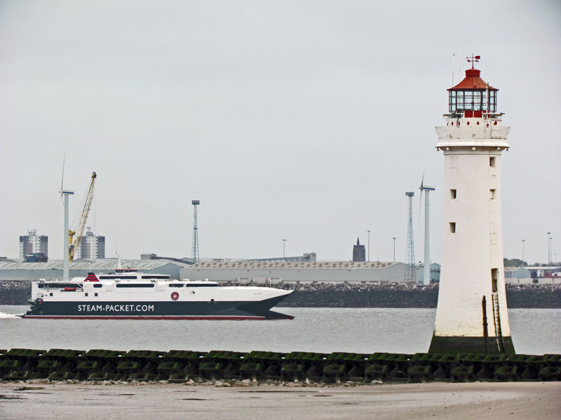
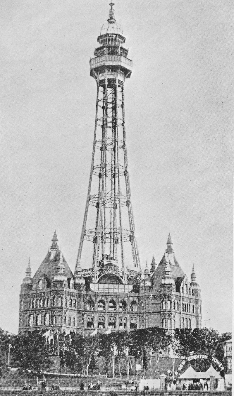
| 4) Historians have classified the Wirral Peninsula as the birthplace of England, after the Battle of Brunanburh - present day Bromborough - in 937 brought together the might of England's combined armed forces for the very first time in order to fight the armies of both Norway and Scotland. 5) The peninsula's Leasowe Lighthouse, built in 1763, is the oldest brick built lighthouse in the U.K. The lighthouse was also the first in the country to have a female lighthouse keeper, when Mrs Mary Elisabeth Williams began her service as keeper in 1908. 6) The Wirral's only recognised holiday resort, New Brighton, is home to the United Kingdom's longest promenade at 3.5 kilometres. As well as having the country's longest promenade the Wirral seaside resort was also the site of other record breakers during it's heyday of the 19th century. Classified as one of the most elegant seaside resort of the Regency period the town could boast the highest tower in Britain, the largest theatre stage in the world, the largest open air swimming pool in Europe, Britain's first amusements arcade and was the smallest town in the country to have a league football club. 7) Hilbre Island situated one mile off the Wirral coast at West Kirby covers an area of just 11.6 acres and is the United Kingdom's smallest, inhabited island. 8) The Wirral Country Park was Britain's first ever designated country park when it was opened in 1973. 9) The world's first, commercial hovercraft service began on the Wirral Peninsula during the Summer of 1962, when passengers were ferried from the Wirral seaside town of Moreton to Rhyl in North Wales on a Vickers VA - 3 hovercraft. 10) The Ministry of Defences' tidal activity research for the famous D - Day landings of June 1944 were all taken at Bidston Observatory. |
Stor: Large Tarn: Lake Thorp: Daughter settlement Thwaite: Forest clearing; meadow Toft: Homestead Wath: Ford Wray: Remote place Vollr: Field Translation of Place Names Arrowe: Summer Pastures with a Cottage, at the shieling Barnston: Beornwulf's farm Bebington: Bebba's Settlement Bidston: Budeston, Budes Place or possibly rock with a dwelling Birkenhead - headland with birch trees Bromborough - Brunanburh (Viking name); Bruna's Stronghold Burton: Fortified Settlement Caldy: Cold arse, cold hill Claughton: Settlement or farm on a Hill Egremont: After Egremont in Cumberland. Frankby: Frenchmans farm Ford: river crossing Gayton: Settlement with Goat Enclosure Heswall: Derived from Norse Chieftain called 'Essul" Hoylake: Named after the Hoyle Bank & Lake Irby: Settlement of the Irish Landican: Tegans Church Liscard: Fort or hall at the rock Meols: Land of Sand Banks and sandhills Moreton: Farm at a marsh or Mere ton Neston: Farmstead at the headland Ness: at the headland |
|
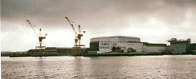
11) In 1947 the Mersey Ferries were the first boats in the world to be installed with fog radar navigation systems. 12) The charitable organisation, The Guide Dogs For The Blind Association, was formed 1934, three years after Britain's first four guide dogs completed their training by German Shepherd breeders Muriel Crooke and Rosamund Bond, whose business was based in Wallasey. BIRKENHEAD. 1) The largest town on the Wirral peninsular is Birkenhead, a town which grew up around the Benedictine, Birkenhead Priory built in 1150. The town's industries first centred around the priory and the River Mersey and since then has been home to an established pottery industry - the Della Robbia pottery - and large areas of docklands and shipbuilding industries. 2) It is unclear as to where the town get's its name from, one theory is that it comes from the peninsula's longest river, the River Birket, which flows from the town of West Kirby and makes it's way eastwards towards the town of Birkenhead, where it drains into the river Mersey at the site of the West Float Docks. Another theory is that the name comes from the town's Benedictine Priory which was known as Birchen Priory. Birchen means birch forest, which that area of the peninsula was covered by during those days. 3) The town we know today is in part the brainchild of Scots shipbuilder and local entrepreneur John Laird who became both Birkenhead's first mayor and the town's first member of parliament. Laird was elemental in the building of dockside cottages, the town's St James' church, the Borough Hospital and the Laird School of Art. |
New Brighton: After Brighton in the South New Ferry: Self Explanatory Noctorum: dry hill Oxton: Settlement where Oxen are kept Parkgate: Derived from Neston Deer Park Pensby: farm on a hill (Penn) Poulton: Settlement with a Small Pool of Water Prenton: Settlement in a Wood Raby: Boundary Settlement or village Saughall Massey: Taken from family names Seacombe: Valley near the Coastline Spital: Leper Colony Storeton: Large Farmstead / Settlement Thingwall: Norse Meeting Place Thornton Hough: Taken from two family names Thurstaston: The farm of a man named Torstein Tranmere: Sandbank with Crane Birds Upton: Anglo Saxon Unknown Wallasey: Island of Strangers (Isle of Welshmen) West Kirby: Western Settlement with a Church Willaston: The settlement/farm of Wiglaf's people Woodchurch: Named after the old Wooden Church in a wood |
|
As the first mayor of the town Laird was instrumental in
improving policing in the town and for implementing the town's market
place - originally held in Market Street near Hamilton Square - street
cleaning and street lighting. He was also instrumental in creating
several public areas for recreation and the arts. Laird was owner of the largest ship yard in the area and contributed to the income, welfare and health of 80% of the town's inhabitants. Laird became Birkenhead's first member of parliament in 1861 and remained the local Conservative member until his death in 1874. Laird,his wife Elizabeth and their three sons William, John and Henry all lived at 63 Hamilton Square. Laird died after a riding accident on October 29th 1874 and is buried in the grounds of Birkenhead Priory. A statue erected in Laird's honour was unveiled in the town on the 30th of October 1877 with the unveiling ceremony witnessed by over two thousand of the town's inhabitants. John Laird is remembered today by way of Birkenhead's Laird Street, Laird Close, Lairdside Technical Park, the Laird Memorial Statue that now stands on Hamilton Square and Liverpool's Laird Place. 4) Birkenhead's Hamilton Square contains the second largest number of listed buildings in the country after Trafalgar Square in London.
6) Birkenhead was the site of the country's first ever cross river ferry service, after monks at Birkenhead Priory were granted ferry rights by King Edward III in 1318. This charter made the route taken by the Mersey Ferry classified as a Royal Highway.
|
North Wirral in WW2 from: http://www.bbc.co.uk/ww2peopleswar © Copyright of content contributed to this Archive rests with the author. The Hoylake area, being close to Liverpool and Birkenhead, could hear and see the dreadful blitz they were experiencing. The Hoylake shore was out of bounds, sealed off with barbed wire and anti-tank obstructions with big guns sited on the Promenade. The Lifeboat slipway had moveable barriers so that it could still operate and throughout the war, was called out frequently. The Fishing Fleet continued operating and the dinghys used between the shore and the boat were chained to the promenade railings when not in use. The crews carried oars from home keeping them aboard the boats until returning with their catch. They came ashore again by the dinghy which had be attached to the mooring buoy. This being due to wartime security measures. During the air raids many people slept on the platforms at Liverpool and Birkenhead on the underground sections of the Mersey Railway. The railway suffered severe damage to stations and carriage sheds as far out as Bidston where there was an AA gun site. There was a Pioneer Corps. Unit stationed in Hoylake and I regularly watched them doing rifle target practice on a Golf Course. Also I joined in their marching and drill practice on the promenade. Each evening, during the air raids, they went off to Liverpool and Birkenhead on the 6pm train from Hoylake in readiness for any rescue work and clearing up needed from the bomb damage. Hoylake also had an American Infantry Unit in the town, which I often watched as they marched and drilled on the promenade. How different they were to our soldiers. They suddenly left Hoylake not long before D. Day. Offshore RAF fighters from Speke airfield regularly carried out air to air gunnery practice using a target towed by another aircraft. There was an RAF transit base at West Kirby where my uncle was a civilian accountant. Airmen going to other postings usually left overnight entraining at Meols Station. My maternal grandparents had a Morrison Shelter under the stairs which came in very useful when Hoylake had its only air raid. Some bombs badly damaged a church near the railway, the signal box and nearby buildings. Other bombs fell on Meols Promenade which was badly damaged and many nearby houses suffered minor damage and lost windows. In the late spring of 1944 I remember seeing many aircraft flying southwards towing Gliders in preparation for D.Day. Towards the end of the war many took advantage of the opportunity of going to Birkenhead Docks where we were shown a captured German U Boat. This was quite an event seeing one of the vessels which had caused so much harm to our convoys and their escorting warships. Life is strange. In a job I had in the 1970's, in a town far removed from Hoylake, one of the men in my department had been a Captain in that Pioneer Corps. Unit and we often talked about those extraordinary times and recalled so many events from that era. |
|
Andrew Barr, like me, is fascinated by any
old images of North Wirral. He runs a few Facebook Groups and produced
photographs that are magnificent and rarely, if ever, seen online. Opposite are links. You will need to ask to join the groups but it does not take long and are well worth visiting and staying in. Thoroughly recommended. |
https://www.facebook.com/groups/235781049850134/?fref=nf
Birkenhead https://www.facebook.com/groups/148748861937742/ Wirral Military https://www.facebook.com/groups/199495886824527/ Hoylake, Meols & West Kirby |
|
WIRRAL SPORTING ACHIEVEMENTS.
2) The World Windsurfing speed record was set on the Wirral Peninsula, when windsurfer Dave White attained a speed of 42.16 knots at West Kirby Marine Lake in October 1991. 3. Guinea Gap swimming baths situated in Wallasey has been the site of more swimming records than any other swimming pool in the world. This amazing feat is due to one man, local born, Olympic bronze medalist, Neil McKechnie who attained no less than thirty English and British swimming records at this Wirral swimming pool during the 1950's and who, by 1958, held every English freestyle swimming record from one hundred metres to one mile during his time as a member of the Wallasey Swimming Club. His prowess in the water has been attributed to the baths being filled with water from the River Mersey. 4. West Kirby situated on the Wirral's Irish Sea coast is home to the prestigious Wilson Cup, the world's biggest team yacht racing event. |
Cheshire, a palatine and maritime county of England, bounded on the NW. by the Irish Sea, and bordering on the counties of Lancaster, York, Derby, Stafford, Salop, Denbigh, and Flint; extreme length, NE. and SW., 58 miles; extreme breadth, 40 miles; average breadth 18 miles; area, 657,123 acres; population 644,037. Cheshire forms, towards the Irish Sea, a flat peninsula, the Wirrall [sic] (12 miles by 7 miles), between the estuaries of the Mersey and the Dee, and inland a vast plain separating the mountains of Wales from those of Derbyshire. This plain is diversified with fine woods of oak, and &c., and is studded with numerous small lakes or meres. A low ridge of sandstone hills runs North from Congleton, near the East border, and another extends from the neighbourhood of Malpas to Frodsham, near the estuary of the Mersey. The chief rivers are the Mersey with its affluent the Bollin, the Weaver, and the Dee. The soil consists of marl, mixed with clay and sand, and is generally fertile. There are numerous excellent dairy farms, on which the celebrated Cheshire cheese is made; also extensive market gardens, the produce of which is sent to Liverpool, Manchester, and the neighbouring towns. Salt has been long worked; it is obtained from rock salt and saline springs; the principal works are at Nantwich, Northwich, and Winsford. Coal and ironstone are worked in the districts of Macclesfield and Stockport. There are manufacturers of cotton, silk, and ribbons, carried on chiefly in the towns of the East division; and shipbuilding, on the Mersey. Cheshire contains 7 hundreds and 503 parishes, and is entirely within the Diocese of Chester. (From Bartholemew's Gazetteer of the British Isles, 1887. -C.H.) The county boundary has changed several times since the late nineteenth century, most significantly in 1974, when sizeable areas were transferred to the counties of Greater Manchester and Merseyside. http://www.fhsc.org.uk/genuki/chs/ |
|
WIRRAL'S OLDEST BUILDINGS. 1) The majority of the Wirral Peninsula's oldest buildings are made from the area's local, red, sandstone and are most prominent in the area's smaller villages such as Caldy, Saughall Massey, Brimstage and Raby. 2) Several of the area's 215 churches have their roots in medieval times with St Hilary's Church in Wallasey and St Bridget's Church in West Kirby both vying for oldest church in the area, both of which have their origins in the 11th century. 3) The peninsula's oldest pub is reputedly that of the Wheatsheaf Pub in Raby, which dates back to 1611. 4) The peninsula's oldest house is a large, two storey, stone built house situated on Limekiln Road, Wallasey which dates back to around 1627.
5) Although the oldest building on
the peninsula is Birkenhead Priory, built in 1150, Birkenhead is not the
oldest town, that honour goes to Wallasey which was already an
established settlement when mentioned in the Doomsday Book of 1086. 6) The United Kingdom's oldest brick built lighthouse is situated on the Wirral Peninsula, at Leasowe shore. It was built in 1763 by the Liverpool Corporation Docks. 7) The area's oldest railway line was a branch line of the Birkenhead to Chester line, from West Kirby to Hooton, opened in September 1838. Although the line is now defunct, the line lives on in the form of the twelve mile long Wirral Way nature trail. 8) The area's oldest farmhouse is Old Hall Farm situated in Chapel Lane, Moreton believed to have been built in 1719 for a Daniel and Mary Wilson. 9) Brimstage Hall situated in the picturesque village of the same name was apparently built between the 12th and 14th century, making it one of the peninsula's oldest buildings and certainly the oldest manorial residence in the area. |
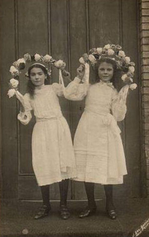
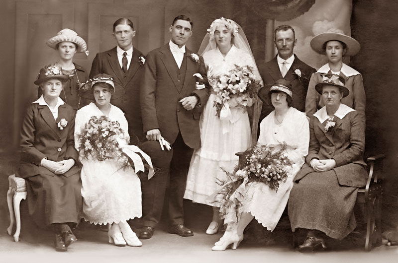 Rock Ferry Wedding (Broomfield - Hulse)  |
|
|
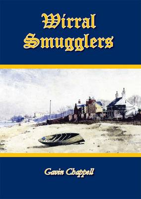
Wirrall, was a dangerous region. The inhabitants were nearly all wreckers and smugglers - they ostensibly carried on the trade of fishermen, farm labourers, and small farmers; but they were deeply saturated with the sin of covetousness, and many a fierce fire has been lighted on the Wirral shore on stormy nights to lure the good ship on the Burbo or Hoyle Banks, there to beat, strain and throb, until her timbers parted, and her planks were floating in confusion on the stormy waves. Fine times then for the Cheshire men..... James Stonehouse 1863. Published by Countywise Publishers, Wirral Smugglers, Wreckers and Pirates by Gavin Chappell is the first authoritative, illustrated, full-length account of smuggling and related activities in Wirral. Covering the eighteenth and nineteenth centuries, it represents the first book-length account of this important chapter in Wirral’s heritage. Not only does it describe familiar facts in great detail – Mother Redcap and her smugglers’ tavern on the Wallasey shore, the labyrinth of smugglers’ tunnels stretching from the Red Noses in New Brighton throughout Wallasey, and the wreckers who used to prey upon Liverpool-bound shipping – it also covers less well-known aspects of Wirral’s piratical past, including smuggling in Parkgate and Heswall, and the swashbuckling adventures of Captain Fortunatus Wright – the Wallasey privateer. Wirral Smugglers, Wreckers and Pirates is available in paperback at £7.99 from http://countyvise.tbpcontrol.co.uk/ (I found this site difficult - mk) and local bookshops including Waterstones, Linghams and News From Nowhere. I got my copy from the first link below. http://www.newsfromnowhere.org.uk/books/DisplayBookInfo.php?ISBN=9781906823207 http://www.waterstones.com/waterstonesweb/displayProductDetails.do?sku=6845353 About the Author After researching local history for over ten years, Gavin Chappell became interested in smuggling after a visit to a smugglers’ cave in the garden of a private house in Heswall. This book is the result of his researches. He is also available to give talks, lectures and interviews on the subject. MEDIA CONTACT: Gavin Chappell. Email: gavin_chappell@hotmail.com. Phone: 07799655530. |
 |
 |
 |
The study of Wirral in Cheshire is the forerunner of many that will be included on this web site. Cheshire was chosen as an introductory simply because it is the author's home domain. For those interested in their local surnames in Cheshire, Lancashire, Wales and the north west you will notice that some well known surnames of Cheshire are already beginning in the Domesday Book to appear amongst the landholders such as Cook, Venables, Hunter, Mallbank or Millbank, Vernon, Burcy, Massey and Brassey(ie). |
 |
 Christ Church Moreton |
 Egerton Park (fond memories, my future wife lived here) |
 Barnston Lane Moreton (formerly Chapel Lane) |
 Embankment at Moreton |
My thanks to the members of the Mersey Ferry Group on Facebook and to David Langton, Jeanette Land (Kansas), David Garbutt, Robbie Quinn, Brian Gill, Robert Hayden Foy, Mersey Ferries.Tony Franks Buckley, and many others. David Langton actually does talks on the Ferries. I saw him in October 2012 in the Floral Pavilion in New Brighton doing such a talk. Well worth a visit. David is a former skipper on the Ferries. |
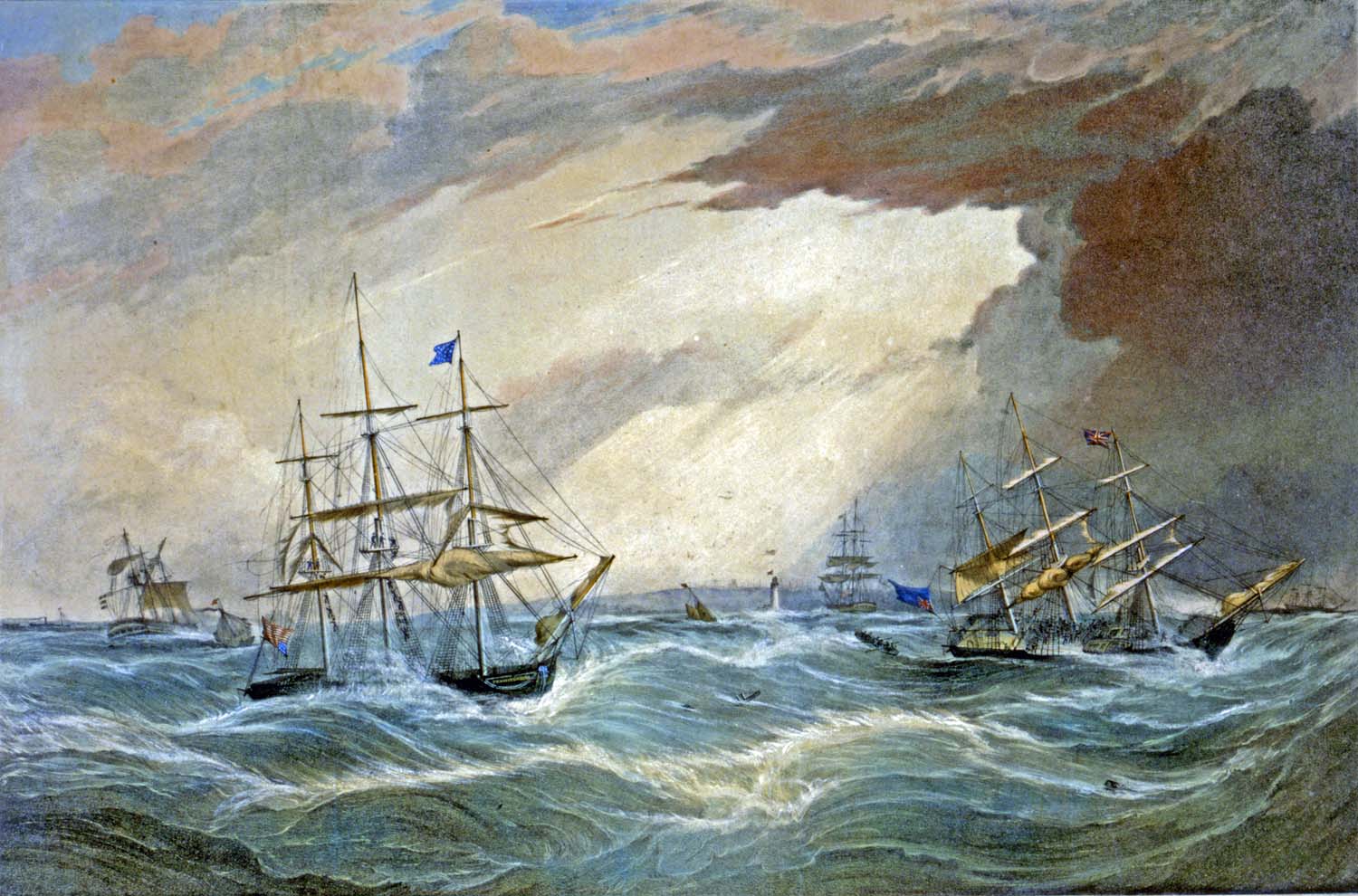
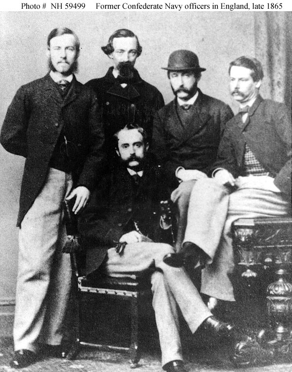 CSS Shenandoah The US Confederate Warship that came to Rock Ferry to surrender |
 |
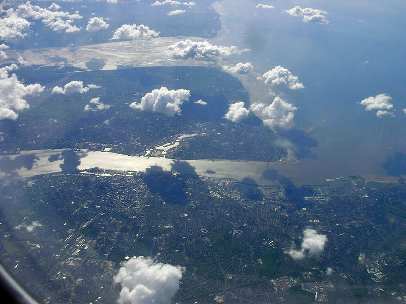 Top to bottom: North Wales,The Dee, The Wirral, The Mersey and Liverpool (The 2 football stadiums can be seen lower centre - Everton FC on the left, LFC on the right) |
|
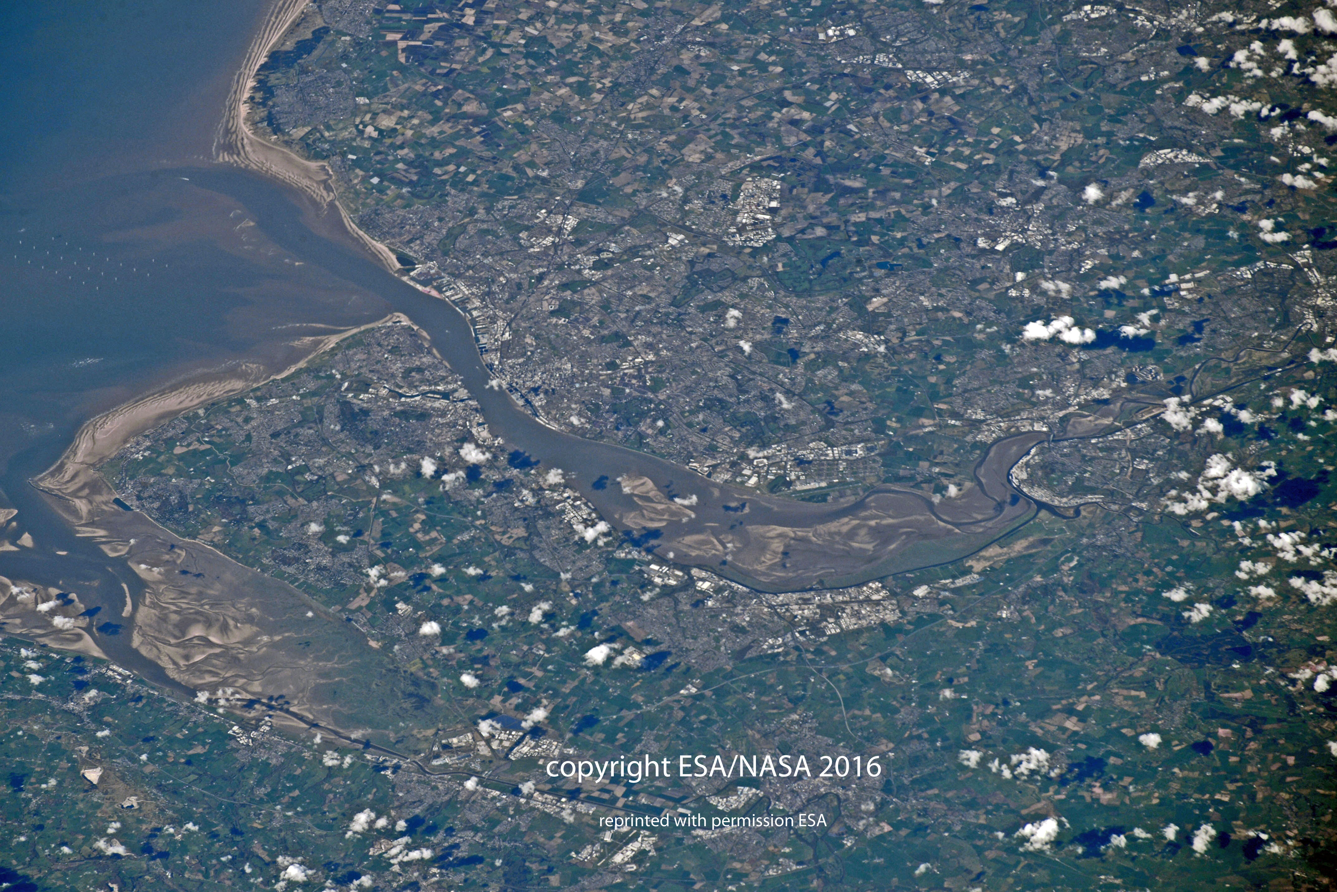 the above image was taken by Tim Peake from the ISS. |
|
 Smithy Thornton Hough |
|
 |
|
| There are many more pages on The Wirral, access is via the home page | |
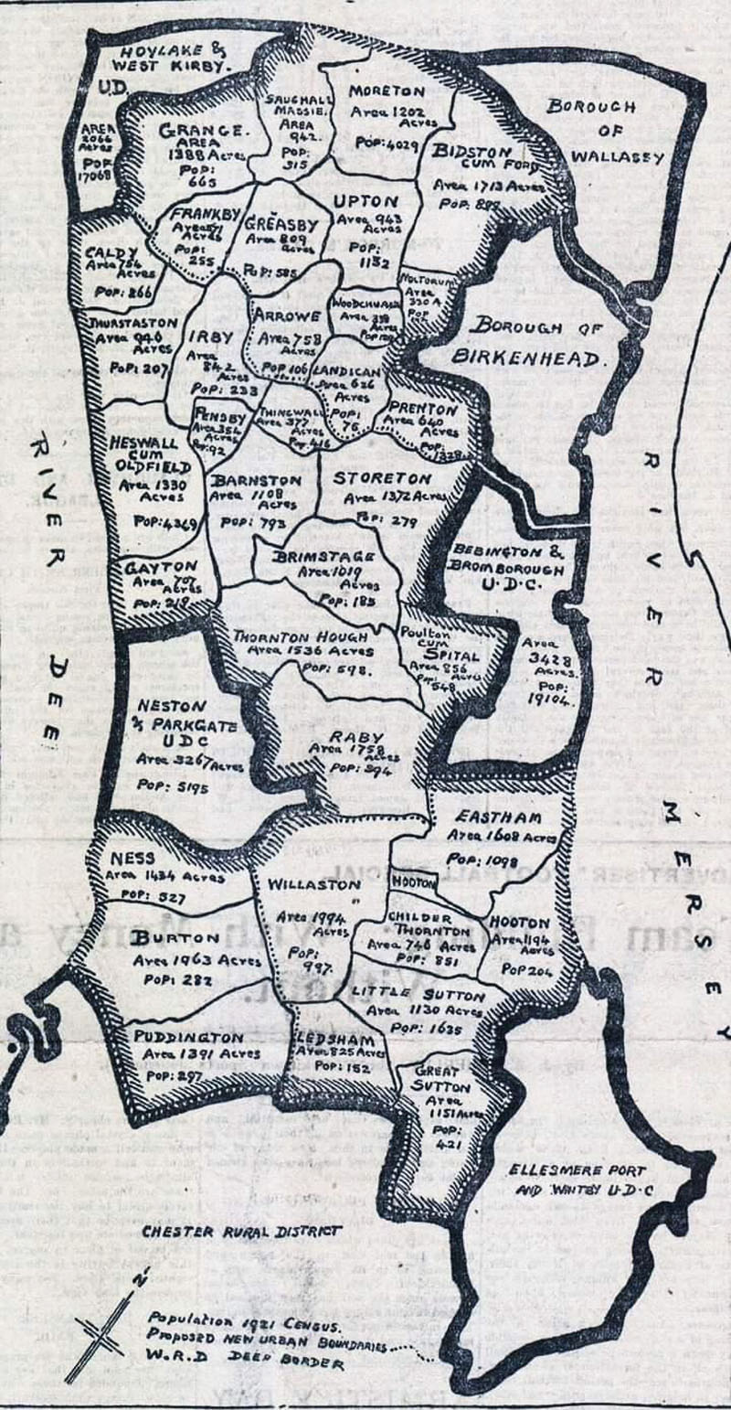 1921 showing proposed boundary changes |
|
|
|
Credits credits, reference and associated sites of interest |
Wallasey Videos: http://www.youtube.com/watch?v=gH59hHwDxZc&feature=youtu.be http://www.youtube.com/watch?v=nmw8yIlVsUU&feature=related http://www.youtube.com/watch?v=zciRmnvQAVA&feature=related http://www.youtube.com/watch?v=FBjpUkH1Uuw&feature=related http://www.youtube.com/watch?v=aWEHx6CpNEI&feature=related Wirral Railways http://www.youtube.com/watch?v=32aJTEdvOuc&feature=related Wirral of old Pt 1 http://www.youtube.com/watch?v=RAXWTe_ljxk&feature=related Wirral of old Pt 2 http://www.youtube.com/watch?v=xVYSS-HkBok&feature=related Wirral of old Pt 3 http://www.youtube.com/watch?v=9IFASVqSozI&feature=related Wirral of old Pt 4 http://www.youtube.com/watch?v=G1TndpGsojA&feature=related - Wirral of old Part 5 |
|
![]()