
![]()

Monks Ferry Birkenhead
|
|
 |
|
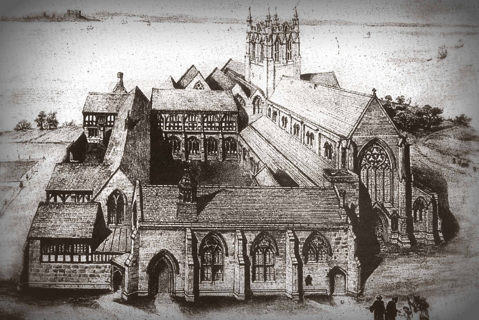
A sketch of how the Priory would have
looked. In the top left you can see Liverpool Castle. The image
below is the remains of the site on which stood Monks Ferry. Edward
III granted the Priory the rights to operate a ferry in 1330. There
was a ferry in existence well before the Monks arrived. It ran from
a stone slipway situated at Seacombe on an inlet on the northern
side of Wallasey Pool close to where Kelvin Road meets Birkenhead
Road today. In those days Seacombe consisted of a small collection
of cottages that had no other reason for existence other than the
ferry and is mentioned in the “Doomsday Book” of 1086.The following
is taken from the link described below the item:
Where did the monks ferry service operate from? There are three schools of thought on this question; Firstly, the most obvious comes from the place name Monks Ferry, which is situated off the promenade fronting present day Priory Wharf Housing Estate. However the foreshore was fronted by treacherous rocks, later known as Ivy Rocks. Furthermore the area was subject to strong currents on each tide. It is also likely that the monks would find it extremely difficult to load and discharge their boat due to the distance from the priory to what is now commonly known as Monks Ferry. It is recorded that the monks sold their produce at Liverpool town market; it is unlikely that they would want to haul sacks of grain such a long distance from the Priory. It is worth mentioning that what one sees today and refers to as Monks Ferry slipway is actually a wharf! It was at one time used by tugs as a coaling berth, and at low tide the mobile steam crane rail lines can be seen. At the end of the wharf there is a 10 foot 9 inch drop at low tide! Finally, the wharf is 95 feet out into the River Mersey from the original shore line of the twelfth century. My calculations are taken from a survey of the foreshore and wharf in 1987. The second school of thought is that Woodside was the Benedictine monks base for their ferry service to Liverpool. Due to lack of any concrete evidence in any form, this can only be described as folk lore, better still myth. A third theory arises from a painting dated
circa 1796 in Birkenhead Art Gallery depicting the headland, which
affords a view to the north of Wallasey Pool, and to the south that of
Tranmere Pool. This painting also depicts the Priory, and it is
interesting to note that there is both a slipway and a boat house
depicted in Tranmere pool. Therefore it is my opinion that Tranmere Bay
was the base for the monks boat service. The bay offered shelter from
the strong winds and tides of the Mersey. From my own maritime research
over many years, I have come to the conclusion that the old boat house
of the Benedictine monks would have been situated 500 yards to the rear
of the old Cammell Lairds gates opposite the Castle Hotel on the A41.
For one must be aware that half of the one time Tranmere Pool has been
back filled leaving what is known as Lairds Basin.
Cost of the Ferry in 1357 (single) |
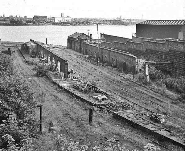 |
| (Above): This was a goods facility and was served by a railway which connected with the main line at Tranmere |
 |
 |
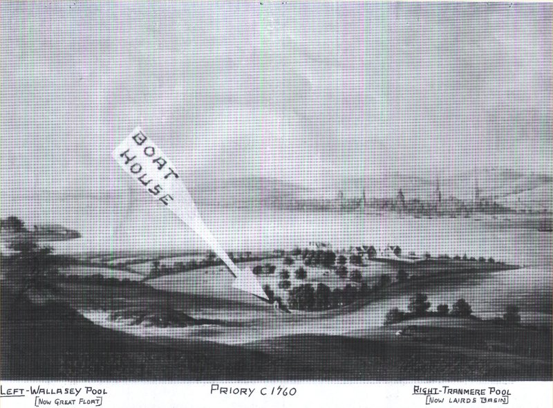 |
| In the above image it is thought that the Monks may have actually operated the ferry from here. This image is from the same source as the link above. |
|
|
![]()